Tag Archives: WP22

Tropical Storm Lionrock Drops Heavy Rain on Northern Vietnam

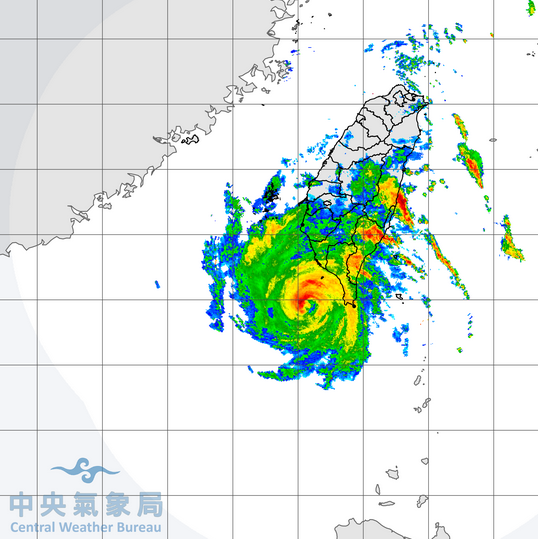
Tropical Storm Lionrock dropped heavy rain on parts of northern Vietnam on Saturday night. At 11:00 p.m. EDT on Saturday the center of Tropical Storm Lionrock was located at latitude 20.4°N and longitude 107.1°E which put it about 25 miles (40 km) southeast of Haiphong, Vietnam. Lionrock was moving toward the west-northwest at 15 m.p.h. (24 km/h). The maximum sustained wind speed was 40 m.p.h. (65 km/h) and there were wind gusts to 50 m.p.h. (80 km/h). The minimum surface pressure was 995 mb.

Tropical Storm Lionrock dropped heavy rain over the part of northern Vietnam between Hanoi and Haiphong on Saturday night. The heaviest rain was falling in bands in the western half of Tropical Storm Lionrock. Bands in the eastern side of Lionrock consisted primarily of showers and lower clouds. Winds to tropical storm force extended out 120 miles (195 km) from the center of Lionrock’s circulation.

Tropical Storm Lionrock will move south of a high pressure system over China during the next 24 hours. The high pressure system will steer Lionrock toward the west during the next day or so. On its anticipated track Tropical Storm Lionrock will move across northern Vietnam and northern Laos. Lionrock will bring gusty winds and locally heavy rain to parts of northern Vietnam and northern Laos. Heavy rain could cause flash floods in some locations.

Elsewhere over the Western North Pacific Ocean, Tropical Storm Kompasu was spinning east of Luzon and Tropical Storm Namtheun formed east of the northern Marianas. At 11:00 p.m. EDT on Saturday the center of Tropical Storm Kompasu was located at latitude 15.9°N and longitude 129.8°E which put it about 470 miles (760 km) east of Luzon. Kompasu was moving toward the northwest at 9 m.p.h. (15 km/h). The maximum sustained wind speed was 50 m.p.h. (80 km/h) and there were wind gusts to 65 m.p.h. (105 km/h). The minimum surface pressure was 990 mb. Kompasu is forecast to move toward the west-northwest and to strengthen.

At 11:00 p.m. EDT on Saturday the center of Tropical Storm Namtheun was located at latitude 17.0°N and longitude 160.3°E which put it about 980 miles (1580 km) east of Alamagan. Namtheun was moving toward the west at 8 m.p.h. (13 km/h). The maximum sustained wind speed was 40 m.p.h. (65 km/h) and there were wind gusts to 50 m.p.h. (80 km/h). The minimum surface pressure was 1000 mb. Namtheun was forecast to move toward the northwest and to strengthen.

Tropical Storm Lionrock Drops Heavy Rain on Hainan

Tropical Storm Lionrock dropped heavy rain on Hainan on Friday. At 11:00 a.m. EDT on Friday the center of Tropical Storm Lionrock was located at latitude 19.1°N and longitude 110.2°E which put it about 50 miles (80 km) south of Haikou, China. Lionrock was moving toward the north at 7 m.p.h. (11 km/h). The maximum sustained wind speed was 45 m.p.h. (75 km/h) and there were wind gusts to 60 m.p.h. (95 km/h). The minimum surface pressure was 991 mb.

Tropical Storm Lionrock brought gusty winds and heavy rain to Hainan on Friday. The center of Lionrock was over Hainan. Bands of showers and thunderstorms on the northern and western sides of Tropical Storm Lionrock were dropping heavy rain over much of Hainan. Bands on the southern and eastern sides of Lionrock consisted primarily of showers and lower clouds. Storms near the center of circulation generated upper level divergence that pumped mass away from the tropical storm. The circulation around Tropical Storm Lionrock was large. Winds to tropical storm force extended out 220 miles (350 km) from the center of circulation.

Tropical Storm Lionrock is likely to weaken during the next 12 hours while the center of circulation moves over Hainan. Lionrock will move into an environment favorable for intensification when the center moves over the Gulf of Tonkin. Lionrock will move over water where the Sea Surface Temperatures are near 29˚C. It will move under the western side of a small upper level ridge. The ridge will produce southerly winds that will blow toward the top of Lionrock’s circulation. Those winds will cause some vertical wind shear, but the shear will not be strong enough to prevent intensification. Tropical Storm Lionrock is likely to intensify slowly after the center of circulation moves over the Gulf of Tonkin.

Tropical Storm Lionrock will move around the southwestern part of a subtropical high pressure system over the Western North Pacific Ocean during the next 12 hours. The subtropical high will steer Lionrock toward the northwest. On its anticipated track the center of Tropical Storm Lionrock will move across Hainan and it will emerge over the Gulf of Tonkin on Saturday. Lionrock will continue to bring gusty winds and locally heavy rain to Hainan during the next 12 hours. Heavy rain could cause flash floods in some locations. Tropical Storm Lionrock will move south of a second high pressure system that is centered over China during the weekend. The second high pressure system will steer Lionrock toward the west. Tropical Storm Lionrock could approach the coast of northern Vietnam in 36 hours.

Elsewhere over the Western North Pacific Ocean, a former tropical depression east of the Philippines strengthened to Tropical Storm Kompasu. At 11:00 a.m. EDT on Friday the center of Tropical Storm Kompasu was located at latitude 13.8°N and longitude 131.5°E which put it about 570 miles (920 km) east of Daet, Philippines. Kompasu was stationary. The maximum sustained wind speed was 40 m.p.h. (65 km/h) and there were wind gusts to 50 m.p.h. (80 km/h). The minimum surface pressure was 998 mb.

Tropical Storm Lionrock Forms Southeast of Hainan

Tropical Storm Lionrock formed over the South China Sea southeast of Hainan on Thursday. At 5:00 p.m. EDT on Thursday the center of Tropical Storm Lionrock was located at latitude 17.5°N and longitude 111.0°E which put it about 95 miles (150 km) southeast of Lingshui, China. Lionrock was moving toward the north-northwest at 5 m.p.h. (8 km/h). The maximum sustained wind speed was 40 m.p.h. (65 km/h) and there were wind gusts to 50 m.p.h. (80 km/h). The minimum surface pressure was 994 mb.

The circulation around a low pressure system over the South China Sea strengthened on Thursday and the Japan Meteorological Agency designated the system as Tropical Storm Lionrock. There was a broad center of circulation in the middle of Tropical Storm Lionrock. Many of the thunderstorms were occurring in bands northeast and southwest of the broad center. Storms in the bands generated upper level divergence that pumped mass away from the tropical storm. Winds to tropical storm force extended out 150 miles (240 km) on the eastern side of Lionrock. Winds to tropical storm force extended out 75 miles (120 km) on the western side of the circulation.

Tropical Storm Lionrock will move through an environment somewhat favorable for intensification during the next 24 hours. Lionrock will move over water where the Sea Surface Temperatures are near 29˚C. It will move under the eastern side of a small upper level ridge. The ridge will produce northeasterly winds that will blow toward the top of Lionrock’s circulation. Those winds will cause some vertical wind shear, but the shear will not be strong enough to prevent intensification. Tropical Storm Lionrock is likely to intensify slowly during the next 24 hours because of the broad center of circulation.

Tropical Storm Lionrock will move around the southwestern part of a subtropical high pressure system over the Western North Pacific Ocean during the next 24 hours. The subtropical high will steer Lionrock toward the north-northwest. On its anticipated track the center of Tropical Storm Lionrock will reach Hainan in 24 hours. Lionrock will bring gusty winds and locally heavy rain to Hainan. Heavy rain could cause flash floods in some locations.

Elsewhere over the Western North Pacific Ocean, a tropical depression formed east of the Philippines. At 5:00 p.m. EDT on Thursday the center of the tropical depression was located at latitude 13.3°N and longitude 129.7°E which put it about 400 miles (645 km) east of Legazpi, Philippines. The tropical depression was moving toward the east-northeast at 7 m.p.h. (11 km/h). The maximum sustained wind speed was 35 m.p.h. (55 km/h) and there were wind gusts to 45 m.p.h. (75 km/h). The minimum surface pressure was 1002 mb.

Tropical Storm Atsani Passes Just South of Taiwan

Tropical Storm Atsani passed just south of Taiwan early on Friday. At 4:00 a.m. EST on Friday the center of Tropical Storm Atsani was located at latitude 21.5°N and longitude 120.7°E which put it about 30 miles (50 km) south of Taiwan. Atsani was moving toward the west-northwest at 12 m.p.h. (19 km/h). The maximum sustained wind speed was 60 m.p.h. (95 km/h) and there were wind gusts to 75 m.p.h. (120 km/h). The minimum surface pressure was 995 mb.

The center of Tropical Storm Atsani passed just to the south of the southern tip of Taiwan early on Friday. Radar images from the Taiwan Central Weather Bureau showed the well organized structure of Tropical Storm Atsani.

There was a small, tight center of circulation. The center was surrounded by a partial eyewall and the strongest winds were occurring in eyewall. Multiple bands of showers and thunderstorms were revolving around the core of Tropical Storm Atsani. Bands in the northern half of Atsani were dropping heavy rain over the southern half of Taiwan. The heaviest rain was falling in parts of southeastern Taiwan where the wind was pushing air up the eastern slopes of mountains. Flash floods are possible in those areas. Winds to tropical storm force extended out 100 miles (160 km) from the center of Atsani.

Tropical Storm Atsani will be in an environment favorable for intensification during the next 12 to 24 hours. Atsani will move over water where the Sea Surface Temperature is near 28°C. It will be in an area where the upper level winds are weaker and there will be little vertical wind shear. Tropical Storm Atsani could intensify during the next 24 hours and there is a chance it could strengthen into a typhoon. An upper level trough over eastern Asia will approach Atsani during the weekend. The trough will produce stronger southwesterly winds which will cause more vertical wind shear. Tropical Storm Atsani will weaken when the wind shear increases. If the shear is strong enough, the upper level winds could blow the top half of Atsani northeast of the low level circulation.

Tropical Storm Atsani will move south of a ridge of high pressure over the Western North Pacific Ocean. The high will steer Atsani toward the west during the next day or so. If the wind shear blows the top half of Tropical Storm Atsani northeast of the lower level circulation, then a surface high pressure system over eastern Asia could push the lower half of Atsani toward the southeast. On its anticipated track Tropical Storm Atsani will pass southeast of Hong Kong and it could eventually move toward Vietnam.

Elsewhere over the Western North Pacific Ocean, the remnants of former Typhoon Goni were dropping heavy rain over parts of Vietnam. At 4:00 a.m. EST on Friday the center of Tropical Depression Goni was located at latitude 13.8°N and longitude 108.3°E which put it about 50 miles (80 km) west of Quy Nhon, Vietnam. Goni was moving toward the west at 7 m.p.h. (11 km/h). The maximum sustained wind speed was 30 m.p.h. (50 km/h) and there were wind gusts to 40 m.p.h. (65 km/h). The minimum surface pressure was 1003 mb. Tropical Depression Goni is dropping heavy rain over ground that is already saturated and the rain will make ongoing floods worse.

Dangerous Typhoon Goni Hits Catanduanes

Extremely dangerous Typhoon Goni hit Catanduanes Island on Saturday. At 5:00 p.m. EDT on Saturday the center of Typhoon Goni was located at latitude 13.7°N and longitude 124.4°E which put it about 25 miles (40 km) northeast of Virac, Philippines. Goni was moving toward the west-southwest at 16 m.p.h. (26 km/h). The maximum sustained wind speed was 195 m.p.h. (315 km/h) and there were wind gusts to 235 m.p.h. (380 km/h). The minimum surface pressure was 884 mb.

The eye of Typhoon Goni moved over the southern part of Catanduanes Island on Saturday. Despite the development of concentric eyewalls and the occurrence of an eyewall replacement cycle, Goni actually strengthened on Saturday. The original inner eyewall weakened and the outer eyewall contracted around the center of Typhoon Goni. Goni exhibited an eye with a diameter of 14 miles (22 km) when it made landfall on Catanduanes Island.

The circulation around Typhoon Goni increased in size during the eyewall replacement cycle. Winds to typhoon force extended out 60 miles (95 km) from the center of Goni. Winds to tropical storm force extended out 130 miles (210 km) from the center of circulation. The Hurricane Intensity Index (HII) for Typhoon Goni was 48.0. The Hurricane Size Index (HSI) was 16.0 and the Hurricane Wind Intensity Size Index (HWISI) was 64.0. Typhoon Goni was capable of causing catastrophic damage on a regional scale.

Typhoon Goni will also generate a storm surge of up to 20 feet (6 meters) along the coasts of Catanduanes Island and southeastern Luzon. Typhoon Goni will move west across the Philippines. Goni will weaken as the core passes over land. The center of Goni will make landfall in southeastern Luzon near Tabaco. The southern eyewall of Goni will produce strong winds in Legaspi. The northern eyewall will bring strong winds to Naga. Typhoon Goni could be near Manila in 18 hours and it could still be the equivalent of a major hurricane at that time. Goni will also drop locally heavy rain over southern Luzon and flash floods are likely.

Elsewhere over the Western North Pacific Ocean, Tropical Storm Atsani was organizing slowly east of the Philippines. At 5:00 p.m. EDT on Saturday the center of Tropical Storm Atsani was located at latitude 15.2°N and longitude 135.8°E which put it about 900 miles (1450 km) east of Luzon. Atsani was moving toward the west-northwest at 11 m.p.h. (17 km/h). The maximum sustained wind speed was 40 m.p.h. (65 km/h) and there were wind gusts to 50 m.p.h. (80 km/h). The minimum surface pressure was 1001 mb. Tropical Storm Atsani was forecast to move toward the west and to strengthen.

Potentially Catastrophic Typhoon Goni Nears Luzon

Potentially catastrophic Typhoon Goni neared Luzon on Saturday morning. At 5:00 a.m. EDT on Saturday the center of Typhoon Goni was located at latitude 14.6°N and longitude 126.9°E which put it about 300 miles (485 km) east-northeast of Labo, Philippines. Goni was moving toward the west-southwest at 15 m.p.h. (24 km/h). The maximum sustained wind speed was 180 m.p.h. (290 km/h) and there were wind gusts to 220 m.p.h. (355 km/h). The minimum surface pressure was 898 mb.

Typhoon Goni exhibited a double eyewall structure sometimes seen in very intense tropical cyclones. There was a small inner eye with a diameter of 6 miles (10 km). That eye was surrounded by a ring of strong thunderstorms and the strongest winds were occurring in that inner eyewall. A second, outer eyewall with a diameter of 35 miles (56 km) surrounded the inner core of Typhoon Goni. Storms near the core of Gone generated strong upper level divergence which pumped large quantities of mass away from the typhoon. The removal of so much mass allowed the surface pressure to remain very low. Bands of showers and thunderstorms were revolving around the core of the typhoon.

The circulation around Typhoon Goni increased in size when the double eyewalls formed. Winds to typhoon force extended out 35 miles (55 km) from the center of Goni. Winds to tropical storm force extended out 130 miles (210 km) from the center of circulation. The Hurricane Intensity Index (HII) for Typhoon Goni was 42.2. The Hurricane Size Index (HSI) was 13.6 and the Hurricane Wind Intensity Size Index (HWISI) was 55.8. Typhoon Goni was capable of causing catastrophic damage.

Typhoon Goni will move through an environment favorable for a strong typhoon during the next 12 hours. Goni will move over water where the Sea Surface Temperature is near 30°C. It will move through a region where the upper level winds are weak and there will be little vertical wind shear. An eyewall replacement cycle could cause Typhoon Goni to start to weaken. If the original inner eyewall dissipates and convergence becomes concentrated into the new outer eyewall, then the wind speed will decrease. However, Goni is likely to maintain much of its intensity until it reaches Luzon.

Typhoon Goni will move south of a subtropical high pressure system over the Western North Pacific Ocean. The high will steer Goni toward the west. On its anticipated track Typhoon Goni will be near Cataduanes Island in 12 48 hours. Goni could be near Manila in 24 hours. Typhoon Goni is capable of causing catastrophic damage to Luzon. Goni could generate a storm surge of up to 20 feet (6 meters) along the coast of southeastern Luzon. Typhoon Goni will drop heavy rain over parts of Luzon and flash floods are likely.

Elsewhere over the Western North Pacific Ocean, Tropical Storm Atsani moved north of Yap. At 5:00 a.m. EDT on Saturday the center of Tropical Storm Atsani was located at latitude 14.6°N and longitude 138.2°E which put it about 1060 miles (1705 km) east of Luzon. Astani was moving toward the west at 17 m.p.h. (28 km/h). The maximum sustained wind speed was 40 m.p.h. (65 km/h) and there were wind gusts to 50 m.p.h. (80 km/h). The minimum surface pressure was 1001 mb. Tropical Storm Atsani was forecast to move toward the northwest and to strengthen.

Typhoon Goni Rapidly Intensifies Into Equivalent of Cat. 5 Hurricane

Typhoon Goni intensified rapidly into the equivalent of a Category 5 hurricane on the Saffir-Simpson Scale east of the Philippines on Thursday night. At 5:00 a.m. EDT on Friday the center of Typhoon Goni was located at latitude 16.2°N and longitude 131.2°E which put it about 620 miles (1000 km) east of Luzon. Goni was moving toward the west at 13 m.p.h. (20 km/h). The maximum sustained wind speed was 175 m.p.h. (280 km/h) and there were wind gusts to 205 m.p.h. (330 km/h). The minimum surface pressure was 912 mb. Typhoon Goni is capable of causing catastrophic damage.

Typhoon Goni continued to intensify rapidly on Thursday night. A small circular eye with a diameter of 10 miles (16 km) was at the center of Goni. The eye was surrounded by a ring of strong thunderstorms and the strongest winds were occurring in that ring of storms. Bands of showers and thunderstorms were revolving around the tight core of Typhoon Goni. Storms near the core generated strong upper level divergence which pumped mass away from the typhoon. The removal of mass allowed the surface pressure to decrease quickly which contributed to the rapid increase in wind speed.

Typhoon Goni will move through an environment favorable for a strong typhoon during the next 36 to 48 hours. Goni will move over water where the Sea Surface Temperature is near 30°C. It will move through a region where the upper level winds are weak and there will be little vertical wind shear. If the inner end of a rainband wraps around the existing eye and eyewall, then an eyewall replacement cycle could occur. The cycle would cause Goni to weaken when the original inner eyewall dissipates and convergence becomes concentrated into a new outer eyewall. An eyewall replacement cycle would also cause the size of the circulation around Goni to Increase.

Typhoon Goni will move south of a subtropical high pressure system over the Western North Pacific Ocean. The high will steer Goni toward the west. On its anticipated track Typhoon Goni will approach the coast of Luzon in about 48 hours. Goni is likely to be the equivalent of a major hurricane when it approaches Luzon.

Elsewhere over the Western North Pacific Ocean, Tropical Storm Atsani moved south of the Marianas. At 5:00 a.m. EDT on Friday the center of Tropical Storm Atsani was located at latitude 11.6°N and longitude 142.6°E which put it about 170 miles (275 km) south-southwest of Guam. Astani was moving toward the west-northwest at 30 m.p.h. (48 km/h). The maximum sustained wind speed was 40 m.p.h. (65 km/h) and there were wind gusts to 50 m.p.h. (80 km/h). The minimum surface pressure was 1001 mb. Tropical Storm Atsani was forecast to move toward the northwest and to strengthen.

Typhoon Goni Rapidly Intensifies to Equivalent of a Major Hurricane

Typhoon Goni intensified rapidly into the equivalent of a major hurricane east of the Philippines on Thursday. At 11:00 p.m. EDT on Thursday the center of Typhoon Goni was located at latitude 16.2°N and longitude 132.2°E which put it about 690 miles (1115 km) east of Luzon. Goni was moving toward the west at 7 m.p.h. (11 km/h). The maximum sustained wind speed was 145 m.p.h. (230 km/h) and there were wind gusts to 175 m.p.h. (280 km/h). The minimum surface pressure was 934 mb.

Typhoon Goni intensified rapidly on Thursday. A small circular eye with a diameter of 12 miles (19 km) was at the center of Goni. The eye was surrounded by a ring of strong thunderstorms and the strongest winds were occurring in that ring of storms. Bands of showers and thunderstorms were revolving around the core of Typhoon Goni. Storms near the core generated strong upper level divergence which pumped mass away from the typhoon. The removal of mass allowed the surface pressure to decrease quickly which contributed to the rapid increase in wind speed.

The circulation around Typhoon Goni was small. Winds to typhoon force extended out 25 miles (40 km) from the center of Goni. Winds to tropical storm force extended out 100 miles (160 km) from the center of circulation. The Hurricane Intensity Index (HII) for Typhoon Goni was 29.9. The Hurricane Size Index (HSI) was 6.3 and the Hurricane Wind Intensity Size Index (HWISI) was 36.2.

Typhoon Goni will move through an environment favorable for intensification during the next 24 hours. Goni will move over water where the Sea Surface Temperature is near 30°C. It will move through a region where the upper level winds are weak and there will be little vertical wind shear. Goni could intensify more during the next 24 hours. If the inner end of a rainband wraps around the existing eye and eyewall, then an eyewall replacement cycle could cause Goni to weaken.

Typhoon Goni will move south of a subtropical high pressure system over the Western North Pacific Ocean. The high will steer Goni toward the west. On its anticipated track Typhoon Goni will approach the coast of Luzon in about 48 hours. Goni is likely to be the equivalent of a major hurricane when it approaches Luzon.

Elsewhere over the Western North Pacific Ocean, Tropical Storm Atsani moved south-southeast of the Marianas. At 11:00 p.m. EDT on Thursday the center of Tropical Storm Atsani was located at latitude 10.7°N and longitude 145.3°E which put it about 245 miles (400 km) south-southeast of Guam. Astani was moving toward the northwest at 18 m.p.h. (30 km/h). The maximum sustained wind speed was 40 m.p.h. (65 km/h) and there were wind gusts to 50 m.p.h. (80 km/h). The minimum surface pressure was 1001 mb. Tropical Storm Atsani was forecast to move toward the northwest and to strengthen.

Goni Rapidly Intensifies to a Typhoon, Atsani Forms

Former Tropical Storm Goni intensified rapidly into a typhoon east of the Philippines on Thursday and Tropical Storm Atsani formed south-southeast of the Marianas. At 11:00 a.m. EDT on Thursday the center of Typhoon Goni was located at latitude 16.7°N and longitude 134.1°E which put it about 820 miles (1320 km) east of Luzon. Goni was moving toward the west at 14 m.p.h. (22 km/h). The maximum sustained wind speed was 90 m.p.h. (145 km/h) and there were wind gusts to 115 m.p.h. (185 km/h). The minimum surface pressure was 973 mb.

Typhoon Goni intensified rapidly on Thursday. A small circular eye was at the center of Goni. The eye was surrounded by a ring of strong thunderstorms and the strongest winds were occurring in that ring of storms. Bands of showers and thunderstorms were revolving around the core of Typhoon Goni. Storms near the core generated strong upper level divergence which pumped mass away from the typhoon. The removal of mass allowed the surface pressure to decrease quickly which contributed to the rapid increase in wind speed. The circulation around Typhoon Goni was small. Winds to typhoon force extended out 20 miles (30 km) from the center of Goni. Winds to tropical storm force extended out 80 miles (130 km) from the center of circulation.

Typhoon Goni will move through an environment favorable for intensification during the next several days. Goni will move over water where the Sea Surface Temperature is near 30°C. It will move through a region where the upper level winds are weak and there will be little vertical wind shear. Goni could intensify into the equivalent of a major hurricane during the next 24 hours.

Typhoon Goni will move south of a subtropical high pressure system over the Western North Pacific Ocean. The high will steer Goni toward the west. On its anticipated track Typhoon Goni will approach the coast of Luzon in about 72 hours. Goni is likely to be the equivalent of a major hurricane when it approaches Luzon.

Elsewhere over the Western North Pacific Ocean, Tropical Storm Atsani formed south-southeast of the Marianas. At 11:00 a.m. EDT on Thursday the center of Tropical Storm Atsani was located at latitude 8.7°N and longitude 148.0°E which put it about 450 miles (720 km) south-southeast of Guam. Astani was moving toward the north-northwest at 14 m.p.h. (22 km/h). The maximum sustained wind speed was 40 m.p.h. (65 km/h) and there were wind gusts to 50 m.p.h. (80 km/h). The minimum surface pressure was 1001 mb. Tropical Storm Atsani was forecast to move toward the northwest and to strengthen.

Tropical Storm Goni Develops Rapidly East of the Philippines

Tropical Storm Goni developed rapidly east of the Philippines on Wednesday. At 11:00 p.m. EDT on Wednesday the center of Tropical Storm Goni was located at latitude 16.5°N and longitude 136.1°E which put it about 960 miles (1505 km) east of Luzon. Goni was moving toward the west at 11 m.p.h. (17 km/h). The maximum sustained wind speed was 65 m.p.h. (105 km/h) and there were wind gusts to 80 m.p.h. (130 km/h). The minimum surface pressure was 988 mb.

The circulation around Tropical Storm Goni developed rapidly. A small circular eye formed at the center of Goni. The eye was surrounded by a ring of strong thunderstorms and the strongest winds were occurring in that ring of storms. Bands of showers and thunderstorms were revolving around the core of Tropical Storm Goni. Storms near the core generated upper level divergence which pumped mass away from the tropical storm. The circulation around Goni was small. Winds to tropical storm force extended out 70 miles from the center of circulation.

Tropical Storm Goni will move through an environment favorable for intensification during the next several days. Goni will move over water where the Sea Surface Temperature is near 30°C. It will move through a region where the upper level winds are weak and there will be little vertical wind shear. Goni will strengthen to a typhoon during the next 12 hours and it could intensify into the equivalent of a major hurricane during the next several days.

Tropical Storm Goni will move south of a subtropical high pressure system over the Western North Pacific Ocean. The high will steer Goni toward the west. On its anticipated track Tropical Storm Goni will approach the coast of Luzon in about three days.

Elsewhere over the Western North Pacific Ocean, a new tropical depression formed east-southeast of the Philippines. At 11:00 p.m. EDT on Wednesday the center of Tropical Depression 23W was located at latitude 5.3°N and longitude 148.7°E which put it about 170 miles (280 km) west-southwest of Chuuk. The depression was moving toward the west at 17 m.p.h. (28 km/h). The maximum sustained wind speed was 35 m.p.h. (55 km/h) and there were wind gusts to 45 m.p.h. (75 km/h). The minimum surface pressure was 1004 mb.