
Tropical Storm Hanna formed over the Central North Atlantic Ocean west of the Azores on Monday. At 5:00 p.m. EDT on Monday the center of Tropical Storm Hanna was located at latitude 36.5°N and longitude 47.8°W which put the center about 1195 miles (1920 km) west of the Azores. Hanna was moving toward the east-southeast at 17 m.p.h. (28 km/h). The maximum sustained wind speed was 45 m.p.h. (75 km/h) and there were wind gusts to 60 m.p.h. (95 km/h). The minimum surface pressure was 1006 mb.
A low pressure system over the Central North Atlantic Ocean strengthened on Monday and the U.S. National Hurricane Center designated the system as Tropical Storm Hanna.
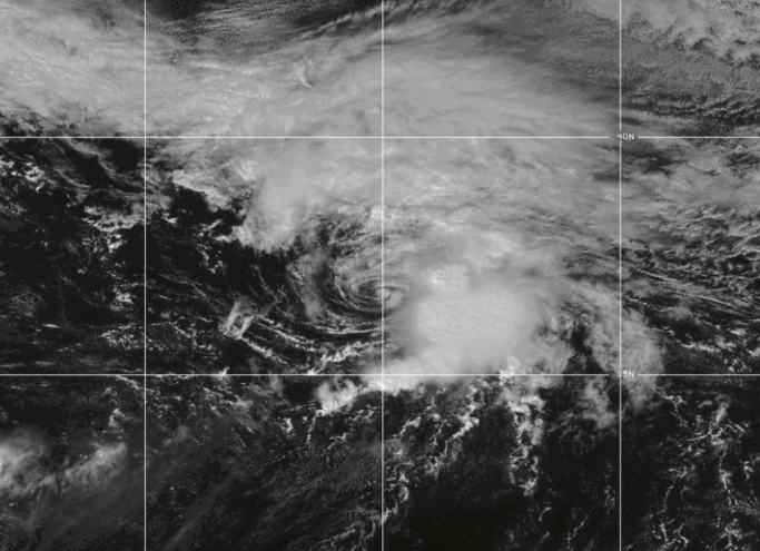
Tropical Storm Hanna was moving under the southern extent of the upper level westerly winds in the middle latitudes. Those upper level winds were causing moderate to strong vertical wind shear. The vertical wind shear caused the distribution of thunderstorms in Tropical Storm Hanna to be asymmetrical. Thunderstorms were occurring in bands in the eastern side of Hanna’s circulation. Bands in the western side of Tropical Storm Hanna consisted primarily of showers and lower clouds.
The distribution of wind speeds in Tropical Storm Hanna was also asymmetrical. Winds to tropical storm force extended out 90 miles (145 km) in the eastern side of Hanna’s circulation. The winds in the western side of Tropical Storm Hanna were blowing at less than tropical storm force.
Tropical Storm Hanna will move through an environment that will be only marginally favorable for intensification during the next 24 hours. Hanna will move over water where the Sea Surface Temperatures are near 27°C. It will continue to move under the upper level westerly winds in the middle latitudes. Those upper level winds will continue to cause moderate to strong vertical wind shear. Tropical Storm Hanna could intensify a little on Tuesday in spite of the vertical wind shear. However, the vertical wind shear is more likely to cause Hanna to weaken.
Tropical Storm Hanna will move around the northern side of a high pressure system that is over the North Central Atlantic Ocean. The high pressure system will steer Hanna toward the east-southeast during the next 24 hours. On its anticipated track, Tropical Storm Hanna will remain far to the west of the Azores.
Elsewhere over the Atlantic Ocean, Tropical Depression Fay was spinning south of Tropical Storm Hanna. At 5:00 p.m. EDT on Monday the center of Tropical Depression Fay was located at latitude 26.6°N and longitude 45.3°W which put the center about 1325 miles (2130 km) west-southwest of the Azores. Fay was moving toward the southwest at 9 m.p.h. (15 km/h). The maximum sustained wind speed was 35 m.p.h. (55 km/h) and there were wind gusts to 45 m.p.h. (75 km/h). The minimum surface pressure was 1011 mb.