Tag Archives: Tropical Cyclone Mal

Tropical Cyclone Mal Moves South of Fiji

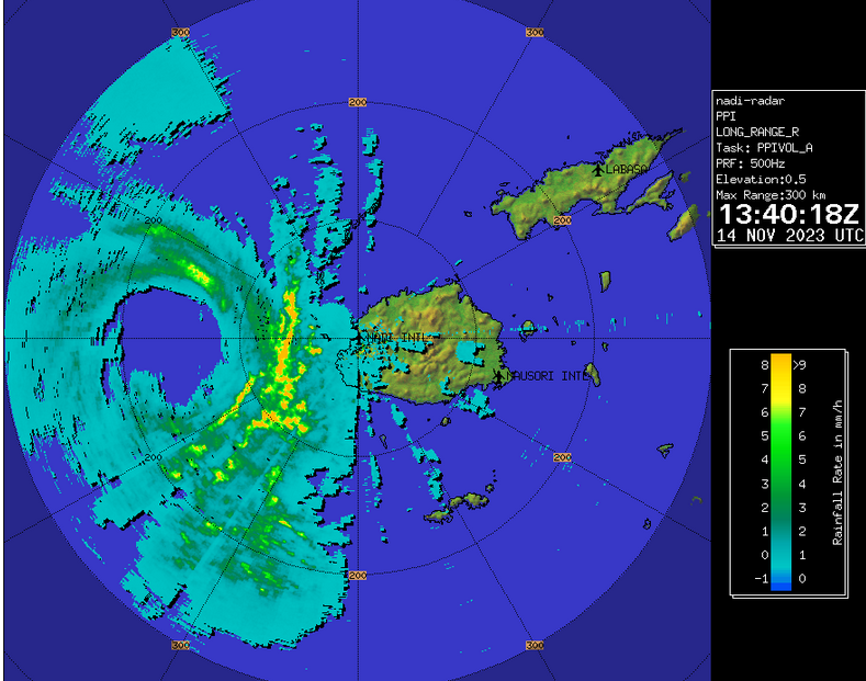
Tropical Cyclone Mal moved south of Fiji during Tuesday night. At 10:00 a.m. EST on Wednesday the center of Tropical Cyclone Mal was located at latitude 23.2°S and longitude 179.0°E which put it about 310 miles (500 km) south of Suva, Fiji. Mal was moving toward the south-southeast at 14 m.p.h. (22 km/h). The maximum sustained wind speed was 75 m.p.h. (120 km/h) and there were wind gusts to 90 m.p.h. (145 km/h). The minimum surface pressure was 984 mb.

Strong vertical wind shear and cooler Sea Surface Temperatures caused the structure of Tropical Cyclone Mal to start to change during Tuesday night. An eye was not longer present at the center of Mal’s circulation. Thunderstorms were occurring in bands in the southeastern part of Tropical Cyclone Mal. Bands in the other parts of Mal’s circulation consisted primarily of showers and lower clouds. Tropical Cyclone Mal was in the process of making a transition to an extratropical cyclone.

The size of the circulation around Tropical Cyclone Mal increased when it started to make a transition to an extratropical cyclone. Winds to hurricane/typhoon force extended out 50 miles (80 km) from the center of Mal’s circulation. Winds to tropical storm force extended out 200 miles (320 km) from the center of Tropical Cyclone Mal.

Tropical Cyclone Mal will move into an environment that will be unfavorable for intensification of a tropical cyclone during the next 36 hours. Mal will move over water where the Sea Surface Temperatures are near 24°C. It will move under the eastern side of an upper level trough over the Coral Sea. The upper level trough will produce northwesterly winds that will blow toward the top of Mal’s circulation. Those winds will cause strong vertical wind shear. The combination of cooler water and strong vertical wind shear will cause Tropical Cyclone Mal to weaken during the next 36 hours. Mal will continue to make a transition to an extratropical cyclone.

The upper level trough over the Coral Sea will steer Tropical Cyclone Mal toward the southeast during the next 36 hours. On its anticipated track, Tropical Cyclone Mal will continue to move farther away from Fiji.

Tropical Cyclone Mal Passes West of Fiji

The center of Tropical Cyclone Mal passed just to the west of Fiji on Tuesday morning. At 10:00 a.m. EST on Tuesday the center of Tropical Cyclone Mal was located at latitude 17.8°S and longitude 175.9°E which put it about 125 miles (200 km) west of Nadi, Fiji. Mal was moving toward the south-southeast at 14 m.p.h. (22 km/h). The maximum sustained wind speed was 75 m.p.h. (120 km/h) and there were wind gusts to 90 m.p.h. (145 km/h). The minimum surface pressure was 983 mb.

Radar from the Fiji Meteorological Service showed the center of Tropical Cyclone Mal passing just to the west of Viti Levu on Tuesday morning. A weather station at the airport in Nadi (NFFN) reported a sustained wind speed of 41 m.p.h. (66 km/h) and a wind gust of 63 m.p.h. (102 km/h).

Tropical Cyclone Mal was the equivalent of a hurricane/typhoon when it passed just to the west of Fiji on Tuesday morning. A circular eye with a diameter of 50 miles (80 km) was at the center of Mal’s circulation. The eye was surrounded by a ring of thunderstorms and the strongest winds were occurring in that ring of storms. Bands of showers and thunderstorms were revolving around the core of Tropical Cyclone Mal. Storms near the core generated upper level divergence that pumped mass away to the southeast of the tropical cyclone.

Winds to hurricane/typhoon force extended out 40 miles (65 km) from the center of Tropical Cyclone Mal. Winds to tropical storm force extended out 155 miles (250 km) from the center of Mal’s circulation.

Tropical Cyclone Mal will move into an environment that will become unfavorable for intensification during the next 24 hours. Mal will move over water where the Sea Surface Temperatures are near 26°C. It will move under the eastern side of an upper level trough over the Coral Sea. The upper level trough will produce northwesterly winds that will blow toward the top of Mal’s circulation. Those winds will cause moderate vertical wind shear. The combination of cooler water and moderate vertical wind shear will cause Tropical Cyclone Mal to start to weaken during the next 24 hours.

The upper level trough over the Coral Sea will steer Tropical Cyclone Mal toward the south-southeast during the next 24 hours. On its anticipated track, Tropical Cyclone Mal will move south of Fiji.

The eastern side of the eyewall of Tropical Cyclone Mal could pass close to the west coast of Viti Levu. A rainband on the eastern side of Mal’s circulation could bring strong winds and heavy rain to the western part of Viti Levu. Scattered electricity outages are possible. Locally heavy rain could cause flash floods in some locations. Tropical Cyclone Mal could cause a storm surge of up to 7 feet (2 meters) along parts of the northern and western coasts of Viti Levu. Mal could also bring gusty winds and heavy rain to Kadavu and Ono.

Tropical Cyclone Mal Intensifies to Equivalent of a Hurricane/Typhoon

Tropical Cyclone Mal intensified to the equivalent of a hurricane/typhoon over the South Pacific Ocean northwest of Fiji on Monday. At 10:00 p.m. EST on Monday the center of Tropical Cyclone Mal was located at latitude 15.3°S and longitude 175.1°E which put it about 225 miles (365 km) northwest of Nadi, Fiji. Mal was moving toward the south-southeast at 16 m.p.h. (26 km/h). The maximum sustained wind speed was 75 m.p.h. (120 km/h) and there were wind gusts to 90 m.p.h. (145 km/h). The minimum surface pressure was 984 mb.

Tropical Cyclone Mal rapidly intensified to the equivalent of a hurricane/typhoon northwest of Fiji on Monday. The inner end of a rainband wrapped around the center of Mal’s circulation. Microwave satellite images suggested that an eye was forming at the center of Tropical Cyclone Mal. Bands of showers and thunderstorms were revolving around the core of Mal’s circulation. Storms near the core generated upper level divergence that pumped mass away to the southeast of the tropical cyclone.

Winds to hurricane/typhoon force extended out 20 miles (30 km) from the center of Tropical Cyclone Mal. Winds to tropical storm force extended out 155 miles (250 km) from the center of Mal’s circulation.

Tropical Cyclone Mal will move through an environment favorable for intensification during the next 18 hours. Mal will move over water where the Sea Surface Temperatures are near 28°C. It will move under the western part of an upper level ridge over the South Pacific Ocean. The upper level ridge will produce northerly winds that will blow toward the top of Mal’s circulation. Those winds will cause vertical wind shear, but the wind shear will not be strong enough to prevent intensification. Tropical Cyclone Mal is likely to intensify during the next 18 hours.

Tropical Cyclone Mal will move around the southwestern part of a high pressure system over the South Pacific Ocean. The high pressure system will steer Mal toward the southeast during the next 24 hours. On its anticipated track, Tropical Cyclone Mal will pass just to the west of Viti Levu in 12 to 18 hours.

Tropical Cyclone Mal will bring strong winds and locally heavy rain to Fiji. The strongest winds and heaviest rain will affect Viti Levu. Heavy rain could cause flash floods in some locations. Scattered outages of electricity are possible. Tropical Cyclone Mal could cause a storm surge of up to 7 feet (2 meters) along the north and west coasts of Viti Levu.

Tropical Cyclone Mal Forms Northwest of Fiji

Tropical Cyclone Mal formed over the South Pacific Ocean northwest of Fiji on Sunday night. At 4:00 a.m. EST on Monday the center of Tropical Cyclone Mal was located at latitude 11.9°S and longitude 172.3°E which put it about 520 miles (840 km) northwest of Nadi, Fiji. Mal was moving toward the southeast at 21 m.p.h. (33 km/h). The maximum sustained wind speed was 50 m.p.h. (80 km/h) and there were wind gusts to 65 m.p.h. (105 km/h). The minimum surface pressure was 994 mb.

A low pressure system over the South Pacific Ocean northwest of Fiji strengthened during Sunday night and the Fiji Meteorological Service designated the system as Tropical Cyclone Mal. The circulation around Tropical Cyclone Mal exhibited more organization on Monday morning. More thunderstorms developed near the center of Mal’s circulation. Bands of showers and thunderstorms were revolving around the center of circulation. Storms near the center of circulation generated upper level divergence that pumped mass away to the southeast of the tropical cyclone. Winds to tropical storm force extended out 150 miles (240 km) from the center of Tropical Cyclone Mal.

Tropical Cyclone Mal will move through an environment favorable for intensification during the next 24 hours. Mal will move over water where the Sea Surface Temperatures are near 28°C. It will move under the western part of an upper level ridge over the South Pacific Ocean. The upper level ridge will produce northerly winds that will blow toward the top of Mal’s circulation. Those winds will cause vertical wind shear, but the wind shear will not be strong enough to prevent intensification. Tropical Cyclone Mal will intensify during the next 24 hours. Mal could strengthen to the equivalent of a hurricane/typhoon.

Tropical Cyclone Mal will move around the southwestern part of a high pressure system over the South Pacific Ocean. The high pressure system will steer Mal toward the southeast during the next 24 hours. On its anticipated track, Tropical Cyclone Mal will approach Fiji in 24 hours.

Tropical Cyclone Mal will bring strong winds and locally heavy rain to Fiji. Heavy rain could cause flash floods in some locations.