Tag Archives: Nadi

Tropical Cyclone Maila Intensifies to Equivalent of Cat. 4 Hurricane

Tropical Cyclone Maila intensified to the equivalent of a Category 4 hurricane on the Saffir-Simpson Scale on Tuesday.  At 5:00pa.m. EDT on Tuesday the center of Tropical Cyclone Maila was located at latitude 9.5°S and longitude 155.9°E which put the center about 565 miles (910 km) east of Port Moresby, Papua New Guinea.  Maila was moving toward the northwest at 5 m.p.h. (8 km/h).  The maximum sustained wind speed was 145 m.p.h. (235 km/h) and there were wind gusts to 175 m.p.h. (285 km/h).  The minimum surface pressure was 930 mb.

Tropical Cyclone Maila intensified to the equivalent of a Category 4 hurricane as it continued to meander over the Solomon Sea on Tuesday.  A circular eye with a diameter of 28 miles (45 km) was present at the center of Maila’s circulation.  The eye was surrounded by a ring of thunderstorms and the strongest winds were occurring in that ring of storms.  Bands of showers and thunderstorms were revolving around the center of Tropical Cyclone Maila.  Storms near the center of Maila generated upper level divergence that pumped mass away from the tropical cyclone.  The removal of mass caused the surface pressure to decrease.

The distribution of wind speeds around Tropical Cyclone Maila was fairly symmetrical.  Winds to hurricane/typhoon force extended out 45 miles (75 km) from the center of Maila’s circulation.  Winds to tropical storm force extended out 140 miles (220 km) from the center of Tropical Cyclone Maila.

The Hurricane Intensity Index (HII) for Tropical Cyclone Maila is 29.9.  The Hurricane Size Index (HSI) is 16.5 and the Hurricane Wind Intensity Size Index (HWISI) is 46.4.  Tropical Cyclone Maila is similar in size and intensity to Hurricane Ida when Ida hit Louisiana in 2021.

Tropical Cyclone Maila will continue to be in an environment that will be slightly unfavorable for a strong tropical cyclone during the next 24 hours.  Maila will be over water where the Sea Surface Temperatures were originally near 30°C.  It will be under the middle of an upper level ridge that is over the Solomon Sea.  The upper level winds are weak near the middle of the ridge and there will be little vertical wind shear.  Since Tropical Cyclone Maila has been moving slowly over the Solomon Sea, the strong winds near the surface of the ocean are mixing cooler water to the surface.  Maila will move back over cooler water that has already mixed to the surface of the ocean.  The cooler water is likely to prevent further intensification of Tropical Cyclone Maila.  Maila is likely to weaken slowly during the next 24 hours.

Tropical Cyclone Maila will move around the northern side of a high pressure system that is developing over the Coral Sea.  The high pressure system will steer Maila toward the west during the next 24 hours.  On its anticipated track, Tropical Cyclone Maila will move toward the southeastern part of Papua New Guinea.

Tropical Cyclone Maila could approach Woodlark Island in less than 48 hours.  Maila will bring strong winds and locally heavy rain to the Kiriwina Islands, the D’Entrecasteaux Islands, and the Louisiade Archipelago.  Heavy rain could cause flash floods in some locations.  Tropical Cyclone Maila will be capable of causing major damage.

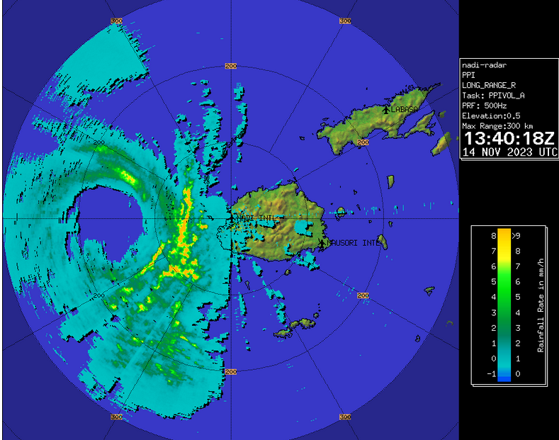
Elsewhere over the South Pacific Ocean, Tropical Cyclone Vaianu started to weaken as it moved away from Fiji.  At 5:00 p.m. EDT on Tuesday the center of Tropical Cyclone Vaianu was located at latitude 21.6°S and longitude 177.3°E which put the center about 255 miles (410 km) south of Nadi, Fiji.  Vaianu was moving toward the southeast at 17 m.p.h. (28 km/h).  The maximum sustained wind speed was 105 m.p.h. (165 km/h) and there were wind gusts to 125 m.p.h. (200 km/h).  The minimum surface pressure was 962 mb.

Tropical Cyclone Maila Strengthens to Equivalent of a Major Hurricane

Tropical Cyclone Maila strengthened to the equivalent of a major hurricane as it moved slowly over the Solomon Sea on Monday night.  At 5:00 a.m. EDT on Tuesday the center of Tropical Cyclone Maila was located at latitude 9.9°S and longitude 156.5°E which put the center about 605 miles (970 km) east of Port Moresby, Papua New Guinea.  Maila was moving toward the east at 2 m.p.h. (3 km/h).  The maximum sustained wind speed was 115 m.p.h. (185 km/h) and there were wind gusts to 145 m.p.h. (235 km/h).  The minimum surface pressure was 953 mb.

Tropical Cyclone Maila intensified to the equivalent of a major hurricane on Monday night.  A circular eye was present at the center of Maila’s circulation.  The eye was surrounded by a ring of thunderstorms and the strongest winds were occurring in that ring of storms.  Bands of showers and thunderstorms were revolving around the center of Tropical Cyclone Maila. Storms near the center of Maila generated upper level divergence that pumped mass away from the tropical cyclone.  The removal of mass caused the surface pressure to decrease.

The distribution of wind speeds around Tropical Cyclone Maila was fairly symmetrical.  Winds to hurricane/typhoon force extended out 45 miles (75 km) from the center of Maila’s circulation.  Winds to tropical storm force extended out 140 miles (220 km) from the center of Tropical Cyclone Maila.

The Hurricane Intensity Index (HII) for Tropical Cyclone Maila is 20.6.  The Hurricane Size Index (HSI) is 16.5 and the Hurricane Wind Intensity Size Index (HWISI) is 37.1.  Tropical Cyclone Maila is similar in intensity to Hurricane Rita when Rita hit Southwest Louisiana in 2005.  Maila is smaller than Rita was.

Tropical Cyclone Maila will continue to be in an environment that will be mostly favorable for intensification during the next 24 hours.  Maila will be over water where the Sea Surface Temperatures are near 30°C.  It will be under the middle of an upper level ridge that is over the Solomon Sea.  The upper level winds are weak near the middle of the ridge and there will be little vertical wind shear.  Since Tropical Cyclone Maila has been moving slowly over the Solomon Sea, the strong winds near the surface of the ocean are mixing cooler water to the surface.  If enough cooler water mixes to the surface of the ocean, then the cooler water could stop the intensification of Maila.  Tropical Cyclone Maila could intensify slowly during the next 24 hours, unless too much cooler water mixes to the surface of the ocean.

Tropical Cyclone Maila will continue to be in a region where the steering winds are weak during the next 24 hours. Tropical Cyclone Maila is forecast to meander over the Solomon Sea because the steering winds are weak.  A high pressure system is forecast to develop over the Coral Sea later this week.  The high pressure system will steer Maila toward the west after it develops.

Elsewhere over the South Pacific Ocean, Tropical Cyclone Vaianu passed southwest of Fiji.  At 5:00 a.m. EDT on Tuesday the center of Tropical Cyclone Vaianu was located at latitude 19.7°S and longitude 175.6°E which put the center about 175 miles (285 km) southwest of Nadi, Fiji.  Vaianu was moving toward the south-southeast at 14 m.p.h. (22 km/h).  The maximum sustained wind speed was 115 m.p.h. (185 km/h) and there were wind gusts to 145 m.p.h. (235 km/h).  The minimum surface pressure was 954 mb.

Tropical Cyclone Maila Meanders over the Solomon Sea

Tropical Cyclone Maila continued to strengthen on Monday as it meandered over the Solomon Sea.   At 11:00 a.m. EDT on Monday the center of Tropical Cyclone Maila was located at latitude 9.7°S and longitude 155.6°E which put the center about 555 miles (895 km) east of Port Moresby, Papua New Guinea.  Maila was moving toward the east at 3 m.p.h. (5 km/h).  The maximum sustained wind speed was 110 m.p.h. (175 km/h) and there were wind gusts to 130 m.p.h. (210 km/h).  The minimum surface pressure was 958 mb.

Tropical Cyclone Maila continued to strengthen on Monday as it meandered over the Solomon Sea.  A small circular eye was at the center of Maila’s circulation.  The eye was surrounded by a ring of thunderstorms and the strongest winds were occurring in that ring of storms.  Bands of showers and thunderstorms were revolving around the center of Tropical Cyclone Maila.  Storms near the center of Maila generated upper level divergence that pumped mass away from the tropical cyclone.  The removal of mass caused the surface pressure to decrease.

The distribution of wind speeds around Tropical Cyclone Maila was fairly symmetrical.  Winds to hurricane/typhoon force extended out 50 miles (80 km) from the center of Maila’s circulation.  Winds to tropical storm force extended out 155 miles (250 km) from the center of Tropical Cyclone Maila.

The Hurricane Intensity Index (HII) for Tropical Cyclone Maila is 19.2.  The Hurricane Size Index (HSI) is 17.0 and the Hurricane Wind Intensity Size Index (HWISI) is 36.2.  Tropical Cyclone Maila is similar in intensity to Hurricane Sally when Sally hit South Alabama in 2020.  Maila is bigger than Sally was.

Tropical Cyclone Maila will continue to be in an environment that will be mostly favorable for intensification during the next 24 hours.  Maila will be over water where the Sea Surface Temperatures are near 30°C. It will be under the northern part of an upper level ridge that is over the Solomons.  The upper level ridge will produce easterly winds that will blow toward the top of Maila’s circulation.  Those winds will cause some vertical wind shear.  The vertical wind shear will inhibit intensification, but the wind shear will not be enough to prevent intensification.  Since Tropical Cyclone Maila has been moving slowly over the Solomon Sea, the strong winds near the surface of the ocean are mixing cooler water to the surface.  If enough cooler water mixes to the surface of the ocean, then the cooler water could stop the intensification of Maila. Tropical Cyclone Maila could intensify slowly during the next 24 hours, unless too much cooler water mixes to the surface of the ocean.  If Maila intensifies it will strengthen to the equivalent of a major hurricane.

Tropical Cyclone Maila will continue to be in a region where the steering winds are weak during the next 24 hours.  Tropical Cyclone Maila is forecast to meander over the Solomon Sea because the steering winds are weak.

Elsewhere over the South Pacific Ocean, Tropical Cyclone Vaianu continued to intensify west of Fiji.  At 11:00 a.m. EDT on Monday the center of Tropical Cyclone Vaianu was located at latitude 16.8°S and longitude 174.1°E which put the center about 230 miles (375 km) west of Nadi, Fiji.  Vaianu was moving toward the southeast at 9 m.p.h. (15 km/h).  The maximum sustained wind speed was 110 m.p.h. (175 km/h) and there were wind gusts to 130 m.p.h. (210 km/h).  The minimum surface pressure was 959 mb.

Tropical Cyclone Maila Strengthens to Equivalent of Hurricane/Typhoon

Tropical Cyclone Maila strengthened to the equivalent of a hurricane/typhoon as it meandered over the Solomon Sea on Sunday.  At 11:00 a.m. EDT on Sunday the center of Tropical Cyclone Maila was located at latitude 9.3°S and longitude 154.7°E which put the center about 500 miles (805 km) east of Port Moresby, Papua New Guinea.  Maila was moving toward the east-southeast at 3 m.p.h. (5 km/h).  The maximum sustained wind speed was 85 m.p.h. (135 km/h) and there were wind gusts to 105 m.p.h. (165 km/h).  The minimum surface pressure was 973 mb.

Tropical Cyclone Maila strengthened to the equivalent of a hurricane/typhoon on Sunday.  A small circular eye formed at the center of Maila’s circulation.  The eye was surrounded by a ring of thunderstorms and the strongest winds were occurring in that ring of storms.  Bands of showers and thunderstorms were revolving around the center of Tropical Cyclone Maila.  Storms near the center of Maila generated upper level divergence that pumped mass away from the tropical cyclone.  The removal of mass caused the surface pressure to decrease.

The size of the circulation around Tropical Cyclone Maila increased as Maila intensified on Sunday.  Wind to hurricane/typhoon force extended out 40 miles (65 km) from the center of Maila’s circulation.  Winds to tropical storm force extended out 175 miles (285 km) from the center of Tropical Cyclone Maila.

Tropical Cyclone Maila will continue to be in an environment that will be favorable for intensification during the next 24 hours.  Maila will be over water where the Sea Surface Temperatures are near 30°C.  It will be under the northwestern part of an upper level ridge that is over the Solomons.  The upper level ridge will produce easterly winds that will blow toward the top of Maila’s circulation.  Those winds will cause some vertical wind shear.  The vertical wind shear will inhibit intensification, but the wind shear will not be enough to prevent intensification.  Tropical Cyclone Maila will intensify during the next 24 hours. Maila is could strengthen to the equivalent of a major hurricane.

Tropical Cyclone Maila will continue to be in a region where the steering winds are weak during the next 24 hours.  Tropical Cyclone Maila is forecast to meander over the Solomon Sea because the steering winds are weak.

Elsewhere over the South Pacific Ocean, Tropical Cyclone Vaianu was intensifying northwest of Fiji.  At 11:00 a.m. EDT on Sunday the center of Tropical Cyclone Vaianu was located at latitude 15.1°S and longitude 172.6°E which put the center about 405 miles (655 km) west-northwest of Nadi, Fiji.  Vaianu was moving toward the south-southeast at 5 m.p.h. (8 km/h).  The maximum sustained wind speed was 65 m.p.h. (105 km/h) and there were wind gusts to 80 m.p.h. (130 km/h).  The minimum surface pressure was 987 mb.

Tropical Cyclone Mal Passes West of Fiji

The center of Tropical Cyclone Mal passed just to the west of Fiji on Tuesday morning. At 10:00 a.m. EST on Tuesday the center of Tropical Cyclone Mal was located at latitude 17.8°S and longitude 175.9°E which put it about 125 miles (200 km) west of Nadi, Fiji. Mal was moving toward the south-southeast at 14 m.p.h. (22 km/h). The maximum sustained wind speed was 75 m.p.h. (120 km/h) and there were wind gusts to 90 m.p.h. (145 km/h). The minimum surface pressure was 983 mb.

Radar from the Fiji Meteorological Service showed the center of Tropical Cyclone Mal passing just to the west of Viti Levu on Tuesday morning. A weather station at the airport in Nadi (NFFN) reported a sustained wind speed of 41 m.p.h. (66 km/h) and a wind gust of 63 m.p.h. (102 km/h).

Tropical Cyclone Mal was the equivalent of a hurricane/typhoon when it passed just to the west of Fiji on Tuesday morning. A circular eye with a diameter of 50 miles (80 km) was at the center of Mal’s circulation. The eye was surrounded by a ring of thunderstorms and the strongest winds were occurring in that ring of storms. Bands of showers and thunderstorms were revolving around the core of Tropical Cyclone Mal. Storms near the core generated upper level divergence that pumped mass away to the southeast of the tropical cyclone.

Winds to hurricane/typhoon force extended out 40 miles (65 km) from the center of Tropical Cyclone Mal. Winds to tropical storm force extended out 155 miles (250 km) from the center of Mal’s circulation.

Tropical Cyclone Mal will move into an environment that will become unfavorable for intensification during the next 24 hours. Mal will move over water where the Sea Surface Temperatures are near 26°C. It will move under the eastern side of an upper level trough over the Coral Sea. The upper level trough will produce northwesterly winds that will blow toward the top of Mal’s circulation. Those winds will cause moderate vertical wind shear. The combination of cooler water and moderate vertical wind shear will cause Tropical Cyclone Mal to start to weaken during the next 24 hours.

The upper level trough over the Coral Sea will steer Tropical Cyclone Mal toward the south-southeast during the next 24 hours. On its anticipated track, Tropical Cyclone Mal will move south of Fiji.

The eastern side of the eyewall of Tropical Cyclone Mal could pass close to the west coast of Viti Levu. A rainband on the eastern side of Mal’s circulation could bring strong winds and heavy rain to the western part of Viti Levu. Scattered electricity outages are possible. Locally heavy rain could cause flash floods in some locations. Tropical Cyclone Mal could cause a storm surge of up to 7 feet (2 meters) along parts of the northern and western coasts of Viti Levu. Mal could also bring gusty winds and heavy rain to Kadavu and Ono.

Tropical Cyclone Mal Intensifies to Equivalent of a Hurricane/Typhoon

Tropical Cyclone Mal intensified to the equivalent of a hurricane/typhoon over the South Pacific Ocean northwest of Fiji on Monday. At 10:00 p.m. EST on Monday the center of Tropical Cyclone Mal was located at latitude 15.3°S and longitude 175.1°E which put it about 225 miles (365 km) northwest of Nadi, Fiji. Mal was moving toward the south-southeast at 16 m.p.h. (26 km/h). The maximum sustained wind speed was 75 m.p.h. (120 km/h) and there were wind gusts to 90 m.p.h. (145 km/h). The minimum surface pressure was 984 mb.

Tropical Cyclone Mal rapidly intensified to the equivalent of a hurricane/typhoon northwest of Fiji on Monday. The inner end of a rainband wrapped around the center of Mal’s circulation. Microwave satellite images suggested that an eye was forming at the center of Tropical Cyclone Mal. Bands of showers and thunderstorms were revolving around the core of Mal’s circulation. Storms near the core generated upper level divergence that pumped mass away to the southeast of the tropical cyclone.

Winds to hurricane/typhoon force extended out 20 miles (30 km) from the center of Tropical Cyclone Mal. Winds to tropical storm force extended out 155 miles (250 km) from the center of Mal’s circulation.

Tropical Cyclone Mal will move through an environment favorable for intensification during the next 18 hours. Mal will move over water where the Sea Surface Temperatures are near 28°C. It will move under the western part of an upper level ridge over the South Pacific Ocean. The upper level ridge will produce northerly winds that will blow toward the top of Mal’s circulation. Those winds will cause vertical wind shear, but the wind shear will not be strong enough to prevent intensification. Tropical Cyclone Mal is likely to intensify during the next 18 hours.

Tropical Cyclone Mal will move around the southwestern part of a high pressure system over the South Pacific Ocean. The high pressure system will steer Mal toward the southeast during the next 24 hours. On its anticipated track, Tropical Cyclone Mal will pass just to the west of Viti Levu in 12 to 18 hours.

Tropical Cyclone Mal will bring strong winds and locally heavy rain to Fiji. The strongest winds and heaviest rain will affect Viti Levu. Heavy rain could cause flash floods in some locations. Scattered outages of electricity are possible. Tropical Cyclone Mal could cause a storm surge of up to 7 feet (2 meters) along the north and west coasts of Viti Levu.

Tropical Cyclone Mal Forms Northwest of Fiji

Tropical Cyclone Mal formed over the South Pacific Ocean northwest of Fiji on Sunday night. At 4:00 a.m. EST on Monday the center of Tropical Cyclone Mal was located at latitude 11.9°S and longitude 172.3°E which put it about 520 miles (840 km) northwest of Nadi, Fiji. Mal was moving toward the southeast at 21 m.p.h. (33 km/h). The maximum sustained wind speed was 50 m.p.h. (80 km/h) and there were wind gusts to 65 m.p.h. (105 km/h). The minimum surface pressure was 994 mb.

A low pressure system over the South Pacific Ocean northwest of Fiji strengthened during Sunday night and the Fiji Meteorological Service designated the system as Tropical Cyclone Mal. The circulation around Tropical Cyclone Mal exhibited more organization on Monday morning. More thunderstorms developed near the center of Mal’s circulation. Bands of showers and thunderstorms were revolving around the center of circulation. Storms near the center of circulation generated upper level divergence that pumped mass away to the southeast of the tropical cyclone. Winds to tropical storm force extended out 150 miles (240 km) from the center of Tropical Cyclone Mal.

Tropical Cyclone Mal will move through an environment favorable for intensification during the next 24 hours. Mal will move over water where the Sea Surface Temperatures are near 28°C. It will move under the western part of an upper level ridge over the South Pacific Ocean. The upper level ridge will produce northerly winds that will blow toward the top of Mal’s circulation. Those winds will cause vertical wind shear, but the wind shear will not be strong enough to prevent intensification. Tropical Cyclone Mal will intensify during the next 24 hours. Mal could strengthen to the equivalent of a hurricane/typhoon.

Tropical Cyclone Mal will move around the southwestern part of a high pressure system over the South Pacific Ocean. The high pressure system will steer Mal toward the southeast during the next 24 hours. On its anticipated track, Tropical Cyclone Mal will approach Fiji in 24 hours.

Tropical Cyclone Mal will bring strong winds and locally heavy rain to Fiji. Heavy rain could cause flash floods in some locations.

Two Tropical Lows Form over South Pacific

Two tropical lows formed over the South Pacific Ocean on Saturday morning. The first Tropical Low formed over the Coral Sea east of the Cape York Peninsula. At 7:00 a.m. EST on Saturday the center of that Tropical Low was located at latitude 13.0°S and longitude 147.8°E which put it about 240 miles (350 km) northeast of Cooktown, Australia. The Tropical Low was nearly stationary. The maximum sustained wind speed was 30 m.p.h. (50 km/h) and there were wind gusts to 40 m.p.h. (65 km/h). The minimum surface pressure was 1004 mb.

A well defined low level center of circulation formed in a small low pressure system over the Coral Sea on Saturday morning and the Australian Bureau of Meteorology designated the system as a Tropical Low. A Watch was issued for the portion of the east coast of the Cape York Peninsula from Cape Grenville to Cape Tribulation. The distribution of thunderstorms around the Tropical Low was asymmetrical. The distribution of thunderstorms around the Tropical Low was asymmetrical. The strongest thunderstorms were occurring in bands in the northwestern quadrant of the circulation. Bands in other parts of the circulation consisted primarily of showers and lower clouds. Storms near the center began to generate upper level divergence that pumped mass away from the Tropical Low.

The Tropical Low will move through an environment somewhat favorable for intensification during the next 24 hours. The Tropical Low will move over water where the Sea Surface Temperatures are near 30˚C. It will move under the northwestern part of an upper level ridge centered east of Australia. The ridge will produce easterly winds that will blow toward the top of the Tropical Low’s circulation. Those winds will cause some vertical wind shear and the shear will inhibit intensification. The Tropical Low could intensify gradually during the next 24 hours.

The Tropical Low will move north of a high pressure system centered east of Australia. The high pressure system will steer the Tropical Low toward the west during the next 24 hours. On its anticipate track the Tropical Low could approach the eastern Cape York Peninsula between Lockhart River and Cooktown in 36 hours. It could be a named tropical cyclone when it approaches the coast.

The second Tropical Low developed over the South Pacific Ocean west of Fiji. At 10:00 a.m. EST on Saturday the center of the second Tropical Low was located at latitude 18.6°S and longitude 173.3°E which put it about 320 miles (515 km) west-southwest of Nadi, Fiji. That Tropical Low was moving toward the southeast at 4 m.p.h. (6 km/h). The maximum sustained wind speed was 40 m.p.h. (65 km/h) and there were wind gusts to 50 m.p.h. (80 km/h). The minimum surface pressure was 1000 mb.

A distinct low level center of circulation developed in a large low pressure system over the South Pacific Ocean west of Fiji and the Fiji Meteorological Service designated the system as a tropical low. The circulation around the second Tropical Low was much larger than the one over the Coral Sea, but the distribution of thunderstorms was also asymmetrical. The strongest thunderstorms were occurring in bands north and east of the center of circulation. Bands south and west of the center consisted primarily of showers and lower clouds. Storms near the center generated upper level divergence that pumped mass away from Tropical Low.

The second Tropical Low will move through an environment favorable for intensification during the next 24 hours. The Tropical Low will move over water where the Sea Surface Temperatures are near 30˚C. It will move through an area where the upper level winds are weak and there will be little vertical wind shear. The Tropical Low is likely to intensify into a named tropical cyclone during the next 24 hours.

The second Tropical Low will be in an area where the steering currents are weak during the next 24 hours. It is likely to meander slowly over the South Pacific Ocean between Fiji and Vanuatu during the next day or so.

Tropical Cyclone Ana Forms Northwest of Fiji

Tropical Cyclone Ana formed northwest of Fiji on Friday afternoon. At 1:00 p.m. EST on Friday the center of Tropical Cyclone Ana was located at latitude 15.3°S and longitude 175.4°E which put it about 215 miles (345 km) northwest of Nadi, Fiji. Ana was moving toward the east at 13 m.p.h. (20 km/h). The maximum sustained wind speed was 40 m.p.h. (65 km/h) and there were wind gusts to 50 m.p.h. (80 km/h). The minimum surface pressure was 992 mb.

A low pressure system northwest of Fiji strengthened on Friday afternoon and the Fiji Meteorological Service designated the system as Tropical Cyclone Ana. More thunderstorms developed near the center of Ana. Thunderstorms also formed in bands in the eastern half of the tropical cyclone. Bands in the western side of the circulation consisted primarily of showers and lower clouds. Storms near the center began to generate upper level divergence which pumped mass away to the north and east of the tropical cyclone.

Tropical Cyclone Ana will move through an environment favorable for intensification during the next 24 hours. Ana will move over water where the Sea Surface Temperature is near 29°C. It will move under the eastern end of an upper level ridge that is oriented from west to east. The ridge will produce southerly winds which will blow toward the top of the tropical cyclone. Those winds will cause moderate vertical wind shear which will inhibit intensification at times. Tropical Cyclone Ana is likely to intensify during the next 24 hours, but the wind shear could limit strengthening.

Tropical Cyclone Ana will move around the southwestern part of a high pressure system over the South Pacific Ocean. The high will steer Ana toward the southeast during the next 36 hours. On its anticipated track the center of Tropical Cyclone Ana could reach the northern coast of Vita Levu within 36 hours. Ana will bring gusty winds and heavy rain to the Yasawa Group of islands first and then it will bring stormy conditions to Vita Levu and Vanua Levu. Heavy rain could cause flash floods in some locations.

Tropical Cyclone Yasa Strengthens to Equivalent of Cat. 5 Hurricane

Tropical Cyclone Yasa strengthened to the equivalent of a Category 5 hurricane on the Saffir-Simpson Scale on Tuesday night. At 10:00 p.m. EST on Tuesday the center of Tropical Cyclone Yasa was located at latitude 14.6°S and longitude 174.5°E which put it about 285 miles (460 km) northwest of Nadi, Fiji. Yasa was moving toward the east at 7 m.p.h. (11 km/h). The maximum sustained wind speed was 160 m.p.h. (260 km/h) and there were wind gusts to 195 m.p.h. (315 km/h). The minimum surface pressure was 915 mb.

Tropical Cyclone Yasa intensified to the equivalent of a Category 5 hurricane on the Saffir-Simpson Scale northwest of Fiji on Tuesday night. An eye with at diameter of 35 miles (55 km) was at the center of Yasa. The eye was surrounded by a ring of strong thunderstorms and the strongest winds were occurring in that ring of storms. Bands of showers and thunderstorms were revolving around the core of Tropical Cyclone Yasa. Storms near the core generated strong upper level divergence which pumped mass away from the tropical cyclone in all directions.

Winds to hurricane/typhoon force extended out 50 miles (80 km) from the center of Tropical Cyclone Yasa. Winds to tropical storm force extended out 160 miles (260 km) from the center. The Hurricane Intensity Index (HII) for Tropical Cyclone Yasa was 35.0. The Hurricane Size Index (HSI) was 19.3 and the Hurricane Wind Intensity Size Index (HWISI) was 54.3. Tropical Cyclone Yasa was capable of causing regional catastrophic damage.

Tropical Cyclone Yasa will move through an environment capable of sustaining an intense tropical cyclone during the next 24 hours. Yasa will be over water where the Sea Surface Temperature is near 29°C. It will be in a region where the upper level winds are weak and there will be little vertical wind shear. Tropical Cyclone Yasa will remain an intense tropical cyclone during the next 24 hours. If the inner end of a rainband wraps around the existing eye and eyewall, then concentric eyewalls could form. If that happens, then an eyewall replacement cyclone could cause Yasa to start to weaken.

Tropical Cyclone Yasa will move around the southwestern part of a high pressure system near the Equator. The high will steer Yasa toward the southeast during the next 36 hours. On its anticipated track Tropical Cyclone Yasa could reach Fiji in less than 36 hours. Yasa will be the equivalent of a major hurricane when it approaches Fiji. The center of Tropical Cyclone Yasa could pass over Vanua Levu. Yasa could bring very strong winds and locally heavy rain to the some of the most populated parts of Fiji. Tropical Cyclone Yasa could cause severe damage to Fiji.

Elsewhere over the South Pacific Ocean, the center of Tropical Cyclone Zazu was moving away from of Niue. At 10:00 p.m. EST on Tuesday the center of Tropical Cyclone Zazu was located at latitude 21.7°S and longitude 169.6°W which put it about 130 miles (210 km) south of Niue. Zazu was moving toward the southeast at 14 m.p.h. (22 km/h). The maximum sustained wind speed was 65 m.p.h. (105 km/h) and there were wind gusts to 80 m.p.h. (130 km/h). The minimum surface pressure was 979 mb.