
Hurricane Nolo strengthened back to a major hurricane as it moved over the Central North Pacific Ocean far to the west of Hawaii on Saturday.
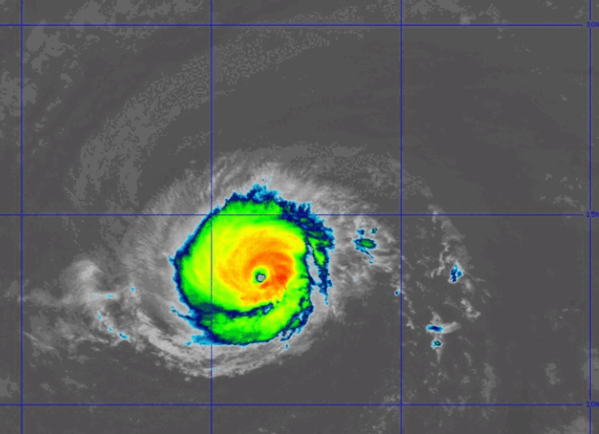
At 11:00 p.m. EDT on Saturday the center of Hurricane Nolo was located at latitude 23.4°N and longitude 175.1°W which put the center about 200 miles (320 km) south-southwest of Lisianski Island. Nolo was moving toward the west at 20 m.p.h. (32 km/h). The maximum sustained wind speed was 115 m.p.h. (185 km/h) and there were wind gusts to 135 m.p.h. (215 km/h). The minimum surface pressure was 957 mb.
Hurricane Nolo strengthened back to a major hurricane on Saturday. However, Nolo appeared to be in the middle of an eyewall replacement cycle on Saturday night. The inner end of a rainband wrapped around the existing eye and eyewall. The eye was no longer seen on satellite images. Bands of showers and thunderstorms were revolving around the core of Nolo’s circulation. Storms near the core of Nolo generated upper level divergence that pumped mass away from the hurricane. The removal of mass caused the surface pressure to decrease on Saturday.
The distribution of wind speeds in Hurricane Nolo was relatively symmetrical. Winds to hurricane force extended out 30 miles (50 km) from the center of Nolo’s circulation. Winds to tropical storm force extended out 150 miles (240 km) from the center of Hurricane Nolo.
The Hurricane Intensity Index (HII) for Hurricane Nolo is 20.6. The Hurricane Size Index (HSI) is 11.6 and the Hurricane Wind Intensity Size Index (HWISI) is 32.2. Hurricane Nolo is similar in size and intensity to Hurricane Delta when Delta hit Louisiana in 2020.
Hurricane Nolo will move through an environment favorable for intensification during the next 24 hours. Nolo will move over water where the Sea Surface Temperatures are near 28°C. It will move through a region where the upper level winds are weak and there will be little vertical wind shear. Hurricane Nolo could weaken during the next few hours until the eyewall replacement cycle is completed. Nolo is likely to intensify again after the eyewall replacement cycle is completed.
Hurricane Nolo will move around the southern side of a high pressure system that is over the Western North Pacific Ocean. The high pressure system will steer Nolo toward the west-northwest during the next 24 hours. On its anticipated track, Hurricane Nolo will move across the International Date Line on Sunday.
Elsewhere, Hurricane Rachel continued to spin south of Baja California.
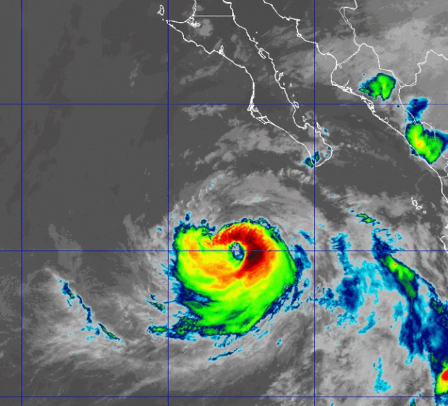
At 11:00 p.m. EDT on Saturday the center of Hurricane Rachel was located at latitude 20.0°N and longitude 112.8°W which put the center about 275 miles (440 km) southwest of the southern tip of Baja California. Rachel was moving toward the west-northwest at 5 m.p.h. (8 km/h). The maximum sustained wind speed was 90 m.p.h. (145 km/h) and there were wind gusts to 105 m.p.h. (165 km/h). The minimum surface pressure was 970 mb.