Category Archives: Western North Pacific

Western Pacific Typhoons and Tropical Storms

Typhoon Hagibis Rapidly Intensifies Into Equivalent of Major Hurricane

Typhoon Hagibis rapidly intensified into the equivalent of a major hurricane east of the Marianas on Sunday night.  At 11:00 p.m. EDT on Sunday the cener of Typhoon Hagibis was located at latitude 15.3°N and longitude 148.8°E which put it about 320 miles (515 km) east-northeast of Guam.  Hagibis was moving toward the west-northwest at 19 m.p.h. (31 km/h).  The maximum sustained wind speed was 115 m.p.h. (185 km/h) and there were wind gusts to 145 m.p.h. (230 km/h).  The minimum surface pressure was 953 mb.

Typhoon Warnings were in effect for Tinian, Saipan, Alamagan and Pagan.  Tropical Storm Warnings were in effect for Rota and Agrihan.  A Tropical Storm Watch was in effect for Guam.

Typhoon Hagibis intensified very rapidly on Sunday night.  The maximum sustained wind speed increased from 75 m.p.h. (120 km/h) to 115 m.p.h. (185 km/h) in six hours.  A small circular eye formed at the center of Hagibis and a ring of strong thunderstorms surrounded the eye.  The strongest winds were occurring in that ring of storms.  Bands of showers and thunderstorms were revolving around the core of the typhoon.  Storms near the core were generating strong upper level divergence which was pumping mass away in all directions.  The removal of mass was allowing the minimum surface pressure to decrease rapidly.

The circulation around Typhoon Hagibis was increasing in size.  Winds to typhoon force extended out 50 miles (80 km) from the center of circulation.  Winds to tropical storm force extended out 175 miles (280 km) from the center.  The Hurricane Intensity Index (HII) for Typhoon Hagibis was 20.2.  The Hurricane Size Index (HSI) was 18.1 and the Hurricane Wind intensity Size Index (HWISI) was 38,3,  Typhoon Hagibis was capable of causing major damage.

Typhoon Hagibis will continue to move through an environment very favorable for intensification for another 24 to 36 hours.  Hagibis will move over water where the Sea Surface Temperature is near 30°C.  It will move through a region where the upper level winds are weak and there will be little vertical wind shear.  Typhoon Hagibis could continue to intensify rapidly and it could strengthen into the equivalent of a Category 5 hurricane on the Saffir-Simpson Scale during the next 24 hours.  At some point a rainband is likely to wrap around the existing eye and eyewall and an eyewall replacement cycle will end the intensification of Typhoon Hagibis.

Typhoon Hagibis will move around the southwestern part of a subtropical high pressure system over the Western North Pacific Ocean.  The high will steer Hagibis toward the west-northwest during the next 12 to 24 hours.  Hagibis will turn more toward the northwest in a day or so.  On its anticipated track Typhoon Hagibis will reach the Marianas in about 12 hours.  The center of Hagibis is likely to pass north of Saipan.  Typhoon Hagibis will bring strong winds and heavy rain.  It will be capable of causing major damage to the Northern Marianas.  Typhoon Hagibis could approach southwestern Japan in four or five days.

Hagibis Strengthens to a Typhoon, Warnings Issued for Marianas

Former Tropical Storm Hagibis strengthened into a typhoon Sunday and warnings were issued for the Marianas.  At 5:00 p.m. EDT on Sunday the center of Typhoon Hagibis was located at latitude 15.1°N and longitude 150.3°E which put it about 425 miles (685 km) east-northeast of Guam.  Hagibis was moving toward the west-northwest at 16 m.p.h. (26 km/h).  The maximum sustained wind speed was 75 m.p.h. (120 km/h) and there were wind gusts to 90 m.p.h. (145 km/h).  The minimum surface pressure was 978 mb.

Typhoon Warnings were in effect for Tinian, Saipan, Alamagan and Pagan.  Tropical Storm Warnings were in effect for Rota and Agrihan.  A Tropical Storm Watch was in effect for Guam.

Typhoon Hagibis exhibited much better organization on satellite images on Sunday.  The inner end of a rainband wrapped almost entirely around the center of circulation and an eye was forming in the middle of Hagibis.  Other bands of showers and thunderstorms were revolving around the core of Typhoon Hagibis.  Storms near the core were generating strong upper level divergence which was pumping mass away from the typhoon in all directions.  Winds to typhoon force extend out 30 miles (50 km) from the center of circulation.  Winds to tropical storm force extended out 145 miles (230 km) from the center.

Typhoon Hagibis will move through an environment very favorable for intensification during the next 48 to 72 hours.  Hagibis will move over water where the Sea Surface Temperature is near 30°C.  It will move through a region where the upper level winds are weak and there will be little vertical wind shear.  Typhoon Hagibis will continue to intensify and it is likely to intensify rapidly once the eye and eyewall are fully developed.  Hagibis could strengthen into the equivalent of a major hurricane within 36 hours and it could intensify to the equivalent of a Category 5 hurricane on the Saffir-Simpson Scale within 72 hours.

Typhoon Hagibis will move around the southwestern portion of a subtropical ridge over the Western North Pacific Ocean.  The ridge will steer Hagibis toward the west-northwest during the next 24 to 48 hours.  Typhoon Hagibis will move more toward the northwest when it gets closer to western end of the ridge in a couple of days.  On its anticipated track Typhoon Hagibis will move through the Marianas in about 24 hours.  The center of Hagibis is forecast to pass north of Saipan.  Typhoon Hagibis will bring strong gusty winds and heavy rain to portions of the Northern Marianas.

Tropical Storm Hagibis Forms East of the Marianas

Tropical Storm Hagibis formed east of the Marianas on Saturday.  At 11:00 p.m. EDT on Saturday the center of Tropical Storm Hagibis was located at latitude 15.0°N and longitude 155.0°E which put it about 735 miles (1185 km) east of Guam.  Hagibis was moving toward the west at 21 m.p.h. (34 km/h).  The maximum sustained wind speed was 50 m.p.h. (80 km/h) and there were wind gusts to 65 m.p.h. (105 km/h).  The minimum surface pressure was 993 mb.

More thunderstorms formed near the center of a low pressure system east of the Marianas and the Japan Meteorological Agency designated the system as Tropical Storm Hagibis.  The circulation around Tropical Storm Hagibis was organizing quickly.  The inner end of a band of showers and thunderstorms wrapped around the southern and eastern sides of the center of circulation.  Bands of showers and thunderstorms formed and were revolving around the center of Hagibis.  Storms near the center began to generate upper level divergence which pumped mass away from the tropical storm.  Winds to tropical storm force extended out 110 miles (175 km) from the center of circulation.

Tropical Storm Hagibis will move through an environment very favorable for intensification.  Haigibis will move over water where the Sea Surface Temperature is near 30°C.  It will move through a region where the upper level winds are weak and there will be little vertical wind shear.  Tropical Storm Hagibis will continue to strengthen and it could intensify rapidly once an eye and an eyewall create a fully developed inner core.  Hagibis could strengthen into a typhoon within 24 hours.  It could be the equivalent of a major hurricane in two or three days.

Tropical Storm Hagibis will move south of a subtropical ridge of high pressure over the Western North Pacific Ocean.  The ridge will steer Hagibis toward the west during the next 24 to 36 hours.  Hagibis will move toward the northwest next week when it gets closer to the western end of the subtropical ridge.  On its anticipated track Tropical Storm Hagibis could reach the Northern Marianas within 36 hours.  Hagibis could be a typhoon when it reaches the Marianas.

Tropical Storm Mitag Brings Wind and Rain to South Korea

Tropical Storm Mitag brought wind and rain to South Korea on Wednesday.  At 5:00 p.m. EDT on Wednesday the center of Tropical Storm Mitag was located at latitude 36.1°N and longitude 128.5°E which put it about 20 miles (30 km) north-northeast of Taegu, South Korea.  Mitag was moving toward the northeast at 21 m.p.h. (34 km/h).  The maximum sustained wind speed was 45 m.p.h. (75 km/h) and there were wind gusts to 60 m.p.h. (95 km/h).  The minimum surface pressure was 993 mb.

Tropical Storm Mitag moved quickly across South Korea on Wednesday.  An upper level trough over eastern Asia was producing strong southwesterly winds which steered Mitag quickly toward the northeast.  Those winds were also causing strong vertical wind shear, which was blowing the upper part of Tropical Storm Mitag northeast of the lower level circulation.  The vertical wind shear and the tilting of the circulation toward the northeast were contributing to the transition of Mitag to an extratropical cyclone.  The strongest winds were occurring in the eastern portion of the tropical storm over the Korea Strait and Sea of Japan.  Winds to tropical storm force extended out 155 miles (250 km) on that side of Tropical Storm Mitag.

Tropical Storm Mitag was dropping heavy rain over parts of South Korea.  The rain could cause flash floods in some locations.  Rain will taper off when Tropical Storm Mitag moves away from South Korea on Thursday.  Mitag will start to move more toward the east when it makes the transition to an extratropical cyclone.  On its anticipated track the extratropical storm will move quickly across the Sea of Japan and it could reach northern Honshu in about 24 hours.  It could drop locally heavy rain on parts of northern Honshu and cause flash floods in some locations.

Typhoon Mitag Passing Just East of China

Typhoon Mitag was passing just to the east of China on Monday night.  At 11:00 p.m. EDT on Monday the center of Typhoon Mitag was located at latitude 27.7°N and longitude 122.2°E which put it about 250 miles (400 km) south-southeast of Shanghai, China.  Mitag was moving toward the north-northeast at 14 m.p.h. (22 km/h).  The maximum sustained wind speed was 85 m.p.h. (135 km/h) and there were wind gusts to 105 m.p.h. (165 km/h).  The minimum surface pressure was 970 mb.

Typhoon Mitag began to weaken later on Monday.  An upper level  trough over eastern Asia was producing southerly winds which were blowing toward the top of the circulation.  Those winds were causing moderate vertical wind shear.  The circulation around Mitag was drawing drier air from Asia into the southern and western parts of the typhoon.  There was still an eye at the center of Typhoon Mitag.  However the ring of strong thunderstorms around the eye weakened.  The stronger bands of showers and thunderstorms were in the northern half of the circulation.  Bands in the southern half of the circulation consisted primarily of showers and lower clouds.  Winds to typhoon force extended out 60 miles (95 km) from the center of circulation.  Winds to tropical storm force extended out 215 miles (345 km) from the center.

Typhoon Mitag will likely to continue to weaken during the next several days.  The upper level trough will continue to cause moderate vertical wind shear.  The circulation around Mitag will also continue to draw drier air from Asia into the typhoon.  Typhoon Mitag will continue to weaken slowly and it could weaken to a tropical storm  within 24 hours.

The upper level trough will steer Typhoon Mitag toward the north-northeast during the next 12 to 24 hours.  Mitag will turn more toward the northeast in a day or so.  On its anticipated track Typhoon Mitag will pass to the east of Ningbo and Shanghai.  Mitag could approach South Korea in about 36 hours.  It will likely be a tropical storm by that time, but Mitag could drop locally heavy rain over South Korea.

Typhoon Mitag Nears Northeast Taiwan

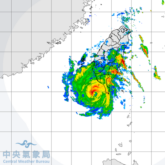
Typhoon Mitag moved nearer to northeastern Taiwan on Sunday night.  At 11:00 p.m. EDT on Sunday the center of Typhoon Mitag was located near latitude 22.3°N and longitude 122.7°E which put it about 180 miles (290 km) south-southeast of Taipei, Taiwan.  Mitag was moving toward the northwest at 14 m.p.h. (22 km/h).  The maximum sustained wind speed was 75 m.p.h. (120 km/h) and there were wind gusts to 90 m.p.h. (145 km/h).  The minimum surface pressure was 976 mb.

Former Tropical Storm Mitag strengthened into a typhoon on Sunday.  A circular eye appeared at the center of Typhoon Mitag on satellite images.  The eye was surrounded by a ring of thunderstorms.  There were some breaks in the ring of storms, but the strongest winds were occurring in the ring.  Bands of showers and thunderstorms were revolving around the core of Typhoon Mitag.  Storms near the core were generating upper level divergence which was pumping mass away in all directions.  Winds to typhoon force extended out 50 miles (80 km) from the center of circulation.  Winds to tropical storm force extended out about 185 miles (295 km) from the center.

Typhoon Mitag will move through an environment favorable for intensification during the next 12 to 24 hours.  Mitag will move over water where the Sea Surface Temperature is near 28°C.  It will move through a region where the upper level winds are not too strong and there will not be a lot of vertical wind shear.  Typhoon Mitag could strengthen on Monday if the center of circulation does not pass over northeastern Taiwan.  If the center of Mitag does move over Taiwan, then the typhoon will weaken,

Typhoon Mitag will move around the western end of a ridge of high pressure over the Western North Pacific Ocean.  The ridge will steer Mitag toward the north-northwest.  On its anticipated track the center of Typhoon Mitag will be near northeastern Taiwan within 12 hours.  Mitag could drop heavy rain over parts of Taiwan and flash floods are possible.  Rainbands in the eastern side of the typhoon will bring gusty winds and heavy rain to the southern Ryukyu Islands.  Typhoon Mitag could approach the east coast of China near Taizhou in about 36 hours.

Tropical Storm Mitag Forms Southeast of Ryukyu Islands

Tropical Storm Mitag formed southeast of the Ryukyu Islands on Friday.  At 11:00 p.m. EDT on Friday the center of Tropical Storm Mitag was located at latitude 16.4°N and longitude 131.5°E which put it about 730 miles (1180 km) southeast of Ishigaki, Japan.  Mitag was movign toward the west-northwest at 27 m.p.h. (44 km/h).  The maximum sustained wind speed was 45 m.p.h. (75 km/h) and there were wind gusts to 60 m.p.h. (95 km/h).  The minimum surface pressure was 994 mb.

More thunderstorms developed near the center of a low pressure system southeast of the Ryukyu Islands on Friday and the Japan Meteorological Agency designated the system as Tropical Storm Mitag.  The distribution of thunderstorms around Tropical Storm Mitag was asymmetrical.  A few thunderstorms developed near the center of circulation, but most of the thunderstorms were forming in bands in the southern half of the circulation.  Bands in the northern half of Mitag consisted primarily of showers and lower clouds.  Tropical Storm Mitag was moving around the southwestern portion of an upper level ridge over the Western North Pacific Ocean.  The ridge was producing northeasterly winds which were blowing toward the top of Mitag.  Those winds were causing moderate vertical wind shear and they were contributing to the asymmetrical distribution of thunderstorms.

Tropical Storm Mitag will move through an environment somewhat favorable for intensification during the next two days.  Mitag will move over water where the Sea Surface Temperature is near 29°C.  Mitag will move around the western end of the upper level ridge where the winds are weaker.  The wind shear is likely to decrease and Tropical Storm Mitag is forecast to strengthen into a typhoon during the weekend.

The ridge over the Western North Pacific Ocean will steer Tropical Storm Mitag toward the northwest during the next 24 to 36 hours.  Mitag will move more toward the north when it moves around the west end of the ridge in about 48 hours.  On its anticipated track Tropcial Storm Mitag could reach the southern Ryukyu Islands in about 48 hours.  Mitag could be a typhoon at that time.

Tapah Strengthens to a Typhoon Southwest of Japan

Former Tropical Storm Tapah strengthened into a typhoon southwest of Japan on Saturday.  At 11:00 a.m. EDT on Saturday the center of Typhoon Tapah was located at latitude 29.2°N and longitude 125.9°E which put it about 380 miles (610 km) southwest of Nagasaki, Japan.  Tapah was moving toward the north at 12 m.p.h. (19 km/h).  The maximum sustained wind speed was 75 m.p.h. (120 km/h) and there were wind gusts to 90 m.p.h. (145 km/h).  The minimum surface pressure was 972 mb.

The circulation around Typhoon Tapah was very large.  Winds to tropical storm force extended out 250 miles (400 km) from the center of circulation.  There was a large eye with a diameter of 60 miles (95 km) at the center of Typhoon Tapah.  The eye was surrounded by a broken ring of thunderstorms and the strongest winds were occurring in that ring of storms.  Bands of showers and thunderstorms were revolving around the large eye of Tapah.  It appeared on satellite imagery as if some drier air might be wrapping around the southeastern side of the circulation.

Typhoon Tapah will move through an environment that could allow it to maintain its current intensity for another 12 to 24 hours.  Tapah will move over water where the Sea Surface Temperature is near 28°C.  An upper level trough over eastern Asia will produce southwesterly winds which will cause some vertical wind shear, but the shear may not be strong enough to weaken Tapah today.  Typhoon Tapah will move under stronger upper level westerly winds in the middle latitudes on Sunday and the increase in wind shear will weaken the typhoon.  Stronger wind shear and cooler Sea Surface Temperatures will cause Typhoon Tapah to begin a transition into an extratropical cyclone on Sunday.

Typhoon Tapah will move around the western end of a subtropical ridge over the Western North Pacific Ocean during the next 12 to 18 hours.  The ridge will steer Tapah toward the north during that time period.  The stronger westerly winds in the middle latitudes will turn Tapah toward the northeast on Sunday.  On its anticipated track the center of Typhoon Tapah will be west of Kyushu in about 12 to 18 hours.  The center of Tapah could pass between South Korea and Japan on Sunday and then it will move over the Sea of Japan.  Because it has such a large circulation Typhoon Tapah could bring gusty winds and locally heavy rain to parts of Kyushu, Honshu and South Korea.

Tropical Storm Tapah Develops East of Taiwan

Tropical Storm Tapah developed east of Taiwan on Thursday.  At 11:00 p.m. EDT on Thursday the center of Tropical Storm Tapah was located at latitude 23.3°N and longitude 126.5°E which put it about 150 miles (245 km) east-southeast of Ishigaki, Japan.  Tapah was moving toward the west at 7 m.p.h. (11 km/h).  The maximum sustained wind speed was 50 m.p.h. (80 km/h) and there were gusts to 65 m.p.h. (105 km/h).  The minimum surface pressure was 965 mb.

A distinct low level center of circulation formed on the northern side of an area of thunderstorms east of Taiwan on Thursday and the Japan Meteorological Agency designated the system as Tropical Storm Tapah.  The distribution of thunderstorms around Tapah was asymmetrical.  Most of the thunderstorms  were occurring in bands in the southern half of the circulation.  Bands in the northern half of the tropical storm consisted primarily of showers and lower clouds.  Storm on the southern side of the center began to generate upper level divergence which pumped mass away from the tropical storm.  The circulation around Tropical Storm Tapah was very large.  Winds to tropical storm force extended out about 250 miles (400 km) from the center of circulation.

Tropical Storm Tapah will move through an environment favorable for intensification during the next several days.  Tapah will move over water where the Sea Surface Temperature is near 29°C.  It will move through a region where the upper level winds are weak and there will be little vertical wind shear.  Some drier air north of Tropical Storm Tapah could inhibit the development of bands of thunderstorms on the northern side of the circulation.  Tropical Storm Tapah is likely to intensify and it could strengthen into a typhoon during the weekend.

Tropical Storm Tapah will move around the western end of a subtropical ridge over the Western North Pacific Ocean.  The ridge will steer Tapah more toward the northwest on Friday.  Tapah will move more toward the north when it rounds the western end of the ridge.  On its anticipated track Tropical Storm Tapah could move over the southern Ryukyu Islands in about 12 hours.  The center of Tapah could pass west of Okinawa in about 24 hours.

Typhoon Faxai Hits Tokyo

Typhoon Faxai hit Tokyo, Japan on Sunday.  At 2:00 p.m. EDT on Sunday the center of Typhoon Faxai was located at latitude 35.3°N and 139.7°E which put it about 30 miles (50 km) south of Tokyo, Japan.  Faxai was moving toward the north-northeast at 15 m.p.h. (24 km/h).  The maximum sustained wind speed was 110 m.p.h. (170 km/h) and there were wind gusts to 130 m.p.h. (220 km/h).  The minimum surface pressure was 959 mb.

The eye of Typhoon Faxai was very near Tokyo and the northern portion of the eyewall may have been over the city.  The strongest winds were in the ring of thunderstorms around the eye.  Winds to typhoon force extended out about 45 miles (75 km) from the center of Typhoon Faxai.  Winds to typhoon force were likely occurring in the Tokyo metropolitan area.  Winds to tropical storm force extended out about 160 miles (260 km) from the center of Faxai.  Radar operated by the Japan Meteorological Agency indicated that the eyewall and rainbands were dropping heavy rain over the region around Tokyo.  Flash flooding is likely to occur in some locations.

Typhoon Faxai will move northeast across eastern Honshu during the next few hours.  Faxai will be capable of causing serious wind damage while it moves over the region northeast of Tokyo.  Heavy rain is likely to cause flash floods in that area.  Typhoon Faxai will move northeast of Japan on Monday and conditions should improve.