
Tropical Depression Nine formed over the southwestern Gulf of Mexico on Tuesday afternoon. At 5:00 p.m. EDT on Tuesday the center of Tropical Depression Nine was located at latitude 22.1°N and longitude 95.6°W which put the center about 380 miles (615 km) west of Progreso, Mexico. The tropical depression was moving toward the east at 5 m.p.h. (8 km/h). The maximum sustained wind speed was 35 m.p.h. (55 km/h) and there were wind gusts to 45 m.p.h. (75 km/h). The minimum surface pressure was 1007 mb.
A distinct low level center of circulation formed within a cluster of thunderstorms that was over the southwestern Gulf of Mexico and the U.S. National Hurricane Center designated the system as Tropical Depression Nine.
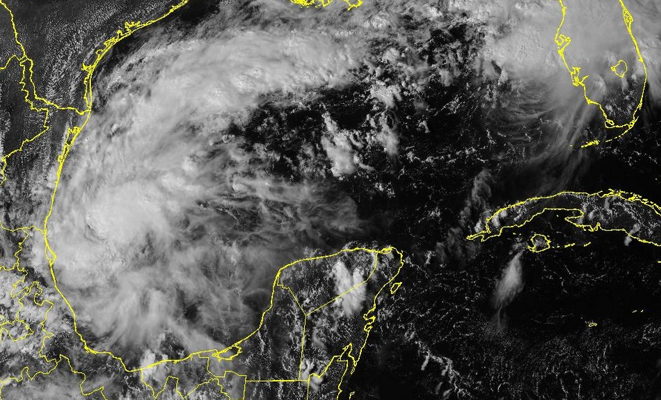
New thunderstorms were forming near the center of Tropical Depression Nine. Thunderstorms were also developing in bands that were revolving around the center of the tropical depression. Storms near the center of the depression started to generate upper level divergence that pumped mass away from the tropical depression. The removal of mass caused the surface pressure to start to decrease.
Tropical Depression Nine will move through an environment that will be favorable for intensification during the next 24 hours. The tropical depression will move over water where the Sea Surface Temperatures are near 30°C. It will move under the western part of an upper level ridge that is over the Gulf of Mexico. The upper level ridge will produce southerly winds that will blow toward the top of the tropical depression. Those winds will cause some vertical wind wind shear. The vertical wind shear will inhibit intensification, but the wind shear will not be enough to prevent that intensification. Tropical Depression Nine will intensify to a tropical storm during the next 24 hours. It could strengthen to a hurricane later this week.
An upper level trough over the eastern U.S. and the Gulf of Mexico will steer Tropical Depression Nine toward the east during the next 24 hours. On its anticipated track, Tropical Depression Nine will move closer to the northwestern part of the Yucatan Peninsula. A different upper level trough approaching from the west will start to steer the tropical depression toward the north later this week.