Strong Tropical Wave over Eastern Atlantic

A strong tropical wave was over the eastern Atlantic Ocean on Thursday night. The tropical wave was designated as Invest 94L. It was located along longitude 27.0°W which put it about 2200 miles (3560 km) east-southeast of the Lesser Antilles. The tropical wave was moving toward the west at 15 m.p.h. (24 km/h). The maximum sustained wind speed was 25 m.p.h. (40 km/h). The minimum surface pressure was 1012 mb.

The axis of a strong tropical wave, also designated as Invest 94L, was located along longitude 27.0°W. The strongest thunderstorms were occurring south of latitude 11.0°N. Satellite derived data indicated that there was some rotation near the axis of the wave. Thunderstorms near the axis of the tropical wave generated upper level divergence.

The tropical wave will move south of a subtropical high pressure system over the Atlantic Ocean. The high pressure system will steer the tropical wave toward the west during the next few days. On its anticipated track the tropical wave could approach the Lesser Antilles on Tuesday.

The tropical wave will move through an environment that is favorable for the development of a tropical cyclone. The wave will move over water where the Sea Surface Temperatures are near 27˚C. It will move through a region where the winds in the troposphere will blow from the east at most levels and there will be little vertical wind shear. The National Hurricane Center is indicating the probability is 40% that the tropical wave develops into a tropical depression during the next five days.

Tropical Storm Celia Churns Southwest of Mexico

Tropical Storm Celia churned over the Eastern North Pacific Ocean southwest of Mexico on Wednesday night. At 11:00 p.m. EDT on Wednesday the center of Tropical Storm Celia was located at latitude 14.2°N and longitude 104.4°W which put it about 330 miles (535 km) south of Manzanillo, Mexico. Celia was moving toward the northwest at 7 m.p.h. (11 km/h). The maximum sustained wind speed was 50 m.p.h. (80 km/h) and and there were wind gusts to 65 m.p.h. (105 km/h). The minimum surface pressure was 1000 mb.

Winds to tropical storm force extended out 70 miles (110 km) from the center of Celia’s circulation. Even though Tropical Storm Celia strengthened a little on Wednesday, the distribution of thunderstorms remained asymmetrical. The strongest thunderstorms were occurring in bands in the western and southern parts of Celia’s circulation. Bands in the eastern and northern parts of Tropical Storm Celia consisted primarily of showers and lower clouds. An upper level ridge over Mexico and the Eastern North Pacific Ocean was producing moderate east-northeasterly winds that were blowing toward the top of Celia’s circulation. Those winds were causing some vertical wind shear and the wind shear was contributing to the asymmetrical distribution of thunderstorms.

Tropical Storm Celia will move through an environment that will become more favorable for intensification during the next 48 hours. Celia will move over water where the Sea Surface Temperatures are near 28˚C. Although the upper level ridge over Mexico and the Eastern North Pacific will continue to produce east-northeasterly winds, those winds will weaken during the next 48 hours. When the upper level winds weaken, the vertical wind shear will diminish. Tropical Storm Celia is likely to intensify during the next 48 hours. Celia could strengthen to a hurricane on Friday.

Tropical Storm Celia will move southwest of a high pressure system over Mexico during the next 48 hours. The high pressure system will steer Celia toward the west-northwest. On its anticipated track Tropical Storm Celia will move south of Baja California by Saturday.

Celia Strengthens Back to a Tropical Storm

One time Tropical Storm Celia strengthened back to a tropical storm over the Eastern North Pacific Ocean south of Mexico on Tuesday morning. At 11:00 a.m. EDT on Tuesday the center of Tropical Storm Celia was located at latitude 11.6°N and longitude 99.5°W which put it about 365 miles (590 km) south of Acapulco, Mexico. Celia was moving toward the west at 12 m.p.h. (19 km/h). The maximum sustained wind speed was 40 m.p.h. (65 km/h) and and there were wind gusts to 50 m.p.h. (80 km/h). The minimum surface pressure was 1005 mb.

After passing south of Guatemala during the weekend as a weak tropical depression, former Tropical Storm Celia strengthened back to a tropical storm on Tuesday morning. Winds to tropical storm force extended out 60 miles in the northern half of Tropical Storm Celia. Winds in the southern half of Celia were blowing at less than tropical storm force. The circulation around Tropical Storm Celia continued to be poorly organized. The strongest thunderstorms were occurring in bands located west of the center of Celia’s circulation. Bands in the eastern half of the circulation consisted primarily of showers and lower clouds. An upper level ridge over southern Mexico was producing moderate easterly winds that were blowing across the top of Celia’s circulation. Those winds cause moderate vertical wind shear and the wind shear was causing the asymmetrical distribution of thunderstorms.

Tropical Storm Celia will move through an environment that will be only marginally favorable for intensification during the next 24 hours. Celia will move over water where the Sea Surface Temperatures are near 29˚C. However, the upper level ridge over southern Mexico will continue to cause moderate vertical wind shear. The wind shear will inhibit intensification during the next day or so. Tropical Storm Celia will move into an area where the upper level winds are weaker later this week. That will cause the vertical wind shear to diminish. Tropical Storm Celia is likely to intensify when the shear diminishes. Celia could strengthen to a hurricane by the end of the week.

Tropical Storm Celia will move south of a high pressure system over Mexico during the next 48 hours. The high pressure system will steer Celia toward the west-northwest. On its anticipated track Tropical Storm Celia will move parallel to the coast of southwest Mexico.

Tropical Depression Celia Passes South of Guatemala

Tropical Depression Celia passed south of Guatemala on Sunday. At 11:00 a.m. EDT on Sunday the center of Tropical Depression Celia was located at latitude 12.8°N and longitude 92.4°W which put it about 130 miles (210 km) southwest of Puerto San Jose, Guatemala. Celia was moving toward the west at 8 m.p.h. (13 km/h). The maximum sustained wind speed was 30 m.p.h. (50 km/h) and and there were wind gusts to 40 m.p.h. (65 km/h). The minimum surface pressure was 1008 mb.

The circulation around Tropical Depression Celia weakened during the weekend. A few thunderstorms formed near the center of Celia, but most of the circulation consisted of bands of showers and lower clouds. An upper level ridge over southeastern Mexico produced easterly winds that blew across the top of Tropical Depression Celia. Those winds caused moderate vertical wind shear. The wind shear blew the tops off of many of the thunderstorms that started to develop in Tropical Depression Celia.

Tropical Depression Celia will move through an environment mostly unfavorable for intensification during the next 24 hours. Celia will move over water where the Sea Surface Temperatures are near 28˚C. However, the upper level ridge over southeastern Mexico will continue to cause moderate vertical wind shear. The wind shear will prevent intensification during the next day or so. Tropical Depression Celia will move into an area where the upper level winds are weaker early next week. That will cause the vertical wind shear to diminish. Tropical Depression Celia could strengthen when the shear diminishes.

Tropical Depression Celia will move south of a high pressure system over Mexico during the next 48 hours. The high pressure system will to steer Celia toward the west. On its anticipated track Tropical Depression Celia will move parallel to the south coast of Mexico.

Elsewhere over the Eastern North Pacific Ocean, Tropical Storm Blas weakened south of Baja California. At 11:00 a.m. EDT on Sunday the center of Tropical Storm Blas was located at latitude 19.0°N and longitude 113.0°W which put it about 335 miles (540 km) southwest of the southern tip of Baja California. Blas was moving toward the west-northwest at 7 m.p.h. (11 km/h). The maximum sustained wind speed was 45 m.p.h. (75 km/h) and and there were wind gusts to 60 m.p.h. (95 km/h). The minimum surface pressure was 1001 mb.

Tropical Depression Three-E Strengthens to Tropical Storm Celia

Former Tropical Depression Three-E strengthened to Tropical Storm Celia over the Eastern North Pacific Ocean south of El Salvador on Friday morning. At 11:00 a.m. EDT on Friday the center of Tropical Storm Celia was located at latitude 11.6°N and longitude 89.3°W which put it about 145 miles (235 km) south of San Salvador, El Salvador. Celia was moving toward the north-northeast at 3 m.p.h. (5 km/h). The maximum sustained wind speed was 40 m.p.h. (65 km/h) and and there were wind gusts to 50 m.p.h. (80 km/h). The minimum surface pressure was 1004 mb.

The circulation around former Tropical Depression Three-E strengthened on Friday morning and the National Hurricane Center upgraded it to Tropical Storm Celia. The strongest thunderstorms were occurring in bands in the western half of Tropical Storm Celia. Bands in the eastern half of Celia’s circulation consisted primarily of showers and lower clouds. The thunderstorms in the western half of the circulation generated upper level divergence that pumped mass away from the tropical storm. The circulation around Tropical Storm Celia was small. Winds to tropical storm force extended out 35 miles (55 km) from the center of Celia.

Tropical Storm Celia will move through an environment favorable for intensification during the next 24 hours. Celia will move over water where the Sea Surface Temperatures are near 27˚C. It will be in an area where the upper level winds are weak and there will be little vertical wind shear. Tropical Storm Celia could strengthen gradually during the next 24 hours.

Tropical Storm Celia will be in an area where the steering winds are weak during the next 18 hours. A broad area of low pressure over Central America and the adjacent part of the Eastern North Pacific Ocean will steer Celia slowly toward the north during the next 18 hours. On its anticipated track Tropical Storm Celia will move slowly closer to El Salvador. Rainbands in the northern fringes of Celia could drop heavy rain over parts of El Salvador and Guatemala. Heavy rain could cause flash floods in some locations. A high pressure system will strengthen over Mexico during the weekend. The high pressure system is likely to steer Tropical Storm Celia toward the west.

Elsewhere over the Eastern North Pacific Ocean, Hurricane Blas strengthened a little as it moved away from the southwest coast of Mexico. At 11:00 a.m. EDT on Friday the center of Hurricane Blas was located at latitude 17.8°N and longitude 109.0°W which put it about 320 miles (515 km) southwest of Manzanillo, Mexico. Blas was moving toward the west-northwest at 14 m.p.h. (22 km/h). The maximum sustained wind speed was 90 m.p.h. (145 km/h) and and there were wind gusts to 105 m.p.h. (165 km/h). The minimum surface pressure was 976 mb.

Tropical Depression Three-E Forms South of El Salvador

Tropical Depression Three-E formed over the Eastern North Pacific Ocean south of El Salvador on Thursday afternoon. At 5:00 p.m. EDT on Thursday the center of Tropical Depression Three-E was located at latitude 10.8°N and longitude 89.9°W which put it about 205 miles (330 km) south-southwest of San Salvador, El Salvador. The tropical depression was moving toward the north at 2 m.p.h. (3 km/h). The maximum sustained wind speed was 35 m.p.h. (55 km/h) and and there were wind gusts to 45 m.p.h. (75 km/h). The minimum surface pressure was 1006 mb.

A low pressure system over the Eastern North Pacific Ocean south of El Salvador strengthened on Thursday afternoon and the National Hurricane Center designated the system as Tropical Depression Three-E. The inner end of a rainband wrapped around the western and southern sides of the center of Tropical Depression Three-E. Other bands of showers and thunderstorms were revolving around the center of the depression. Storms near the center of circulation generated upper level divergence that pumped mass away from the tropical depression.

Tropical Depression Three-E will move through an environment favorable for intensification during the next 24 hours. The tropical depression will move over water where the Sea Surface Temperatures are near 28˚C. It will be in an area where the upper level winds are weak and there will be little vertical wind shear. Tropical Depression Three-E is very likely to strengthen to a tropical storm during the next 24 hours.

Tropical Depression Three-E will be in an area where the steering winds are weak during the next 24 hours. A broad area of low pressure over Central America and the adjacent part of the Eastern North Pacific Ocean will steer the tropical depression slowly toward the north during the next 24 hours. On its anticipated track Tropical Depression Three-E will move slowly closer to El Salvador. Rainbands in the northern fringes of the tropical depression could drop heavy rain over parts of El Salvador and Guatemala. Heavy rain could cause flash floods in some locations.

Elsewhere over the Eastern North Pacific Ocean, Hurricane Blas churned southwest of Mexico. At 5:00 p.m. EDT on Thursday the center of Hurricane Blas was located at latitude 16.2°N and longitude 105.6°W which put it about 210 miles (340 km) south-southwest of Manzanillo, Mexico. Blas was moving toward the west-northwest at 8 m.p.h. (13 km/h). The maximum sustained wind speed was 85 m.p.h. (135 km/h) and and there were wind gusts to 100 m.p.h. (160 km/h). The minimum surface pressure was 980 mb.

Columbus, Ohio Sets Dew Point Record

Columbus, Ohio set a record for the highest dew point temperature measured by an official weather station in Columbus on Tuesday. The Automated Surface Observing System (ASOS) site at the John Glenn International Airport (KCMH) reported a dew point temperature of 84 degrees at 6:45 p.m. EDT on Tuesday, June 14, 2022. The previous record for the highest dew point temperature at KCMH was 81 degrees which was recorded on July 26, 1997. The record dew point temperature of 84 is equal to the highest reported dew point temperature for Miami, Florida (KMIA) which is also 84 degrees.

The graph of the dew point temperature measured at NOAA buoy 42039 in the northern Gulf of Mexico might help to put the record in perspective. 
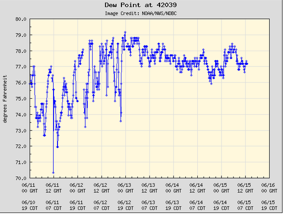
The record dew point temperature of 84 degrees was nearly five degrees higher than any dew point temperature measured by the buoy during the past five days.

Blas Rapidly Intensifies to a Hurricane

Former Tropical Storm Blas rapidly intensified to a hurricane over the Eastern North Pacific Ocean on Wednesday morning. At 11:00 a.m. EDT on Wednesday the center of Hurricane Blas was located at latitude 14.9°N and longitude 102.8°W which put it about 300 miles (485 km) south-southeast of Manzanillo, Mexico. Blas was moving toward the west-northwest at 5 m.p.h. (8 km/h). The maximum sustained wind speed was 75 m.p.h. (120 km/h) and and there were wind gusts to 90 m.p.h. (145 km/h). The minimum surface pressure was 988 mb.

Former Tropical Storm Blas rapidly intensified during the past 24 hours and Blas reached hurricane intensity on Wednesday morning. The inner end of a rainband wrapped around the center of Hurricane Blas and a small eye was apparent on microwave satellite images. The eye was surrounded by a ring of strong thunderstorms and the strongest winds were occurring in that ring of storms. Bands of showers and thunderstorms were revolving around the core of Hurricane Blas. Storms near the core generated upper level divergence that pumped mass away from the hurricane in all directions. The circulation around Blas was small. Hurricane force winds extended out 15 miles (25 km) from the center of circulation. Tropical storm force winds extended out 45 miles from the center.

Hurricane Blas will move through an environment favorable for intensification during the next 24 hours. Blas will move over water where the Sea Surface Temperatures are near 29˚C. It will move through a region where the upper level winds are weak and there will be little vertical wind shear. Hurricane Blas will strengthen during the next 24 hours. Blas could continue to intensify rapidly since an inner core has formed.

Hurricane Blas will move south of the western end of a high pressure system over Mexico during the next several days. The high pressure system will steer Blas toward the west-northwest. On its anticipated track Hurricane Blas will move slowly away from the west coast of Mexico during the next 24 hours.

Possible Development over Southwest Caribbean Sea

A tropical depression or tropical storm could develop over the Southwestern Caribbean Sea east of Nicaragua during the next few days. An area of low pressure at the surface, currently designated as Invest 93L, is over that area. At 2:00 p.m. EDT on Tuesday the center of Invest 93L was located at latitude 11.8°N and longitude 82.2°W which put it about 110 miles (175 km) east of Bluefields, Nicaragua. Invest 93L was moving toward the west-northwest at 6 m.p.h. (10 km/h). The maximum sustained wind speed was 25 m.p.h. (40 km/h) and and there were wind gusts to 35 m.p.h. (55 km/h). The minimum surface pressure was 1009 mb.

Invest 93L was located on the eastern side of a larger area of low pressure that extends from the Southwestern Caribbean Sea across Central America to the Eastern North Pacific Ocean. A second, small low pressure system, currently designated as Invest 93E, was located over the Eastern North Pacific Ocean south of El Salvador. Visible satellite images appeared to show some counterclockwise rotation of lower clouds over the Southwestern Caribbean Sea east of Nicaragua. A few thunderstorms formed near the apparent center of circulation, but the system did not possess enough organization to be classified as a tropical depression.

Invest 93L will be in an environment that is somewhat favorable for the formation of a tropical cyclone during the next few days. Invest 93L will move over water where the Sea Surface Temperatures are near 29˚C. It will move through a region where the upper level winds are weak and there will be little vertical wind shear. If Invest 93L remains over the Southwest Caribbean Sea, it could develop into a tropical depression during the next 48 hours. However, if the center of Invest 93L moves inland over Nicaragua, then it will not develop. The National Hurricane Center is indicating there is a probability of 40% that Invest 93L develops into a tropical cyclone. A reconnaissance plane has been tentatively tasked to investigate Invest 93L on Wednesday afternoon, if necessary.

Invest 93L will move near the southwestern part of a high pressure system that extends from the Western Atlantic Ocean over the Caribbean Sea and the Gulf of Mexico. The steering winds are weak near the southwestern part of the high pressure system, but those winds could steer Invest 93L slowly toward the northwest during the next few days. On its anticipated track, Invest 93L will move close to the coast of Nicaragua. Invest 93L could drop heavy rain over parts of Nicaragua, Honduras, Costa Rica and El Salvador. Locally heavy rain could cause flash floods in some places.

Tropical Depression Two-E Strengthens to Tropical Storm Blas

Former Tropical Depression Two-E strengthened to Tropical Storm Blas over the Eastern North Pacific Ocean south-southeast of Manzanillo, Mexico on Tuesday morning. At 11:00 a.m. EDT on Tuesday the center of Tropical Storm Blas was located at latitude 13.9°N and longitude 102.1°W which put it about 380 miles (615 km) south-southeast of Manzanillo, Mexico. Blas was moving toward the north at 2 m.p.h. (3 km/h). The maximum sustained wind speed was 45 m.p.h. (75 km/h) and and there were wind gusts to 60 m.p.h. (95 km/h). The minimum surface pressure was 1002 mb.

The circulation around Tropical Storm Blas intensified on Tuesday morning. More thunderstorms developed near the center of Blas. Thunderstorms were also forming in bands in the southern half of Tropical Storm Blas. Bands in the northern half of Blas consisted primarily of showers and lower clouds. Storms near the center of circulation generated upper level divergence that pumped mass away from the tropical storm. Winds to tropical storm force extended out 45 miles (75 km) from the center of Blas.

Tropical Storm Blas will move through an environment favorable for intensification during the next 48 hours. Blas will move over water where the Sea Surface Temperatures are near 29˚C. It will move through a region where the upper level winds are weak and there will be little vertical wind shear. Tropical Blas will intensify during the next 48 hours. It could strengthen to a hurricane on Wednesday.

Tropical Storm Blas will be in an area where the steering winds are weak during the next 24 hours. It will move slowly toward the north during that time. The western end of a high pressure system will extend over Mexico on Wednesday. The high pressure system will start to steer Blas toward the west-northwest. On its anticipated track Tropical Storm Blas will move away from the west coast of Mexico later this week.