Tag Archives: Ohio

Tropical Depression Nicole Drops Heavy Rain over Southeast U.S.

Tropical Depression Nicole dropped heavy rain over parts of the southeastern U.S. on Friday morning. At 10:00 a.m. EST on Friday the center of Tropical Depression Nicole was located at latitude 34.2°N and longitude 84.3°W which put it about 35 miles (55 km) north of Atlanta, Georgia. Nicole was moving toward the north-northeast at 23 m.p.h. (37 km/h). The maximum sustained wind speed was 30 m.p.h. (50 km/h) and there were wind gusts to 40 m.p.h. (65 km/h). The minimum surface pressure was 1001 mb.

Tropical Storm Nicole dropped heavy rain over parts of the southeastern U.S. on Friday morning. Heavy rain was falling over eastern Tennessee and eastern Kentucky. Bands in the far eastern side of Nicole’s circulation contained thunderstorms that were dropping heavy rain over parts of eastern South Carolina, eastern North Carolina and southeastern Virginia. Easterly winds blowing around the northern side of Nicole’s circulation were enhancing convergence and rising motion ahead of a cold front moving toward the eastern U.S. The enhanced convergence and rising motion was contributing to rain that was falling in the region from Delaware to Ohio.

The cold front approaching the eastern U.S. and an upper level trough over the central U.S. will steer Tropical Depression Nicole quickly toward the north-northeast during Friday. On its anticipated track the center of Tropical Depression Nicole will be over West Virginia by Friday evening. Heavy rain falling over parts of the southeastern U.S. and Appalachians could cause flooding. Flood Watches were in effect for parts of northern South Carolina, western North Carolina and southern Virginia. There could be enough low level wind shear for tornadoes to develop in the bands on the far eastern side of the circulation around Tropical Depression Nicole. A Tornado Watch was in effect for eastern South Carolina, eastern North Carolina and southeastern Virginia.

Columbus, Ohio Sets Dew Point Record

Columbus, Ohio set a record for the highest dew point temperature measured by an official weather station in Columbus on Tuesday. The Automated Surface Observing System (ASOS) site at the John Glenn International Airport (KCMH) reported a dew point temperature of 84 degrees at 6:45 p.m. EDT on Tuesday, June 14, 2022. The previous record for the highest dew point temperature at KCMH was 81 degrees which was recorded on July 26, 1997. The record dew point temperature of 84 is equal to the highest reported dew point temperature for Miami, Florida (KMIA) which is also 84 degrees.

The graph of the dew point temperature measured at NOAA buoy 42039 in the northern Gulf of Mexico might help to put the record in perspective. 
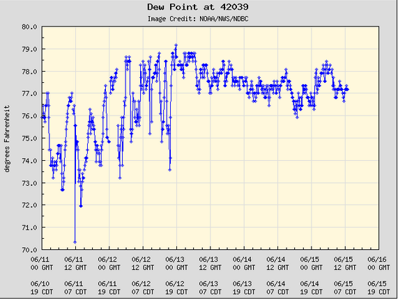
The record dew point temperature of 84 degrees was nearly five degrees higher than any dew point temperature measured by the buoy during the past five days.

Tropical Depression Ida Brings Rain and Storms to Southeast U.S.

Tropical Depression Ida brought rain and thunderstorms to the southeast U.S. on Monday. At 5:00 p.m. EDT on Monday the center of Tropical Depression Ida was located at latitude 32.6°N and longitude 90.3°W which put it about 20 miles (30 km) north-northwest of Jackson, Mississippi. Ida was moving toward the north-northeast at 9 m.p.h. (15 km/h). The maximum sustained wind speed was 35 m.p.h. (55 km/h) and there were wind gusts to 45 m.p.h. (75 km/h). The minimum surface pressure was 999 mb.

Former Hurricane Ida weakened to a tropical depression over Mississippi on Monday afternoon. Even though the speed of the wind circulating around Ida decreased, Tropical Depression Ida was still dropping locally heavy rain and generating a few tornadoes over the southeast U.S. Thunderstorms in bands on the eastern side of Ida were dropping locally heavy rain over parts of Mississippi, Alabama, northwest Florida and northwestern Georgia. Flash Flood Watches were in effect for all of those places. Tornadoes were reported in southeastern Mississippi, and southwestern and central Alabama.

Electricity was still out in all of New Orleans. Southerly winds blowing around the eastern side of Tropical Depression Ida’s circulation were still pushing water toward the coast. Those winds were blowing to near tropical storm force in some locations. A weather station at Fort Morgan, Alabama was reporting a sustained wind speed of 38 m.p.h. (61 km/h) and a wind gust of 47 m.p.h. (76 km/h). The water levels had decreased along the coast, but the persistent southerly winds were preventing the water levels from returning to normal. The water levels should continue to decrease when Tropical Depression Ida moves farther away from the coast.

Tropical Depression Ida will move northeast during the next 72 hours. The center of Ida will cross Tennessee on Tuesday. Ida could be over West Virginia on Wednesday and it could reach the east coast of the U.S. on Thursday. Tropical Depression Ida will continue to drop locally heavy rain over the eastern U.S. The circulation around Ida will interact with a cold front moving slowly south toward the Ohio River. The interaction between Ida and the cold front could enhance rainfall over the Tennessee and Ohio River Valleys. Flash Flood Watches are in effect across the region from Tennessee to New Jersey.

Elsewhere over the Atlantic Ocean, Tropical Storm Julian made a transition to an extratropical cyclone west of the Azores on Monday morning and Tropical Storm Kate developed east-northeast of the Leeward Islands. At 5:00 p.m. EDT on Monday the center of Tropical Storm Ida was located at latitude 22.7°N and longitude 50.9°W which put it about 805 miles (1295 km) east-northeast of the Leeward Islands. Kate was moving toward the north at 10 m.p.h. (16 km/h). The maximum sustained wind speed was 40 m.p.h. (65 km/h) and there were wind gusts to 50 m.p.h. (80 km/h). The minimum surface pressure was 1006 mb.

Hurricane Ida Knocks Out Power in New Orleans

Strong winds in Hurricane Ida knocked out power to New Orleans on Sunday night. At 11:00 p.m. EDT on Sunday the center of Hurricane Ida was located at latitude 30.7°N and longitude 90.7°W which put it about 40 miles (65 km) west-northwest of New Orleans, Louisiana. Ida was moving toward the north-northwest at 9 m.p.h. (15 km/h). The maximum sustained wind speed was 105 m.p.h. (165 km/h) and there were wind gusts to 125 m.p.h. (200 km/h). The minimum surface pressure was 953 mb.

A Hurricane Warning was in effect for the portion of the coast from Morgan City, Louisiana to the Mouth of the Pearl River. The Hurricane Warning included New Orleans, Lake Pontchartrain and Lake Maurepas. Tropical Storm Warnings were in effect for the portions of the coast from Intracoastal City to Morgan City, Louisiana and from the Mouth of the Pearl River to the Alabama/Florida Line.

There were reports Hurricane Ida had damaged transmission lines that deliver electricity to New Orleans and that power was out in all of New Orleans and Orleans parish. There were also reports of widespread power outages in other parts of southeast Louisiana. A weather station at Louis Armstrong International Airport in New Orleans recently reported a sustained wind speed of 64 m.p.h. (104 km/h) and a wind gust of 90 m.p.h. (145 km/h). Heavy rain was causing flash floods in southeastern Louisiana. Flash Flood Emergencies were in effect for Laplace and the South Shore area of Metropolitan New Orleans. Strong southeasterly winds on the eastern side of Hurricane Ida were still blowing water toward the coast. Storm surges were still occurring in southeastern Louisiana and along the coast of Mississippi. A Storm Surge Warning was in effect for the coast from Morgan City, Louisiana to to the Alabama/Florida border. The Storm Surge Warning includes Lake Borgne, Lake Pontchartrain, Lake Maurepas and Mobile Bay.

Hurricane Ida will move slowly toward the north during the next 12 hours. The center of Ida will pass east of Baton Rouge. Hurricane Ida will weaken gradually as it moves farther inland. Ida will move northeast over Mississippi on Monday. Hurricane Ida will continue to drop locally heavy rain over eastern Louisiana and southern Mississippi, during the overnight hours. Heavy rain will spread over the rest of Mississippi, western Alabama and southwestern Tennessee on Monday. Flash Flood Watches have been issued for those locations. Ida will be over Tennessee on Tuesday and it will bring rain to the Tennessee River Valley and the Ohio River Valley.

Florence Still Producing Heavy Rain and Floods in Carolinas

Although former Hurricane Florence weakened to a tropical depression on Sunday, it was still producing heavy rain and causing floods in portions of the Carolinas.  At 5:00 p.m. EDT on Sunday the center of Tropical Depression Florence was located at latitude 34.6°N and longitude 82.2°W which put it about 25 miles (40 km) south-southeast of Greenville, South Carolina.  Florence was moving toward the north at 14 m.p.h. (22 km/h).  The maximum sustained wind speed was 35 m.p.h. (55 km/h) and there were wind gusts to 45 m.p.h. (75 km/h).  The minimum surface pressure was 1006 mb.

Slow movement of Tropical Depression Florence resulted in persistent heavy rain over portions of North Carolina and South Carolina.  The National Weather Service Office in Newport/Morehead City, North Carolina measured 25.20 inches (64.0 cm) of rain with Florence.  The airport in Wilmington, North Carolina measured 23.59 inches (59.9 cm) of rain.  A Remotely operated Automated Weather Station (RAWS) in Marion, South Carolina measured 18.13 inches (46.0 cm) of rain.  There were reports of up to ten inches (25.4 cm) at some locations around Charlotte, North Carolina.  Runoff of the persistent heavy rain has caused floods in many locations.  The Cape Fear River near Chinquapin, North Carolina has risen above the previous record flood level.  Parts of the Cape Fear River, Neuse River, Trent River and Lumber River are at major flood levels.  Minor and moderate flooding is occurring in numerous other places around North Carolina and South Carolina.

Tropical Depression Florence has started to move toward the north.  Florence will move into western Carolina on Sunday night.  It will move over eastern Tennessee, western Virginia, eastern Kentucky, and West Virginia on its way toward Ohio on Monday.  One primary rainband on the eastern side of the circulation will continue to drop heavy rain over parts of eastern South Carolina for a few more hours.  Convergence into the low will produce heavy rain that could move into western Virginia and West Virginia on Monday.  Flash Flood Watches have been issued for South Carolina, North Carolina, western Virginia and southern West Virginia.

Unusual Tropical Depression Alberto Reaches Michigan

Unusual Tropical Depression Alberto reached southern Michigan on Wednesday as it continued its northward journey from the Gulf of Mexico.  At 11:00 p.m. EDT on Wednesday the center of Tropical Depression Alberto was located at latitude 42.4°N and longitude 85.3°W which put it about 45 miles southwest of Lansing, Michigan.  Alberto was moving toward the north-northeast at 26 m.p.h. (43 km/h).  The maximum sustained wind speed was 30 m.p.h. (50 km/h) and there were wind gusts to 40 m.p.h. (65 km/h).  The minimum surface pressure was 996 mb.

The circulation of Tropical Depression Alberto remained intact even though it had been over land for more than two days.  There was a distinct low level center of circulation.  Several bands of showers and thunderstorms were revolving around the center of circulation.  Storms in the core of the circulation were generating upper level divergence.  Tropical Depression Alberto looked like a tropical cyclone on both satellite and radar imagery.

Gusty winds in some of the bands of showers and thunderstorms caused damage to trees and power lines in Indiana and Ohio.  Most of the damage was minor.  The peripheral parts of the circulation of Tropical Depression Alberto interacted with other weather system to produce bands of heavier rain over parts of the southeastern U.S.  The heavy rain contributed to flooding in several states.

Tropical Depression Alberto will move northeast across the Great Lakes and into Canada on Thursday.  The broader circulation around Alberto will again interact with other weather systems to produce bands of heavier rain.  The potential flooding will exist in several states in the southeastern U.S. and Great Lakes region.

Tropical Depression Alberto Drops Heavy Rain Over Southeast U.S.

Tropical Depression Alberto dropped heavy rain over portions of the southeastern U.S. on Tuesday.  At 11:00 p.m. EDT on Monday the center of Tropical Depression Alberto was located at latitude 36.3°N and longitude 87.5°W which put it about 45 miles (75 km) west-northwest of Nashville, Tennessee.  Alberto was moving toward the north at 16 m.p.h. (26 km/h).  The maximum sustained wind speed was 35 m.p.h. (55 km/h) and there were wind gusts to 45 m.p.h. (75 km/h).  The minimum surface pressure was 999 mb.

The core of Tropical Depression Alberto moved northward across Alabama and into Tennessee on Tuesday.  The circulation remained well developed and there was a band of showers and thunderstorms that surrounded most of the center.  Upper air data from Nashville, Tennessee indicated that the system might have a warm core and the Weather Prediction Center called it a Tropical Depression in the 11:00 p.m. EDT advisory.  A large counterclockwise circulation extended all the way to eastern North Carolina.  Bands of showers and thunderstorms were rotating northward in the eastern half of the circulation.

Those bands of showers and thunderstorms were dropping heavy rain as they passed over some locations.  A weather station in Asheville , North Carolina received nearly two inches of rain on Tuesday.  Heavier rain likely fell over parts of the Appalachians where the wind forced the air to rise up the mountains.  There were reports of flooding in several locations and Flash Flood Warnings were in effect for a number of counties in western North Carolina.  The National Weather Service Forecast Office in Greenville-Spartanburg, South Carolina issued a Flash Flood Emergency for areas downstream of the Lake Tahoma Dam in central McDowell County, North Carolina due to imminent failure of the dam.  Flash Flood Watches remained in effect from Georgia to Virginia and westward to the Lower Ohio River Valley.

The core of Tropical Depression Alberto will move northward across Indiana on Wednesday.  Bands of showers and thunderstorms will continue to drop heavy rain in the eastern half of the circulation.  The greatest risk for flooding will be in locations where bands of heavier rain remain over those areas for several hours.  The ground is already very wet in parts of the eastern U.S.  Water levels in streams and rivers could rise quickly.  Saturated ground could also contribute to potential mudslides in steeper terrain.

Subtropical Storm Alberto Makes Landfall in Northwest Florida

Subtropical Storm Alberto made landfall in northwest Florida late on Monday afternoon.  According to the National Hurricane Center the center of Subtropical Storm Alberto officially made landfall near Laguna Beach, Florida.  At 5:00 p.m. the center of Subtropical Storm Alberto was located at latitude 30.3°N and longitude 85.9°W which put it about 15 miles (25 km) west-northwest of Panama City, Florida.  Alberto was moving toward the north at 9 m.p.h. (15 km/h).  The maximum sustained wind speed was 45 m.p.h. (75 km/h) and there were wind gusts to 60 m.p.h. (95 km/h).  The minimum surface pressure was 994 mb.  A Tropical Storm Warning was in effect for the portion of the coast from Aucilla, River, Florida to the border between Florida and Alabama.

Subtropical Storm Alberto weakened slowly as it approached the coast of northwest Florida.  Several factors contributed to the weakening of Alberto.  Drier air spiraled into the core of the circulation.  The drier air inhibited the development of taller thunderstorms in the eastern and southern quadrants of the circulation.  Most of the stronger storms developed north and west of the center of circulation.  Daytime heating of the land made the atmosphere more unstable and the instability contributed to the development of thunderstorms in rainbands in those parts of Alberto.  Subtropical Storm Alberto also mixed cooler water to the surface as it moved slowly toward the coast of Florida.  The Sea Surface Temperature near the coast was about 26°C before Subtropical Storm Alberto arrived.  However, the layer of warmer water was very thin.  The winds caused by Alberto mixed the water in the upper levels of the Gulf of Mexico.  The mixing brought cooler water to the surface and the Sea Surface Temperature cooled to near 24°C.  The cooler water meant there was less energy to support the circulation around Subtropical Storm Alberto.

The circulation of Subtropical Storm Alberto will weaken slowly as it moves inland.  Winds blowing water toward the coast will continue to produce a storm surge of 3 to 4 feet (1 to 1.3 meters) east of the center of circulation for another 12 to 24 hours.  A large surface high pressure system over the Atlantic Ocean will steer Subtropical Storm Alberto slowly toward the north during the next several days.  Locally heavy rain could produce flooding as Alberto moves northward.  Flood Watches have been issued for areas between the Gulf Coast and the Lower Ohio River Valley.  Flood Watches have also been issued for places as far east as the Carolinas and Virginia.  The risk of flooding is even greater for locations that already received heavy rain from previous weather systems.

Tropical Storm Harvey Moves Into Louisiana, Irma Strengthens Quickly

Tropical Storm Harvey finally moved into Louisiana on Wednesday after lingering for several days over the northwestern Gulf of Mexico.  Harvey weakened to a tropical depression after it moved inland.  At the same time a new tropical storm named Irma strengthened quickly over the eastern Atlantic Ocean.  At 11:00 p.m. EDT on Wednesday the center of Tropical Depression Harvey was located at latitude 31.7°N and longitude 92.3°W which put it about 30 miles (50 km) north-northeast of Alexandria, Louisiana.  Harvey was moving toward the north-northeast at 9 m.p.h. (15 km/h).  The maximum sustained wind speed was 35 m.p.h. (55 km/h) and there were wind gusts to 45 m.p.h. (75 km/h).  The minimum surface pressure was 998 mb.

After dropping record rainfall and causing destructive floods of parts of southeastern Texas and western Louisiana, Tropical Depression Harvey finally started to move steadily toward the north-northeast on Wednesday.  Harvey was still producing heavy rain over parts of western Louisiana, but the fact that it was moving should limit the total rainfall at any location.  Bands of showers and thunderstorms on the far eastern periphery of Harvey’s circulation were also dropping heavy rain.  Some of those thunderstorms were strong enough to approach severe criteria.  Tropical Depression Harvey is forecast to move toward the Ohio River Valley during the next several days and it will bring windy, wet weather to the Middle Mississippi and Ohio River Valleys.  Rain associated with the circulation of Tropical Depression Harvey could also reach the Mid-Atlantic States later this week.

At 11:00 p.m. EDT on Wednesday the center of Tropical Storm Irma was located at latitude 16.4°N and longitude 32.2°W which put it about 545 miles (875 km) west of the Cabo Verde Islands.  Irma was moving toward the west at 12 m.p.h. (19 km/h).  The maximum sustained wind speed was 65 m.p.h. (105 km/h) and there were wind gusts to 80 m.p.h. (130 km/h).  The minimum surface pressure was 999 mb.

The circulation of Tropical Storm Irma organized quickly on Wednesday.  Numerous bands of showers and thunderstorms formed and began to revolve around a well organized center of circulation.  Thunderstorms in the core of Irma generated well developed upper level divergence which pumped away mass in all direction.  There were occasional satellite images which hinted that an eye could be forming at the center of Tropical Storm Irma.

Tropical Storm Irma will be moving through an environment that will be favorable for intensification.  Irma will move over water where the Sea Surface Temperature is near 28°C.  The upper level winds are weak and there is little vertical wind shear.  Irma is likely to become a hurricane on Thursday and it could intensify rapidly if an eye forms.  Tropical Storm Irma is forecast to become a major hurricane and it could become one of the big classic Cape Verde hurricanes.

A strong subtropical high to the north of Irma is steering the tropical storm toward the west and a general westerly motion is forecast to continue for the next few days.  There is more divergence in the model guidance after a few days and the future track of Irma when it nears the Lesser Antilles is more uncertain.  Tropical Storm Irma has the potential to become a big dangerous hurricane and it will need to be watched carefully.

Tropical Storm Harvey’s Record Rains Continue Over Texas and Louisiana

The record setting rainfall from Tropical Storm Harvey continued over southeastern Texas and Louisiana on Tuesday morning.  A rain gauge southeast of Houston near Mary’s Creek at Winding Road has measured 49.20 inches (125 cm) of rain from Tropical Storm Harvey as of 9:00 a.m. CDT on Tuesday.  This total sets a new record for the most rainfall from a tropical cyclone over the contiguous 48 states of the U.S.  The previous record was 48 inches (122 cm) dropped by Tropical Cyclone Amelia in 1978 over Medina, Texas.

At 11:00 a.m. EDT on Tuesday the center of Tropical Storm Harvey was located at latitude 28.4°N and longitude 94.3°W which put it about 115 miles (185 km) south-southwest of Cameron, Louisiana.  Harvey was moving toward the north-northeast at 5 m.p.h. (8 km/h).  The maximum sustained wind speed was 45 m.p.h. (75 km/h) and there were wind gusts to 60 m.p.h. (95 km/h).  The minimum surface pressure was 997 mb.

A Tropical Storm Warning is in effect for the portion of the coast from Port O’Connor, Texas to Morgan City, Louisiana.  A Tropical Storm Watch is in effect for the portion of the coast from Morgan City to Grand Isle, Louisiana.

The center of Tropical Storm Harvey moved back over the Gulf of Mexico late on Monday and it is currently over the northwestern Gulf.  Harvey is still producing heavy rain over southeastern Texas and parts of Louisiana.  There is still a well defined center and strong counterclockwise rotation in the lower levels of the atmosphere.  Dry air wrapped around the circulation of Harvey and there are mainly lighter showers near the center of the tropical storm.  There are several stronger bands of thunderstorms on the eastern periphery of the circulation.  Those bands are dropping heavier rain over eastern Louisiana and parts of Mississippi.  The strong counterclockwise rotation is transporting moist air over land.  Increased friction over the land is causing more convergence which is pushing the air upwards.  Stronger rising motion is generating areas of heavier rain over southeast Texas and southern Louisiana.  In addition, the land is warming during the day, which is making the lower atmosphere more unstable and contributing to the heaver rain.

Flood Watches and Warnings are in effect from Northwest Florida to Southeast Texas because of the potential for more heavy rain.  Tropical Storm Harvey is finally starting to move slowly toward the north-northeast.  It should make a landfall on the coast of Louisiana early on Wednesday.  Tropical Storm Harvey will weaken as it moves farther inland and it should move over the Lower Mississippi River Valley as a tropical depression late this week.  The rain over southeastern Texas and southern Louisiana should end once Harvey moves farther inland.

Elsewhere, a low pressure system designated Potential Tropical Cyclone Ten was bringing gusty winds and higher waves to portions of the Mid-Atlantic coast.  At 11:00 a.m. EDT on Tuesday the center of Potential Tropical Cyclone Ten was located at latitude 34.4°N and longitude 77.2°W which put it about 35 miles (60 km) west-southwest of Cape Lookout, North Carolina.  It was moving toward the northeast at 17 m.p.h. (28 km/h).  The maximum sustained wind speed was 40 m.p.h. (65 km/h) and there were gusts to 50 m.p.h. (80 km/h).  The minimum surface pressure was 1006 mb.  A Tropical Storm Warning was in effect from Cape Lookout to Duck, North Carolina including Pamlico and Albemarle Sounds.  Potential Tropical Cyclone Ten is forecast to merge with a front and become a strong extratropical cyclone over the western Atlantic Ocean.