
Tag Archives: Ocean Springs

Isaias Intensifies to a Major Hurricane

Hurricane Isaias intensified to a major hurricane early on Friday as it moved toward the northern Gulf Coast.  At 8:20 a.m. EDT on Friday the center of Hurricane Isaias was located at latitude 27.0°N and longitude 87.6°W which put the center about 240 miles (390 km) south of Pensacola, Florida.  Isaias was moving toward the north-northeast at 15 m.p.h. (24 km/h).  The maximum sustained wind speed was 120 m.p.h. (195 km/h) and there were wind gusts to 140 m.p.h. (225 km/h).  The minimum surface pressure was 959 mb.

A Hurricane Warning is in effect for the portion of the coast from Ocean Springs, Mississippi to the Bay County/ Gulf County line in Florida.  The Hurricane Warning includes Mobile, Alabama and Pensacola, Florida.

A Tropical Storm Warning is in effect for the portion of the coast from the Jefferson Parish/Plaquemines Parish line in Louisiana to Ocean Springs, Mississippi.

A Tropical Storm Warning is in effect for the portion of the coast from the Bay County/Gulf County Line to Aucilla River, Florida.

Aircraft reconnaissance found that Hurricane Isaias had intensified to a major hurricane on Friday morning.
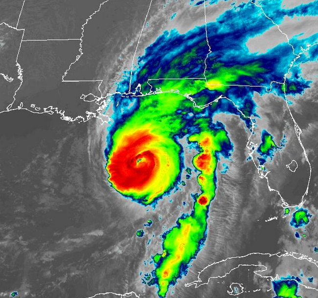
A circular eye with a diameter of 25 miles (40 km) was at the center of Hurricane Isaias.  Bands of showers and thunderstorms were revolving around the center of Isaias’ circulation.  Storms near the center of Isaias generated upper level divergence that pumped mass away from the tropical storm.  The removal of mass caused the surface pressure to decrease.

The size of the circulation around Hurricane Isaias increased on Thursday night.  Winds to hurricane force extended out 30 miles (50 km) from the center of Isaias’ circulation.  Winds to tropical storm force extended out 185 miles (295 km) from the center of Hurricane Isaias.

The Hurricane Intensity Index (HII) for Hurricane Isaias is 22.1.  The Hurricane Size Index (HSI) is 12.0 and the Hurricane Wind Intensity Size Index (HWISI) is 34.1.  Hurricane Isaias is similar in size and intensity to Hurricane Dennis when Dennis hit Northwest Florida in 2005.

Hurricane Isaias will move through an environment that will be somewhat favorable for intensification during the next 12 hours.  Isaias will move over water where the Sea Surface Temperatures are near 30°C.  It will move under the southeastern part of an upper level trough that is over Texas.  The upper level trough will produce southwesterly winds that will blow toward the top of Isaias’ circulation.  Those winds will cause moderate vertical wind shear, but the wind shear may not be enough to prevent intensification.  Hurricane Isaias could intensify during the next 12 hours.

The upper level trough over Texas will steer Isaias toward the north during the next 24 hours. On its anticipated track, Isaias will make landfall on the northern Gulf Coast near Pensacola, Florida on Friday night.

Hurricane Isaias will bring strong winds and locally heavy rain to the northern Gulf Coast.  Heavy rain could cause flash floods in some locations.  Isaias will be capable of causing major damage.  Widespread electricity outages are likely.

Flood Watches are in effect for parts of southern Mississippi, southern Alabama, and Northwest Florida.

Isaias could cause a storm surge of up to 13 feet (4 meters) along portions of the northern Gulf Coast.

A Storm Surge Warning is in effect for the portion of the coast from the Mouth of the Mississippi River to Suwannee River, Florida.
Hurricane Isaias Intensifies to Cat. 2

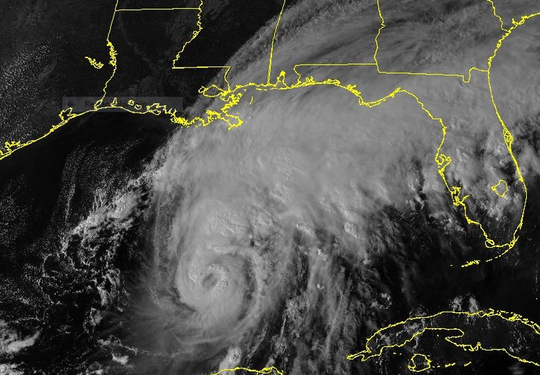
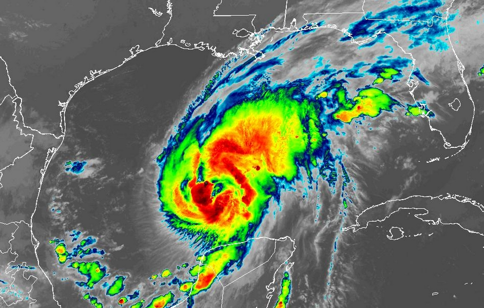
Hurricane Isaias intensified to Category 2 on the Saffir-Simpson Scale on Thursday afternoon.  At 5:00 p.m. EDT on Thursday the center of Hurricane Isaias was located at latitude 24.4°N and longitude 89.3°W which put the center about 325 miles (525 km) south of the Mouth of the Mississippi River.  Isaias was moving toward the northeast at 12 m.p.h. (19 km/h).  The maximum sustained wind speed was 100 m.p.h. (160 km/h) and there were wind gusts to 120 m.p.h. (195 km/h).  The minimum surface pressure was 975 mb.

A Hurricane Warning is in effect for the portion of the coast from Ocean Springs, Mississippi to the Bay County/ Gulf County line in Florida.  The Hurricane Warning includes Mobile, Alabama and Pensacola, Florida.

A Tropical Storm Warning is in effect for the portion of the coast from the Jefferson Parish/Plaquemines Parish line in Louisiana to Ocean Springs, Mississippi.

A Tropical Storm Warning is in effect for the portion of the coast from the Bay County/Gulf County Line to Aucilla River, Florida.

Hurricane Isaias intensified to Cat. 2 on the Saffir- Simpson Scale on Thursday afternoon.

The inner end of a rainband wrapped around the center of Isaias’ circulation.  A circular eye with a diameter of 30 miles (50 km) formed at the center of Hurricane Isaias.  Bands of showers and thunderstorms were revolving around the center of Isaias’ circulation.  Storms near the center of Isaias generated upper level divergence that pumped mass away from the tropical storm.  The removal of mass caused the surface pressure to decrease.

The distribution of wind speeds in Hurricane Isaias became more symmetrical on Thursday afternoon.  Winds to hurricane force extended out 20 miles (30 km) from the center of Isaias’ circulation.  Winds to tropical storm force extended out 130 miles (210 km) from the center of Hurricane Isaias.

The Hurricane Intensity Index (HII) for Hurricane Isaias is 16.5.  The Hurricane Size Index (HSI) is 8.6 and the Hurricane Wind Intensity Size Index (HWISI) is 25.1.  Hurricane Isaias is similar in size and intensity to Hurricane Idalia when Idalia hit Florida in 2023.

Hurricane Isaias will move through an environment that will be favorable for intensification during the next 18 hours.  Isaias will move over water where the Sea Surface Temperatures are near 30°C.  It will move under the southeastern part of an upper level trough that is over the South Central U.S.  The upper level trough will produce westerly winds that will blow toward the top of Isaias’ circulation.  Those winds will cause some vertical wind shear, but the wind shear will not be enough to prevent intensification.  Hurricane Isaias is likely to intensify during the next 18 hours.  Isaias could strengthen to a major hurricane.

Hurricane Isaias will move around the southeastern part of the upper level trough that is over the South Central U.S.   The upper level trough will steer Isaias toward the north-northeast during the next 24 hours.  On its anticipated track, Isaias will reach the northern Gulf Coast on Friday night.

Hurricane Isaias will bring strong winds and locally heavy rain to the northern Gulf Coast.  Heavy rain could cause flash floods in some locations.  Isaias will be capable of causing serious damage.  Widespread electricity outages are likely.

Flood Watches are in effect for parts of southern Mississippi, southern Alabama, and Northwest Florida.

Isaias could cause a storm surge of up to 12 feet (3.6 meters) along portions of the northern Gulf Coast.

A Storm Surge Warning is in effect for the portion of the coast from the Mouth of the Mississippi River to Suwannee River, Florida.
Isaias Strengthens to a Hurricane

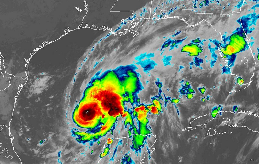
Former Tropical Storm Isaias strengthened to a hurricane as it moved over the central Gulf of Mexico on Wednesday night.  At 8:00 a.m. EDT on Thursday the center of Hurricane Isaias was located at latitude 23.7°N and longitude 90.6°W which put the center about 385 miles (620 km) south-southwest of the Mouth of the Mississippi River.  Isaias was moving toward the east-northeast at 9 m.p.h. (15 km/h).  The maximum sustained wind speed was 80 m.p.h. (130 km/h) and there were wind gusts to 95 m.p.h. (150 km/h).  The minimum surface pressure was 975 mb.

A Hurricane Warning is in effect for the portion of the coast from Ocean Springs, Mississippi to the Bay County/ Gulf County line in Florida.  The Hurricane Warning includes Mobile, Alabama and Pensacola, Florida.

A Tropical Storm Warning is in effect for the portion of the coast from the Jefferson Parish/Plaquemines Parish line in Louisiana to Ocean Springs, Mississippi.

A Tropical Storm Warning is in effect for the portion of the coast from the Bay County/Gulf County Line to Aucilla River, Florida.

Former Tropical Storm Isaias strengthened to a hurricane on Wednesday night.

The inner end of a rainband wrapped around the western and southern sides of the center of Hurricane Isaias.  An eye appeared to be forming at the center of Isaias’ circulation.  Bands of showers and thunderstorms were revolving around the center of Isaias’ circulation.  Storms near the center of Isaias generated upper level divergence that pumped mass away from the tropical storm.  The removal of mass caused the surface pressure to decrease.

The strongest winds were occurring in the rainband that wrapped around the western side of the center of Hurricane Isaias.  Winds to hurricane force extended out 20 miles (30 km) in the western side of Isaias’ circulation.  Winds to tropical storm force extended out 90 miles (145 km) from the center of Hurricane Isaias.

Hurricane Isaias will move through an environment that will be favorable for intensification during the next 24 hours.  Isaias will move over water where the Sea Surface Temperatures are near 30°C.  It will move under the southeastern part of an upper level trough that is over the South Central U.S.  The upper level trough will produce westerly winds that will blow toward the top of Isaias’ circulation.  Those winds will cause some vertical wind shear, but the wind shear will not be enough to prevent intensification.  Hurricane Isaias will intensify during the next 24 hours.

Hurricane Isaias will move around the southeastern part of the upper level trough that is over the South Central U.S.   The upper level trough will steer Isaias toward the northeast during the next 24 hours.  On its anticipated track, Isaias will reach the northern Gulf Coast on Friday night.

Hurricane Isaias will bring strong winds and locally heavy rain to the northern Gulf Coast.  Heavy rain could cause flash floods in some locations.

Flood Watches are in effect for parts of southern Mississippi, southern Alabama, and Northwest Florida.

Isaias could cause a storm surge of up to 12 feet (3.6 meters) along portions of the northern Gulf Coast.

A Storm Surge Warning is in effect for the portion of the coast from the Mouth of the Mississippi River to Steinhatchee River, Florida.


Hurricane Warning issued for Northern Gulf Coast

A Hurricane Warning was issued for a portion of the northern Gulf Coast on Wednesday night because of the threat posed by Tropical Storm Isaias.  At 11:00 p.m. EDT on Wednesday the center of Tropical Storm Isaias was located at latitude 22.9°N and longitude 91.9°W which put the center about 460 miles (745 km) south-southwest of the Mouth of the Mississippi River.  Isaias was moving toward the east-northeast at 9 m.p.h. (15 km/h).  The maximum sustained wind speed was 70 m.p.h. (110 km/h) and there were wind gusts to 85 m.p.h. (135 km/h).  The minimum surface pressure was 988 mb.

A Hurricane Warning is in effect for the portion of the coast from Ocean Springs, Mississippi to the Bay County/ Gulf County line in Florida.

A Tropical Storm Warning is in effect for the portion of the coast from the Jefferson Parish/Plaquemines Parish line in Louisiana to Ocean Springs, Mississippi.

A Tropical Storm Warning is in effect for the portion of the coast from the Bay County/Gulf County Line to Aucilla River, Florida.

Tropical Storm Isaias continued to intensify on Wednesday evening.  Isaias was on the threshold of becoming a hurricane.

Bands of showers and thunderstorms were revolving around the center of Isaias’ circulation.  Storms near the center of Isaias generated upper level divergence that pumped mass away from the tropical storm.  The removal of mass caused the surface pressure to decrease.

The distribution of wind speeds in Tropical Storm Isaias was fairly symmetrical.  Winds to tropical storm force extended out 60 miles (95 km) from the center of Isaias’ circulation.

Tropical Storm Isaias will move through an environment that will be favorable for intensification during the next 24 hours.  Isaias will move over water where the Sea Surface Temperatures are near 30°C.  It will move under the middle of an upper level ridge that is over the Gulf of Mexico.  The upper level winds are weak near the middle of the ridge and there will be little vertical wind shear.  Tropical Storm Isaias will intensify during the next 24 hours.  Isaias could intensify rapidly at times.  Tropical Storm Isaias will strengthen to a hurricane by Thursday morning.

Tropical Storm Isaias will move around the southeastern part of an upper level trough that is over the Southern Plains.  The upper level trough will steer Isaias toward the northeast during the next 24 hours.  On its anticipated track, Isaias will reach the northern Gulf Coast on Friday night.

Tropical Storm Isaias will be a hurricane when it reaches the northern Gulf Coast.  Isaias could be a major hurricane when it reaches the coast.  Isaias will bring strong winds and locally heavy rain to the northern Gulf Coast.  Heavy rain could cause flash floods in some locations.

Isaias could cause a storm surge of up to 12 feet (3.6 meters) along portions of the northern Gulf Coast.

A Storm Surge Warning is in effect for the portion of the coast from the Mouth of the Mississippi River to Steinhatchee River, Florida.