Tag Archives: French Frigate Shoals

Hurricane Lowell Brings Wind and Rain to Kauai

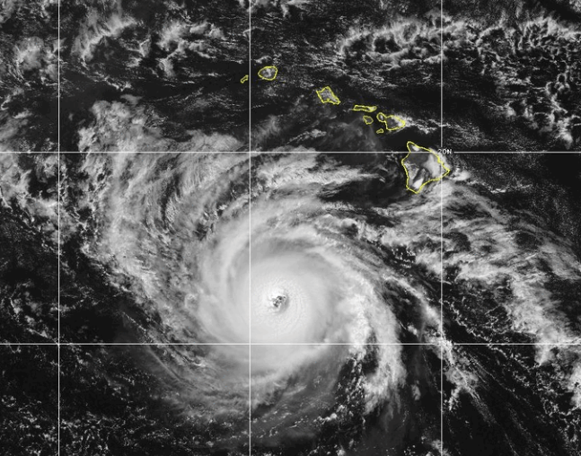
Hurricane Lowell brought wind and rain to Kauai on Monday night.  At 8:00 a.m. EDT on Tuesday the center of Hurricane Lowell was located at latitude 22.9°N and longitude 160.8°W which put the center about 110 miles (175 km) northwest of Lihue, Hawaii.  Lowell was moving toward the north at 18 m.p.h. (30 km/h).  The maximum sustained wind speed was 105 m.p.h. (165 km/h) and there were wind gusts to 125 m.p.h. (200 km/h).  The minimum surface pressure was 965 mb.

A Hurricane Warning is in effect for Kauai County including Kauai and Niihau.

A Hurricane Warning is in effect for the Papahanaumokuakea Marine National Monument from Nihoa to French Frigate Shoals.

A Tropical Storm Warning is in effect for Oahu.

A weather station at the Lihue Airport was reporting a sustained wind speed of 53 m.p.h (85 km/h) and a wind gust of 79 m.p.h (127 km/h).

A weather station at the Honolulu Airport reported a sustained wind speed of 26 m.p.h. (42 km/h) and a wind gust of 45 m.p.h. (73 km/h).

Hurricane Lowell was a Category 2 hurricane on the Saffir-Simpson Scale as it passed over Kauai on Monday night.  The center of Lowell’s circulation passed west of Kauai and Niihau.  An eye was no longer visible at the center of Hurricane Lowell.  Bands of showers and thunderstorms were revolving around the center of Lowell’s circulation.  Storms near the center generated upper level divergence that pumped more mass away from the hurricane.  The removal of mass in the upper levels was less than to the convergence of mass in the lowers levels of the atmosphere.  So, the surface pressure was increasing.

The distribution of wind speeds in Hurricane Lowell was fairly symmetrical.  Winds to hurricane force extended out 65 miles (105 km) from the center of Lowell’s circulation.  Winds to tropical storm force extended out 175 miles (280 km) from the center of Hurricane Lowell.

The Hurricane Intensity Index (HII) for Hurricane Lowell is 17.8.  The Hurricane Size Index (HSI) is 23.9 and the Hurricane Wind Intensity Size Index (HWISI) is 41.7.  Hurricane Lowell is similar in size and intensity to Hurricane Gustav when Gustav hit Louisiana in 2008.

Hurricane Lowell will move through an environment that will be unfavorable for intensification during the next 24 hours.  Lowell will move over water where the Sea Surface Temperatures are near 26°C.  It will move under the southeastern part of an upper level low that is northwest of Hawaii.  The upper level low will produce southwesterly winds that will blow toward the top of Lowell’s circulation.  Those winds will cause strong vertical wind shear.  Hurricane Lowell will continue to weaken on Tuesday because of the strong vertical wind shear.

The upper level low that is northwest of Hawaii will pull Hurricane Lowell toward the north during the next 24 hours.  On its anticipated track, Hurricane Lowell will move away from  Kauai and Niihau on Tuesday.

Bands in the eastern side of Lowell will bring strong winds and heavy rain to Kauai and Niihau during the next few hours.  Heavy rain could cause flash floods in some locations.

Flood Watches are in effect for Kauai and Niihau.

Bands in the eastern periphery of Hurricane Lowell could also drop heavy rain on Maui, Lanai, Molokai, Oahu, the Big Island of Hawaii, and Kahoolawe.

Flood Watches are in effect for Maui, Lanai, Molokai, Oahu, the Big Island of Hawaii, and Kahoolawe.

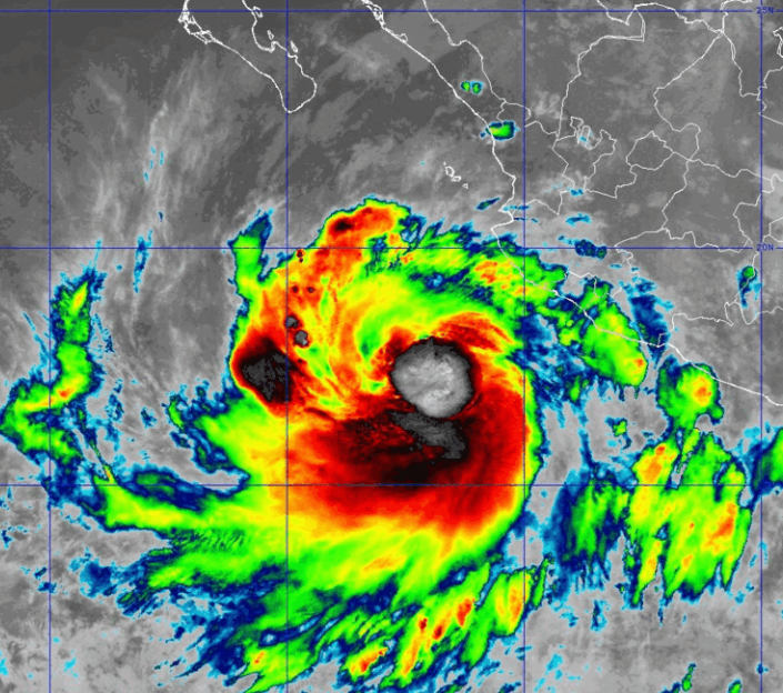
Elsewhere, Tropical Storm Marie continued to weaken gradually southwest of San Diego.

At 5:00 a.m. EDT on Tuesday the center of Tropical Storm Marie was located at latitude 25.5°N and longitude 126.6°W which put the center about 760 miles (1220 km) southwest San Diego, California.  Marie was moving toward the west-northwest at 8 m.p.h. (13 km/h).  The maximum sustained wind speed was 45 m.p.h. (75 km/h) and there were wind gusts to 60 m.p.h. (95 km/h).  The minimum surface pressure was 996 mb.

Hurricane Warning Issued for Kauai

A Hurricane Warning has been issued for Kauai County.  At 8:00 a.m. EDT on Monday the center of Hurricane Lowell was located at latitude 17.0°N and longitude 163.0°W which put the center about 415 miles (670 km) southwest of Lihue, Hawaii.  Lowell was moving toward the north-northeast at 10 m.p.h. (16 km/h).  The maximum sustained wind speed was 115 m.p.h. (185 km/h) and there were wind gusts to 135 m.p.h. (215 km/h).  The minimum surface pressure was 940 mb.

A Hurricane Warning is in effect for Kauai County including Kauai and Niihau.

A Hurricane Warning is in effect for the Papahanaumokuakea Marine National Monument from Nihoa to French Frigate Shoals.

Hurricane Lowell was weakening slowly as it moved toward Kauai on Monday morning.  Lowell was still a major hurricane.  A circular eye with a diameter of 35 miles (55 km) was still at the center of Lowell’s circulation.  The eye was surrounded by a ring of thunderstorms and the strongest winds were occurring in that ring of storms.  Bands of showers and thunderstorms were revolving around the center of Hurricane Lowell.  Storms near the center generated upper level divergence that pumped more mass away from the hurricane.  The removal of mass in the upper levels was a little less than to the convergence of mass in the lowers levels of the atmosphere.  So, the surface pressure was increasing slowly.

The distribution of wind speeds in Hurricane Lowell was fairly symmetrical. Winds to hurricane force extended out 60 miles (95 km) from the center of Lowell’s circulation.  Winds to tropical storm force extended out 175 miles (280 km) from the center of Hurricane Lowell.

The Hurricane Intensity Index (HII) for Hurricane Lowell is 20.6. The Hurricane Size Index (HSI) is 19.5 and the Hurricane Wind Intensity Size Index (HWISI) is 40.1.  Hurricane Lowell is similar in intensity to Hurricane Rita was when Rita hit Southwest Louisiana in 2005.  Lowell is not as big as Rita was.

Hurricane Lowell will move through an environment that will be unfavorable for intensification during the next 24 hours.  Lowell will move over water where the Sea Surface Temperatures are near 27°C.  It will move under the southwestern part of an upper level low that is north of Hawaii.  The upper level low will produce southwesterly winds that will blow toward the top of Lowell’s circulation.  Those winds will cause the vertical wind shear to increase.  Hurricane Lowell will continue to weaken on Monday because of the increase in vertical wind shear.

The upper level low that is north of Hawaii will steer Hurricane Lowell toward the north-northeast during the next 24 hours.  On its anticipated track, the center of Hurricane Lowell will be just southwest of Kauai on Monday night.

Bands in the eastern side of Lowell could bring strong winds and heavy rain to Kauai and Niihau on Monday night.  Heavy rain could cause flash floods in some locations.

Flood Watches are in effect for Kauai and Niihau.

Bands in the eastern periphery of Hurricane Lowell could also drop heavy rain on Maui, Lanai, , Molokai, Oahu, the Big Island of Hawaii, and Kahoolawe.

Flood Watches are in effect for Maui, Lanai, Molokai, Oahu, the Big Island of Hawaii, and Kahoolawe.

Elsewhere, Tropical Storm Marie was weakening gradually southwest of San Diego.

At 5:00 a.m. EDT on Monday the center of Tropical Storm Marie was located at latitude 24.4°N and longitude 123.7°W which put the center about 700 miles (1125 km) southwest San Diego, California.  Marie was moving toward the northwest at 8 m.p.h. (13 km/h).  The maximum sustained wind speed was 65 m.p.h. (105 km/h) and there were wind gusts to 80 m.p.h. (130 km/h).  The minimum surface pressure was 986 mb.

Tropical Storm Warning Issued for Kauai

A Tropical Storm Warning has been issued for Kauai County because of the potential effects of Hurricane Lowell.  At 11:00 a.m. EDT on Sunday the center of Hurricane Lowell was located at latitude 14.7°N and longitude 163.8°W which put the center about 580 miles (935 km) south-southwest of Lihue, Hawaii.  Lowell was moving toward the north-northwest at 6 m.p.h. (10 km/h).  The maximum sustained wind speed was 125 m.p.h. (200 km/h) and there were wind gusts to 150 m.p.h. (240 km/h).  The minimum surface pressure was 943 mb.

A Tropical Storm Warning is in effect for Kauai County including Kauai and Niihau.

A Hurricane Warning is in effect for the Papahanaumokuakea Marine National Monument from Nihoa to French Frigate Shoals.

Hurricane Lowell weakened to Category 3 on the Saffir-Simpson Scale on Sunday morning.  Lowell was still a major hurricane.  A circular eye with a diameter of 30 miles (50 km) was still at the center of Lowell’s circulation.  The eye was surrounded by a ring of thunderstorms and the strongest winds were occurring in that ring of storms.  Bands of showers and thunderstorms were revolving around the center of Hurricane Lowell.  Storms near the center generated upper level divergence that pumped more mass away from the hurricane.  The removal of mass in the upper levels was nearly equal to the convergence of mass in the lowers levels of the atmosphere.  So, the surface pressure did not change much on Sunday morning.

The distribution of wind speeds in Hurricane Lowell was fairly symmetrical.  Winds to hurricane force extended out 50 miles (80 km) from the center of Lowell’s circulation.  Winds to tropical storm force extended out 175 miles (280 km) from the center of Hurricane Lowell.

The Hurricane Intensity Index (HII) for Hurricane Lowell is 23.6. The Hurricane Size Index (HSI) is 19.5 and the Hurricane Wind Intensity Size Index (HWISI) is 43.9.  Hurricane Lowell is bigger and stronger than Hurricane Milton was when Milton hit Florida in 2024.

Hurricane Lowell will move through an environment that will be less favorable for intensification during the next 24 hours.  Lowell will move over water where the Sea Surface Temperatures are near 27°C.  It will move through a region where the upper level winds are weak and there will be little vertical wind wind shear.  However, Lowell will  move into a mass of drier air that is southwest of Hawii.  Hurricane Lowell is likely to continue to weaken slowly because of the effects of the drier air.  Lowell will move southwest of an upper level low that is north of Hawaii on Monday.  The upper level low will produce southwesterly winds that will cause the vertical wind shear to increase.  The increase in vertical wind shear will cause Lowell to weaken faster on Monday.

Hurricane Lowell will move around the western end of a high pressure system that is over the Central North Pacific Ocean.  The high pressure system will steer Lowell toward the north during the next 24 hours.  On its anticipated track, the center of Hurricane Lowell will pass west of Kauai and Niihau on Monday night.

Bands in the eastern side of Lowell could bring strong winds and heavy rain to Kauai and Niihau on Monday night.  Heavy rain could cause flash floods in some locations.

Flood Watches are in effect for Kauai and Niihau.

Bands in the eastern periphery of Hurricane Lowell could also drop heavy rain on Maui, Lanai, , Molokai, Oahu, the Big Island of Hawaii, and Kahoolawe.

Flood Watches are in effect for Maui, Lanai, Molokai, Oahu, the Big Island of Hawaii, and Kahoolawe.

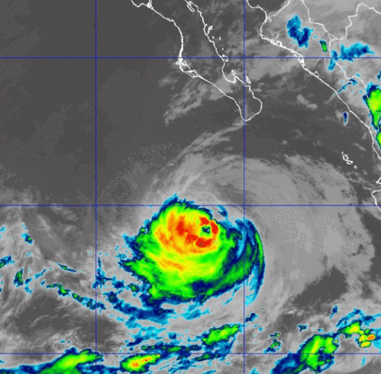
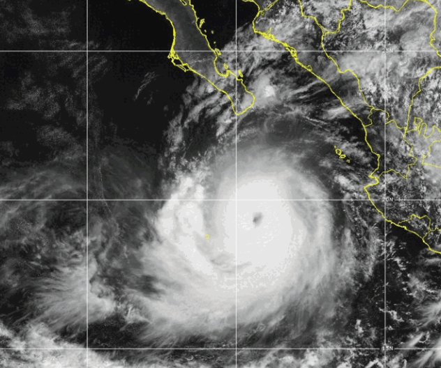
Elsewhere, thunderstorms were decreasing Tropical Storm Karina and Hurricane Marie was weakening west of Baja California.

At 11:00 a.m. EDT on Sunday the center of Tropical Storm Karina was located at latitude 22.7°N and longitude 145.0°W which put the center about 680 miles (1100 km) east-northeast of Hilo, Hawaii.  Karina was moving toward the northwest at 7 m.p.h. (11 km/h).  The maximum sustained wind speed was 60 m.p.h. (95 km/h) and there were wind gusts to 75 m.p.h. (120 km/h).  The minimum surface pressure was 992 mb.

At 11:00 a.m. EDT on Sunday the center of Hurricane Marie was located at latitude 23.5°N and longitude 122.5°W which put the center about 800 miles (1290 km) west of the southern tip of Baja California.  Marie was moving toward the northwest at 9 m.p.h. (15 km/h).  The maximum sustained wind speed was 80 m.p.h. (130 km/h) and there were wind gusts to 95 m.p.h. (150 km/h).  The minimum surface pressure was 977 mb.


Tropical Storm Watch Issued for Kauai

A Tropical Storm Watch has been issued for Kauai County because of the potential effects of Hurricane Lowell.  At 11:00 p.m. EDT on Saturday the center of Hurricane Lowell was located at latitude 13.7°N and longitude 163.4°W which put the center about 630 miles (1015 km) south-southwest of Lihue, Hawaii.  Lowell was moving toward the west-northwest at 5 m.p.h. (8 km/h).  The maximum sustained wind speed was 130 m.p.h. (210 km/h) and there were wind gusts to 155 m.p.h. (250 km/h).  The minimum surface pressure was 942 mb.

A Tropical Storm Watch is in effect for Kauai County including Kauai and Niihau.

A Hurricane Watch is in effect for the Papahanaumokuakea Marine National Monument from Nihoa to French Frigate Shoals.

Hurricane Lowell weakened to Category 4 on the Saffir-Simpson Scale on Saturday.  A circular eye with a diameter of 30 miles (50 km) was still at the center of Lowell’s circulation.  The eye was surrounded by a ring of thunderstorms and the strongest winds were occurring in that ring of storms.  Bands of showers and thunderstorms were revolving around the center of Hurricane Lowell.  Storms near the center generated upper level divergence that pumped more mass away from the hurricane.  The removal of mass in the upper levels was less than the convergence of mass in the lowers levels of the atmosphere.  So, the surface pressure increased on Saturday.

The distribution of wind speeds in Hurricane Lowell was fairly symmetrical.  Winds to hurricane force extended out 45 miles (75 km) from the center of Lowell’s circulation.  Winds to tropical storm force extended out 175 miles (280 km) from the center of Hurricane Lowell.

The Hurricane Intensity Index (HII) for Hurricane Lowell is 25.1.  The Hurricane Size Index (HSI) is 18.8 and the Hurricane Wind Intensity Size Index (HWISI) is 43.9. Hurricane Lowell is similar in intensity to Hurricane Harvey when Harvey hit Texas in 2017.  Hurricane Lowell is larger than Harvey was.

Hurricane Lowell will move through an environment that will be a little less favorable for intensification during the next 24 hours.  Lowell will move over water where the Sea Surface Temperatures are near 28°C.  It will move through a region where the upper level winds are weak and there will be little vertical wind wind shear.  However, Lowell will start to move into a mass of drier air on Sunday.  Hurricane Lowell is likely to continue to weaken slowly on Sunday because of the effects of the drier air.

Hurricane Lowell will move around the western end of a high pressure system that is over the Central North Pacific Ocean.  The high pressure system will steer Lowell toward the north during the next 24 hours.  On its anticipated track, Hurricane Lowell will start to move closer to Kauai and Niihau on Sunday.

Elsewhere, former Hurricane Karina weakened to a tropical storm east of Hawaii and Hurricane Marie started to weaken west of Baja California.

At 11:00 p.m. EDT on Saturday the center of Tropical Storm Karina was located at latitude 22.0°N and longitude 143.9°W which put the center about 740 miles (1190 km) east-northeast of Hilo, Hawaii.  Karina was moving toward the west-northwest at 6 m.p.h. (10 km/h).  The maximum sustained wind speed was 60 m.p.h. (95 km/h) and there were wind gusts to 75 m.p.h. (120 km/h).  The minimum surface pressure was 993 mb.

At 11:00 p.m. EDT on Saturday the center of Hurricane Marie was located at latitude 22.6°N and longitude 121.3°W which put the center about 725 miles (1170 km) west of the southern tip of Baja California.  Marie was moving toward the northwest at 6 m.p.h. (10 km/h).  The maximum sustained wind speed was 90 m.p.h. (145 km/h) and there were wind gusts to 105 m.p.h. (165 km/h).  The minimum surface pressure was 970 mb.

Tropical Depression Forms East-southeast of Hawaii

Tropical Depression Two-C formed east-southeast of Hawaii on Thursday morning.  At 11:00 a.m. EDT on Thursday the center of Tropical Depression Two-C was located at latitude 11.9°N and longitude 143.1°W which put the center about 960 miles (1545 km) east-southeast of Hilo, Hawaii.  The tropical depression was moving toward the west-northwest at 16 m.p.h. (26 km/h).  The maximum sustained wind speed was 35 m.p.h. (55 km/h) and there were wind gusts to 45 m.p.h. (75 km/h).  The minimum surface pressure was 1006 mb.

A low pressure system over the Central North Pacific Ocean east-southeast of Hawaii strengthened on Thursday morning and the U.S. National Hurricane Center designated the system as Tropical Depression Two-C.

The distribution of thunderstorms in Tropical Depression Two-C was asymmetrical.  Thunderstorms were occurring in bands in the western side of Tropical Depression Two-C.  Bands in the eastern side of the tropical depression consisted primarily of showers and lower clouds.  Storms near the center of circulation generated upper level divergence that pumped mass away to the west of the tropical depression.  The removal of mass caused the surface pressure to start to decrease.

Tropical Depression Two-C will move through an environment that will be somewhat favorable for intensification during the next 24 hours.  The tropical depression will move over water where the Sea Surface Temperatures are near 28°C.  It will move under the southern part of an upper level ridge that is over the Eastern and Central North Pacific Ocean.  The upper level ridge will produce easterly winds that will blow toward the top of Tropical Depression Two-C.  Those winds will cause moderate vertical wind shear.  The vertical wind shear will inhibit intensification but the wind shear will probably not be enough to prevent intensification.  Tropical Depression Two-C is likely to intensify slowly during the next 24 hours.

Tropical Depression Two-C will move around the southern side of a high pressure system that is over the Central North Pacific Ocean.  The high pressure system will steer the tropical depression toward the west-northwest during the next 24 hours.  On its anticipated track, Tropical Depression Two-C will move closer to Hawaii.

Elsewhere over the Central Pacific Ocean, Hurricane Lala was nearing the Papahanaumokuakea Marine National Monument.  At 11:00 a.m. EDT on Thursday the center of Hurricane Lala was located at latitude 24.2°N and longitude 172.2°W which put the center about 175 miles (280 km) southeast of Lisianski Island.  Lala was moving toward the north-northwest at 9 m.p.h. (15 km/h).  The maximum sustained wind speed was 100 m.p.h. (160 km/h) and there were wind gusts to 120 m.p.h. (195 km/h).  The minimum surface pressure was 969 mb.

A Hurricane Warning is in effect for the Papahanaumokuakea Marine National Monument from Lisianski Island to Maro Reef.

A Tropical Storm Warning is in effect for the Papahanaumokuakea Marine National Monument from Maro Reef to French Frigate Shoals.

Hurricane Lala Moves North

Hurricane Lala moved north toward the Papahanaumokuakea Marine National Monument on Wednesday.  At 5:00 p.m. EDT on Wednesday the center of Hurricane Lala was located at latitude 22.2°N and longitude 171.0°W which put the center about 330 miles (530 km) southeast of Lisianski Island.  Lala was moving toward the north-northwest at 9 m.p.h. (15 km/h).  The maximum sustained wind speed was 120 m.p.h. (195 km/h) and there were wind gusts to 140 m.p.h. (220 km/h).  The minimum surface pressure was 955 mb.

A Hurricane Warning is in effect for the Papahanaumokuakea Marine National Monument from Lisianski Island to Maro Reef.

A Tropical Storm Warning is in effect for the Papahanaumokuakea Marine National Monument from Maro Reef to French Frigate Shoals.

Hurricane Lala maintained its intensity for much of Wednesday.  Lala was exhibiting signs of starting to weaken slowly on Wednesday afternoon.  An upper level trough that was south of the Aleutian Islands was producing southwesterly winds that were blowing toward the top of Lala’s circulation.  Those winds were causing the vertical wind shear to increase.  The increase in vertical wind shear was likely the cause of the weakening of Hurricane Lala.

There was still a small circular eye at the center of Hurricane Lala.  The eye was surrounded by a ring of thunderstorms and the strongest winds were occurring in that ring of storms.  Bands of showers and thunderstorms were revolving around the core of Hurricane Lala.  Storms near the core of Lala generated upper level divergence that pumped mass away from the hurricane.  The removal of mass in the upper levels was slightly less than the convergence of mass in the lower levels of the atmosphere.  So, the surface pressure started to increase slowly on Wednesday afternoon.

The distribution of wind speeds in Hurricane Lala was still fairly symmetrical on Wednesday afternoon.  Winds to hurricane force extended out 30 miles (50 km) from the center of Lala’s circulation.  Winds to tropical storm force extended out 115 miles (185 km) from the center of Hurricane Lala.

The Hurricane Intensity Index (HII) for Hurricane Lala is 22.1.  The Hurricane Size Index (HSI) is 11.0 and the Hurricane Wind intensity Size Index (HWISI) is 33.1.  Hurricane Lala is similar in size and intensity to Hurricane Dennis when Dennis hit Northwest Florida in 2005.

Hurricane Lala will move through an environment that will become unfavorable for intensification during the next 24 hours.  Lala will move over water where the Sea Surface Temperatures are near 27°C.  However, the upper level trough that is south of Aleutian Islands will continue to cause the vertical wind shear to increase on Thursday.  Hurricane Lala will continue to weaken during the next 24 hours.

The upper level trough south of the Aleutian Islands will steer Hurricane Lala toward the north on Thursday.  On its anticipated track, Hurricane Lala will reach the Papahanaumokuakea Marine National Monument on Thursday night.

Hurricane Lala will bring strong winds and heavy rain to parts of the Papahanaumokuakea Marine National Monument.  The winds around Hurricane Lala will also cause high surf conditions.

Tropical Storm Douglas Moves Away from Hawaii

A weakening Tropical Storm Douglas moved away from Hawaii on Monday.  At 11:00 p.m. EDT on Monday the center of Tropical Storm Douglas was located at latitude 22.9°N and longitude 163.3°W which put it about 200 miles (325 km) east-southeast of French Frigate Shoals.  Douglas was moving toward the west at 18 m.p.h. (30 km/h).  The maximum sustained wind speed was 70 m.p.h. (110 km/h) and there were wind gusts to 85 m.p.h. (135 km/h).  The minimum surface pressure was 993 mb.

Tropical Storm Douglas weakened on Monday.  An upper level trough west of Hawaii produced southerly winds which blew toward the top of Douglas’ circulation.  Those winds caused strong vertical wind shear.  The wind shear caused former Hurricane Douglas to weaken even though it was moving over water where the Sea Surface Temperature was near 27°C.  The low level center of circulation was surrounded by showers and lower clouds.  The only thunderstorms were occurring on the northern periphery of the tropical storm.  Bands in the other parts of Douglas consisted of showers and lower clouds.  Winds to tropical storm force extended out about 100 miles (160 km) from the center of circulation.

Tropical Storm Douglas will move south of a subtropical high pressure system over the North Pacific Ocean.  The high will steer Douglas toward the west during the next few days.  On its anticipated track Tropical Storm Douglas will move across the International Date Line and over the Western North Pacific Ocean later this week.  The upper level trough will continue to cause vertical wind shear and Douglas will continue to weaken.

Hurricane Walaka Rapidly Intensifies to Category 5

Hurricane Walaka rapidly intensified to Category 5 on the Saffir-Simpson Scale on Monday.  At 11:00 p.m. EDT on Monday the center of Hurricane Walaka was located at latitude 13.2°N and longitude 169.8°W which put it about 240 miles (390 km) south of Johnston Atoll.  Walaka was moving toward the northwest at 7 m.p.h. (11 km/h).  The maximum sustained wind speed was 160 m.p.h. (260 km/h) and there were wind gusts to 195 m.p.h. (315 km/h).  The minimum surface pressure was 920 mb.

A Hurricane Warning is in effect for Johnston Atoll.  A Hurricane Watch is in effect for the Papahanaumokuakea Marine National Monument from Nihoa to French Frigate Shoals to Maro Reef.

The circulation of Hurricane Walaka is very well organized,  There is a circular eye at the center of Walaka.  The eye is surrounded by a ring of strong thunderstorms and the strongest winds were occurring in that ring of storms.  Several bands of showers and thunderstorms were revolving around the core of Hurricane Walaka.  Storms near the core were generating strong upper level divergence which was pumping mass away from the hurricane in all directions.

Winds to hurricane force extended out about 50 miles (80 km) from the center of Hurricane Walaka.  Winds to tropical storm force extended out about 185 miles (300 km) from the center of circulation.  The Hurricane Intensity Index (HII) for Hurricane Walaka was 35.0.  The Hurricane Size Index (HSI) was 16.4 and the Hurricane Wind Intensity Size Index (HWISI) was 51.4.

Hurricane Walaka will remain in an environment very favorable for strong hurricanes for several more days.  Walaka will move over water where the Sea Surface Temperature is near 30°C.  It will move through a region where the upper level winds will be weak and there will be little vertical wind shear.  If a rainband wraps around the existing eye and eyewall, then an eyewall replacement cycle could cause Hurricane Walaka to weaken.  In several days Walaka will move into an area where the upper level winds are stronger and the vertical wind shear will increase.  Hurricane Walaka will weaken more quickly when the shear increases.

Hurricane Walaka is moving around the western end of a subtropical high pressure system.  The high pressure system will steer Walaka toward the north during the next several days.  On its anticipated track Hurricane Walaka will pass near Johnston Atoll on Tuesday.