Tag Archives: Hurricane Teddy

Teddy Brings Wind and Rain to Nova Scotia

Former Hurricane Teddy brought wind and rain to Nova Scotia on Wednesday.  At 11:00 a.m. EDT on Wednesday the center of Tropical Storm Teddy was located at latitude 46.0°N and longitude 61.3°W which put it about 150 miles (240 km) southwest of Port aux Basques, Newfoundland.  Teddy was moving toward the north-northeast at 26 m.p.h. (43 km/h).  The maximum sustained wind speed was 60 m.p.h. (95 km/h) and there were wind gusts to 75 m.p.h. (120 km/h).  The minimum surface pressure was 967 mb.

A Tropical Storm Warning was in effect for the portion of the south coast of Nova Scotia from Ecum Secum to Meat Cove.  A Tropical Storm Warning was also in effect for the portion of the coast from Port aux Basques to Francois, Newfoundland.  Tropical Storm Watches were in effect for the portion of the coast from Meat Cove to Brule, Nova Scotia, for the Magdalen Islands and for Prince Edward Island.

The center of former Hurricane Teddy made landfall near Ecum Secum, Nova Scotia on Wednesday morning.  The structure of Teddy made a transition from one typical of a tropical cyclone to one more like an extratropical cyclone as it approached the coast of Nova Scotia.  The area of stronger winds expanded.  Winds to tropical storm force extended out 200 miles (320 km) from the center of Teddy.  The heaviest rain fell over eastern Nova Scotia.  The large circulation around Teddy was producing large waves which caused water level rises and beach erosion as far away as the East Coast of the U.S.

An upper level trough over eastern North America will steer Teddy quickly toward northeast during the rest of today.  On its anticipated track Tropical Storm Teddy will bring gusty winds and heavy rain to parts of southwestern Newfoundland during the next few hours.

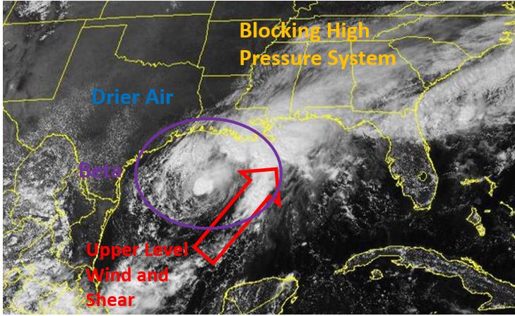
Elswhere, former Tropical Storm Beta was dropping heavy rain over parts of Louisiana.  At 11:00 a.m. EDT on Wednesday the center of Tropical Depression Beta was located at latitude 30.2°N and longitude 94.2°W which put it about 60 miles (95 km) west of lake Charles, Louisiana.  Beta was moving toward the east-northeast at 9 m.p.h. (15 km/h).  The maximum sustained wind speed was 30 m.p.h. (50 km/h) and there were wind gusts to 40 m.p.h. (65 km/h_.  The minimum surface pressure was 1007 mb.

Tropical Depression Beta dropped heavy rain over southeastern Texas on Tuesday.  There were numerous reports of flooding around Houston.  Beta was moving over western Louisiana on Wednesday morning and light to moderate rain was falling over many parts of the state.  Flash Flood Watches were in effect for much of Louisiana and western Mississippi.  Beta will move slowly toward the northeast during the next 48 hours.  Moderate to heavy rain could spread over Mississippi, Tennessee, northern Alabama, western North Carolina and western Virginia.

Hurricane Teddy Heads for Nova Scotia, Beta Reaches Texas

Hurricane Teddy headed for Nova Scotia on Monday night as Tropical Storm Beta reached the coast of Texas.  At 11:00 p.m. EDT on Monday the center of Hurricane Teddy was located at latitude 35.6°N and longitude 61.5°W which put it about 630 miles (1015 km) south of Halifax, Nova Scotia.  Teddy was moving toward the north at 25 m.p.h. (41 km/h).  The maximum sustained wind speed was 100 m.p.h. (160 km/h) and there were wind gusts to 120 m.p.h. (195 km/h).  The minimum surface pressure was 956 mb.

A Tropical Storm Warning was in effect for the south coast of Nova Scotia from Digby to Meat Cove.  Tropical Storm Watches were in effect for the portions of the coast from Meat Cove to Tidnish and from Digby to Fort Lawrence.  Tropical Storm Watches were also in effect for Prince Edward Island, the Magdalen Islands and from Port aux Basques to Francois, Newfoundland.

The circulation around Hurricane Teddy expanded as it began a transition to an extratropical cyclone.  Winds to hurricane force extended out 100 miles (160 km) from the center of Teddy.  Winds to tropical storm force extended out 275 miles (445 km) from the center.  Drier air was wrapping around the southern side of Hurricane Teddy.  The strongest thunderstorms were in bands in the northern half of the hurricane.  Bands in the southern half of the circulation consisted primarily of showers and lower clouds.

An upper level trough over eastern North America will cause strong southerly winds which will blow toward the top of Hurricane Teddy.  Those winds will cause strong vertical wind shear and they will contribute to the extratropical transition of Teddy.  Hurricane Teddy will move over much cooler water when it approaches Nova Scotia.  Teddy will transform into a strong extratropical cyclone.

Hurricane Teddy will be steered rapidly toward the north by the upper level trough over eastern North America.  On its anticipated track Hurricane Teddy will approach Nova Scotia on Tuesday night.  Teddy will bring strong winds and heavy rain to Nova Scotia and southwestern Newfoundland.

Elsewhere, slow moving Tropical Storm Beta reached the coast of Texas on Monday night.  At 11:00 p.m. EDT on Monday the center of Tropical Storm Beta was located at latitude 28.4°N and longitude 96.3°W which put it about 5 miles (10 km) east of Port O Connor, Texas.  Beta was moving toward the northwest at 3 m.p.h. (5 km/h).  The maximum sustained wind speed was 45 m.p.h. (75 km/h) and there were wind gusts to 60 m.p.h. (95 km/h).  The minimum surface pressure was 999 mb.

A Tropical Storm Warning was in effect for the portion of the coast from Port Aransas, Texas to Morgan City Louisiana.

Tropical Storm Beta weakened gradually on Monday as it moved slowly toward the coast of Texas.  Drier air continued to get pulled into the circulation which limited the development of new thunderstorms.  Without updrafts and downdrafts to transport momentum vertically, the circulation around Beta slowly spun down.

Even though Tropical Storm Beta weakened on Monday, its winds pushed water toward the coast of Texas.  Water levels rose along the coast and there were some reports of damage.  Waves contributed to beach erosion.  Moderate rain was falling over the region between Houston and Victoria, Texas.  The rain could cause flooding in some locations.

Tropical Storm Beta was forecast to move slowly toward the northeast along the coast of Texas during the next 24 to 36 hours.  Beta will continue to weaken, but winds will blow water toward the coast from several more days.  Locally heavy rain will continue to create a risk of floods until Tropical Storm Beta moves away from the area.

Tropical Storm Beta Moves Toward Texas

Tropical Storm Beta moves slowly toward the coast of Texas on Sunday.  At 11:00 p.m. EDT on Sunday the center of Tropical Storm Beta was located at latitude 29.6°N and longitude 94.5°W which put it about 130 miles (210 km) east-southeast of Port Oconnor, Texas.  Beta was moving toward the west-northwest at 6 m.p.h. (10 km/h).  The maximum sustained wind speed was 60 m.p.h. (95 km/h) and there were wind gusts to 75 m.p.h. (120 km/h).  The minimum surface pressure was 995 mb.

A Tropical Storm Warning was in effect for the portion of the coast from Port Aransas, Texas to Morgan City, Louisiana.  A Tropical Storm Watch was in effect from Baffin Bay to Port Aransas, Texas.

Tropical Storm Beta exhibited more organization on Sunday afternoon.  Thunderstorms developed near the center of circulation and radar indicated the potential formation of an eye at the center of Beta.  The thunderstorms near the center weakened on Sunday night.  It appeared that drier air over Texas was pulled into the circulation around Tropical Storm Beta.  The drier air mixed into the core of Beta which caused thunderstorms to weaken.  When the thunderstorms near the center weakened, it appeared that the upper part of the circulation drifted northeast of the low level circulation.  Even though the thunderstorms weakened a reconnaissance plane on Sunday night found that the wind speeds had not decreased.  The strongest winds were occurring in the northeastern quadrant of Tropical Storm Beta.  Winds to tropical storm force extended out 200 miles (320 km) in that quadrant of the circulation.  Winds to tropical storm force only extended out 50 miles from the center in the southern half of the circulation.

Tropical Storm Beta will move through an environment only marginally favorable for intensification on Monday.  Beta will move over water where the Sea Surface Temperature is near 30°C.  It will continue to be surrounded by drier air, which will inhibit intensification.  Tropical Storm Beta could maintain its intensity if new thunderstorms develop near the center of circulation.  If thunderstorms do not develop near the center, then Beta will slowly weaken.

Tropical Storm Beta will move around the southwestern part of a large high pressure system over the eastern U.S.  The high will steer Beta toward the west-northwest.  On its anticipated track Tropical Storm Beta will approach the coast of Texas near Matagorda Bay on Monday evening.  Winds blowing water toward the coast will cause a storm surge of 3 to 6 feet (1 to 2 meters).

Elsewhere, Hurricane Teddy was moving closer to Bermuda.  At 11:00 p.m. EDT on Tuesday the center of Hurricane Beta was located at latitude 29.4°N and longitude 63.6°W which put it about 210 miles (340 km) south-south east of Bermuda.  Teddy was moving toward the north-northwest at 6 m.p.h. (10 km/h).  The maximum sustained wind speed was 105 m.p.h. (165 km/h) and there were wind gusts to 125 m.p.h. (200 km/h).  The minimum surface pressure was 963 mb.

A Tropical Storm Warning was in effect for Bermuda.  A Tropical Storm Watch was issued for the portion of the coast from Lower East Pubnico to Canso, Nova Scotia.

Tropical Storm Beta in Holding Pattern

Tropical Storm Beta was in a holding pattern on Saturday afternoon.  At 5:00 p.m. EDT on Saturday the center of Tropical Storm Beta was located at latitude 26.6°N and longitude 92.4°which put it about 320 miles (510 km) east-southeast of Corpus Christi, Texas.  Beta was stationary.  The maximum sustained wind speed was 60 m.p.h. (95 km/h) and there were wind gusts to 75 m.p.h. (120 km/h).  The minimum surface pressure was 994 mb.

A Hurricane Watch was in effect for the portion of the coast from Port Aransas to High Island, Texas.  A Tropical Storm Warning was in effect for the portion of the coast from Port Aransas to Intracoastal City, Louisiana.  Tropical Storm Watches were in effect for the portions of the coast from the Mouth of the Rio Grande River to Port Aransas and from Intracoastal City to Morgan City, Louisiana.

The intensity of Tropical Storm Beta held steady and it moved little on Saturday afternoon.  An upper level trough over Texas produced southwesterly winds which blew across the top of Tropical Storm Beta.  Those winds caused strong vertical wind shear and they blew the tops off thunderstorms near the center of Beta on Saturday morning.  The shear may have decreased later because new thunderstorms formed near the center of circulation on Saturday afternoon.  A reconnaissance flight found that the winds around Tropical Storm Beta had maintained their speed.  Winds to tropical storm force extended out 175 miles (280 km) on the northern side of Beta.  Tropical storm force winds only extended out 50 miles (80 km) in the southern half of the circulation.

Tropical Storm Beta will move through an environment somewhat favorable for intensification during the next 36 hours.  Beta will move over water where the Sea Surface Temperature is near 30°C.  The upper level trough over Texas is forecast to weaken and if that happens, then the vertical wind shear will decrease.  There is drier air over Texas and Tropical Storm Beta could pull some of that air into the southern part of the circulation.  Beta could strengthen on Sunday if the wind shear decreases.  However, if Tropical Storm Beta remains stationary for too long, its winds will mix cooler water to the surface, which would inhibit intensification.

A large cool high pressure system is over the eastern U.S.  The high blocked the northward movement of Beta, which is why the tropical storm became stationary.  The high pressure system will move slowly eastward during the next few days.  As the high moves east, it will steer Tropical Storm Beta slowly toward the west-northwest.  On its anticipated track Tropical Storm Beta could approach the Central Texas coast on Monday.  Beta could be a hurricane when it approaches the coast.

The figure below shows the factors affecting Tropical Storm Beta on Saturday afternoon.

Elsewhere, Hurricane Teddy continued to move in the direction of Bermuda.  At 5:00 p.m. EDT on Saturday the center of Hurricane Teddy was located at latitude 26.7°N and longitude 60.2°W which put it about 475 miles (765 km) southeast of Bermuda.  Teddy was moving toward the northwest at 13 m.p.h. (20 km/h).  The maximum sustained wind speed was 120 m.p.h. (195 km/h) and there were wind gusts to 140 m.p.h. (220 km/h).  The minimum surface pressure was 958 mb.  A Tropical Storm Warning was in effect for Bermuda.

Tropical Storm Beta Strengthens, Hurricane Watch Issued for Texas

Tropical Storm Beta strengthened on Friday night and a Hurricane Watch was issued for a portion of the Texas coast.  At 11:00 p.m. EDT on Friday the center of Tropical Storm Beta was located at latitude 25.2°N and longitude 92.3°W which put it about 305 miles (495 km) east of the Mouth of the Rio Grande River.  Beta was moving toward the north-northeast at 12 m.p.h. (19 km/h).  The maximum sustained wind speed was 60 m.p.h. (95 km/h) and there were wind gusts to 75 m.p.h. (120 km/h).  The minimum surface pressure was 996 mb.

A Hurricane Watch was issued for the portion of the coast from Port Aransas to High Island, Texas.  Tropical Storm Watches were issued for the portions of the coast from the Mouth of the Rio Grande River to Port Aransas, Texas and from High Island, Texas to Morgan City, Louisiana.

Although Tropical Storm Beta looked like a highly sheared tropical cyclone on infrared satellite images, a reconnaissance plane found on Friday night that it had strengthened.  Even though the wind speeds were stronger and the surface pressure had decreased, the circulation was still asymmetrical.  An upper level trough over Texas was producing south-southwesterly winds which were blowing toward the top of Beta.  Those winds were causing moderate vertical wind shear.  Because of the wind shear, the stronger thunderstorms were occurring in bands on the northern side of Tropical Storm Beta.  Bands in the southern half of the tropical storm consisted primarily of showers and lower clouds.  Winds to tropical storm force extended out 175 miles (280 km) in the northeastern quadrant of Beta.  Tropical storm force winds extended out 100 miles (160 km) in the northwestern quadrant and out only 50 miles (80 km) in the southern half of the circulation.  The pressure difference between a large high pressure system over the eastern U.S. and the low pressure at the center of Beta was contributing to the strong winds on the northeastern side of the tropical storm.

Tropical Storm Beta will move through an environment somewhat favorable for intensification during the next several days.  Beta will move over water where the Sea Surface Temperature is near 30°C.  The upper level trough over Texas will weaken and gradually move away from Tropical Storm Beta.  When the trough moves away from Beta, the wind shear will decrease and Beta will be able to intensify more easily.  Tropical Storm Beta could intensify into a hurricane in during the weekend.

The steering pattern around Tropical Storm Beta will be complex.  The upper level trough over Texas is likely to steer Beta toward the north during the next 12 to 18 hours.  Then a large cool high pressure system over the eastern U.S. will block Tropical Storm Beta from moving any farther to the north.  The high will steer Beta to the west.  On its anticipated track Tropical Storm Beta could approach the coast of Texas by the end of the weekend.  Beta could move more toward the northeast when the high pressure system starts to shift toward the east early next week.

Elsewhere, Hurricane Teddy continued to move toward Bermuda.  At 11:00 p.m. EDT on Friday the center of Hurricane Teddy was located at latitude 24.0°N and longitude 57.4°W which put it about 730 miles (1170 km) southeast of Bermuda.  Teddy was moving toward the northwest at 13 m.p.h. (20 km/h).  The maximum sustained wind speed was 130 m.p.h. (210 km/h) and there were wind gusts to 150 m.p.h. (240 km/h).  The minimum surface pressure was 951 mb.

A Tropical Storm Watch was in effect for Bermuda.

TD 22 Strengthens to Tropical Storm Beta

Former Tropical Depression Twentytwo strengthened into Tropical Storm Beta over the western Gulf of Mexico on Friday afternoon.  At 5:00 p.m. EDT on Friday the center of Tropcial Storm Beta was located at latitude 24.3°N and longitude 93.1°W which put it about 280 miles (450 km) east-southeast of the Mouth of the Rio Grande River.  Beta was moving toward the north-northeast at 9 m.p.h. (15 km/h).  The maximum sustained wind speed was 40 m.p.h. (65 km/h) and there were wind gusts to 50 m.p.h. (80 km/h).  The minimum surface pressure was 1004 mb.

Even though Tropical Storm Beta strengthened on Friday, the circulation was asymmetrical.  An upper level trough over Texas was producing south-southwesterly winds which were blowing toward the top of Beta.  Those winds were causing moderate vertical wind shear.  Because of the wind shear, the stronger thunderstorms were occurring in bands on the northern side of Tropical Storm Beta.  Bands in the southern half of the tropical storm consisted primarily of showers and lower clouds.  Winds to tropical storm force extended out 100 miles (160 km) on the northern side of Beta.  Winds in the southern half of the circulation were blowing at less than tropical storm force.

Tropical Storm Beta will move through an environment somewhat favorable for intensification during the next several days.  Beta will move over water where the Sea Surface Temperature is near 30°C.  The upper level trough over Texas will weaken and gradually move away from Tropical Storm Beta.  When the trough moves away from Beta, the wind shear will decrease and Beta will be able to intensify more easily.  There is a chance Tropical Storm Beta could intensify into a hurricane in two or three days.

The steering pattern around Tropical Storm Beta will be complex.  The upper level trough over Texas is likely to steer Beta toward the north during the next 12 to 24 hours.  Then a large cool high pressure system over the eastern U.S.  will block Tropical Storm Beta from moving any farther to the north.  The high will steer Beta to the west.  On its anticipated track Tropical Storm Beta could approach the coast of Texas by the end of the weekend.  Beta could move more toward the northeast when the high pressure system starts to shift toward the east early next week.

Elsewhere, Hurricane Teddy continued to move toward Bermuda, Subtropical Storm Alpha made landfall in Portugal and Tropical Storm Wilfred developed over the eastern Atlantic Ocean.  At 5:00 p.m. EDT on Friday the center of Hurricane Teddy was located at latitude 23.1°N and longitude 57.0°W which put it about 795 miles (1275 km) southeast of Bermuda.  Teddy was moving toward the northwest at 14 m.p.h. (22 km/h).  The maximum sustained wind speed was 125 m.p.h. (200 km/h) and there were wind gusts to 150 m.p.h. (240 km/h).  The minimum surface pressure was 951 mb.

A Tropical Storm Watch was issued for Bermuda.

At 5:00 p.m. EDT on Friday the center of Subtropical Storm Alpha was located at latitude 40.8°N and longitude 8.4°W which put it about 120 miles (195 km) north-northeast of Lisbon, Portugal.  Alpha was moving toward the northeast at 17 m.p.h. (28 km/h).  The maximum sustained wind speed was 45 m.p.h. (75 km/h) and there were wind gusts to 60 m.p.h. (95 km/h).  The minimum surface pressure was 998 mb.

At 5:00 p.m. EDT on Friday the center of Tropical Storm Wilfred was located at latitude 12.5°N and longitude 34.4°W which put it about 735 miles (1185 km) west-southwest of the Cabo Verde Islands.  Wilfred was moving toward the west-northwest at 10 m.p.h. (16 km/h).  The maximum sustained wind speed was 40 m.p.h. (65 km/h) and there were wind gusts to 50 m.p.h. (80 km/h).  The minimum surface pressure was 1008 mb

TD 22 Forms over Western Gulf of Mexico, Teddy at Cat. 4

Tropical Depression Twentytwo formed over the western Gulf of Mexico on Thursday evening and Hurricane Teddy intensified to Category 4 on the Saffir-Simpson Scale.  At 11:00 p.m. EDT on Thursday the center of Tropical Depression Twentytwo was located at latitude 22.0°N and longitude 94.2°W which put it about 235 miles (380 km) east of Tampico, Mexico.  The depression was moving toward the northeast at 3 m.p.h. (5 km/h).  The maximum sustained wind speed was 35 m.p.h. (55 km/h) and there were wind gusts to 45 m.p.h. (75 km/h).  The minimum surface pressure was 1005 mb.

An Air Force Reserve Hurricane Hunter plane determined that a low level center of circulation was present in a low pressure system over the western Gulf of Mexico on Thursday evening and the National Hurricane Center designated the system as Tropical Depression Twentytwo.  The circulation around the depression was still organizing.  Bands of showers and thunderstorms were developing.  Storms near the center of circulation began to generate upper level divergence which pumped mass away from the tropical depression.

Tropical Depression Twentytwo will move through an environment favorable for intensification during the next several days.  The depression will move over water where the Sea Surface Temperature is near 30°C.  An upper level low near the Rio Grande Valley will produce southerly winds which will blow toward the top of the depression.  Those winds will cause some vertical wind shear.  The shear will inhibit intensification, but the depression is likely to strengthen into a tropical storm.

Tropical Depression Twentytwo will be in an area where the steering currents are weak.  The upper low over the Rio Grande Valley could pull the depression toward the north, but the depression could meander over the western Gulf of Mexico for several days.

Elsewhere, Hurricane Teddy strengthened to Category 4 on the Saffir-Simpson Scale southeast of Bermuda on Thursday evening.  At 11:00 p.m. EDT on Thursday the center of Hurricane Teddy was located at latitude 20.9°N and longitude 54.7°W which put it about 1005 miles (1615 km) southeast of Bermuda.  Teddy was moving toward the northwest at 12 m.p.h. (19 km/h).  The maximum sustained wind speed was 140 m.p.h. (220 km/h) and there were wind gusts to 170 m.p.h. (280 km/h).  The minimum surface pressure was 945 mb.  On its anticipated track Hurricane Teddy could be near Bermuda by Sunday night.

Tropical Storm Sally Drops Heavy Rain on Southeast U.S.

Tropical Storm Sally dropped heavy rain over parts of the southeastern U.S. on Wednesday afternoon.  At 5:00 p.m. EDT on Wednesday the center of Tropical Storm Sally was located at latitude 31.2°N and longitude 86.8°W which put it about 85 miles (135 km) west of Dothan, Alabama.  Sally was moving toward the northeast at 7 m.p.h. (11 km/h).  The maximum sustained wind speed was 60 m.p.h. (95 km/h) and there were wind gusts to 75 m.p.h. (120 km/h).  The minimum surface pressure was 990 mb.

A Tropical Storm Warning remained in effect for the portion of the coast from the Alabama/Florida border to Indian Pass, Florida.

The winds to tropical storm force were occurring in bands over the Gulf of Mexico in the southern part of Tropical Storm Sally.  Most of the winds over land were blowing at less than tropical storm force.

Hurricane Sally made landfall near Gulf Shores, Alabama on Wednesday morning as a Category 2 hurricane on the Saffir-Simpson Scale.  A NOAA C-MAN station at Ft. Morgan, Alabama measured a sustained wind speed 98 m.p.h. (158 km/h) and a peak wind gust of 121 m.p.h. (195 km/h) when the western eyewall passed over it.  Another weather station at Bon Secour, Alabama measured a sustained wind speed of 71 m.p.h. (115 km/h).  There were reports of widespread power outages in Alabama.  The Pensacola Naval Air Station reported a wind gust of 82 m.p.h. (132 km/h).

The wind pushed the water toward the coast and there was a storm surge over the barrier sialnds and along the coast of Alabama and northwest Florida.  Since the eye of Sally passed east of Mobile, Alabama, northerly winds pushed the water out of Mobile Bay and the water level dropped several feet.  Heavy rain fell north and east of the center of Sally and creeks an rivers were rising quickly in parts of southern Alabama and northwestern Florida.

Tropical Storm Sally will move northeast across Southeast Alabama on Wednesday night.  Sally will be over Georgia on Thursday and it will be over South Carolina on Thursday night.  Tropical Storm Sally will continue to drop heavy rain over those areas and Flash Flood Watches were in effect for parts of northwestern Florida, southern Alabama, Georgia, western North Carolina and western South Carolina.

Elsewhere, Hurricane Teddy was on a track that could take it near Bermuda in a few days.  At 5:00 p.m. EDT on Wednesday the center of Hurricane Teddy was located at latitude 17.5°N and longitude 50.8°W which put it about 710 miles (1145 km) east of the Lesser Antilles.  Teddy was moving toward the northwest at 13 m.p.h. (20 km/h).  The maximum sustained wind speed was 100 m.p.h. (160 km/h) and there were wind gusts to 120 m.p.h. (195 km/h).  The minimum surface pressure was 973 mb.

Hurricane Sally Makes Landfall Near Gulf Shores

The center of Hurricane Sally officially made landfall near Gulf Shores, Alabama on Wednesday morning.  At 6:00 a.m. EDT on Wednesday the center of Hurricane Sally was located at latitude 30.3°N and longitude 87.7°W which put it near Gulf Shores, Alabama.  Sally was moving toward the north-northeast at 3 m.p.h. (5 km/h).  The maximum sustained wind speed was 105 m.p.h. (165 km/h) and there were wind gusts to 125 m.p.h. (200 km/h).  The minimum surface pressure as 965 mb.

A Hurricane Warning was in effect from the Mississippi/Alabama border to the Okaloosa/Walton County line in Florida.  Tropical Storm Warnings were in effect for the portions of the coast from the Mouth of the Pearl River to the Mississippi/Alabama border and from the Okaloosa/Walton County Line to Indian Pass, Florida.

Hurricane Sally strengthened to Category 2 on the Saffir-Simpson Scale on Tuesday night as it ground its way slowly toward the Gulf Coast.  Winds to hurricane force extended out 40 miles (65 km) from the center of Sally.  Winds to tropical storm force extended out 130 miles (210 km) from the center.  The Hurricane Intensity Index (HII) for Hurricane Sally was 17.8.  The Hurricane Size Index (HSI) was 11.2 and the Hurricane Wind Intensity Size Index (HWISI) was 29.0.  Hurricane Sally was capable of causing regional serious damage.  The winds were pushing water toward the coast and a storm surge of 9 to 12 feet (3 to 4 meters) was possible.

Hurricane Sally will move slowly northeast across Northwest Florida and Southeast Alabama.  Sally will slowly weaken as it moves inland, but it will cause widespread power outages in those areas.  Since Hurricane Sally will move slowly, it will drop heavy rain.  Flash Flood Watches extend from the Gulf Coast to Georgia and North Carolina.

Elsewhere over the Atlantic Ocean, Teddy rapidly intensified into a Category 2 hurricane, Hurricane Paulette passes south of Newfoundland and Tropical Storm Vicky moved farther away from the Cabo Verde Islands.  At 5:00 a.m. EDT on Wednesday the center of Hurricane Teddy was located at latitude 15.4°N and longitude 49.0°W which put it about 820 miles (1315 km) east of the Lesser Antilles.  Teddy was moving toward the northwest at 12 m.p.h. (19 km/h).  The maximum sustained wind speed was 100 m.p.h. (160 km/h) and there were wind gusts to 120 m.p.h. (195 km/h).  The minimum surface pressure was 976 mb.

At 5:00 a.m. EDT on Wednesday the center of Hurricane Paulette was located at latitude 41.9°N and longitude 49.1°W which put it about 385 miles (620 km) south-southeast of Cape Race, Newfoundland.  Paulette was moving toward the east-northeast at 29 m.p.h. (46 km/h).  The maximum sustained wind speed was 100 m.p.h. (160 km/h) and there were wind gusts to 120 m.p.h. (195 km/h).  The minimum surface pressure was 966 mb.

At 5:00 a.m. EDT on Wednesday the center of Tropical Storm Vicky was located at latitude 21.6°N and longitude 33.9°W which put the center about 755 miles (1215 km) west-northwest of the Cabo Verde Islands.  Vicky was moving toward the west-northwest at 9 m.p.h. (15 km/h).  The maximum sustained wind speed was 50 m.p.h. (80 km/h) and there were ind gusts to 65 m.p.h. (105 km/h).  The minimum surface pressure was 1004 mb.